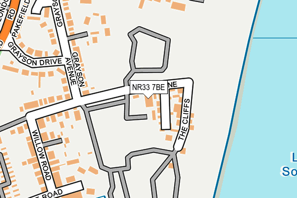
NR33 7BE is located in the Kirkley & Pakefield electoral ward, within the local authority district of East Suffolk and the English Parliamentary constituency of Waveney. The Sub Integrated Care Board (ICB) Location is NHS Norfolk and Waveney ICB - 26A and the police force is Suffolk. This postcode has been in use since January 1980.


GetTheData
Source: OS OpenMap – Local (Ordnance Survey)
Source: OS VectorMap District (Ordnance Survey)
Licence: Open Government Licence (requires attribution)
| Easting | 653680 |
| Northing | 289876 |
| Latitude | 52.447894 |
| Longitude | 1.731743 |
GetTheData
Source: Open Postcode Geo
Licence: Open Government Licence
| Country | England |
| Postcode District | NR33 |
| ➜ NR33 open data dashboard ➜ See where NR33 is on a map ➜ Where is Lowestoft? | |
GetTheData
Source: Land Registry Price Paid Data
Licence: Open Government Licence
Elevation or altitude of NR33 7BE as distance above sea level:
| Metres | Feet | |
|---|---|---|
| Elevation | 10m | 33ft |
Elevation is measured from the approximate centre of the postcode, to the nearest point on an OS contour line from OS Terrain 50, which has contour spacing of ten vertical metres.
➜ How high above sea level am I? Find the elevation of your current position using your device's GPS.
GetTheData
Source: Open Postcode Elevation
Licence: Open Government Licence
| Ward | Kirkley & Pakefield |
| Constituency | Waveney |
GetTheData
Source: ONS Postcode Database
Licence: Open Government Licence
| January 2023 | Bicycle theft | On or near Long Acre | 488m |
| September 2022 | Anti-social behaviour | On or near Long Acre | 488m |
| June 2022 | Criminal damage and arson | On or near Cliftonville | 37m |
| ➜ Get more crime data in our Crime section | |||
GetTheData
Source: data.police.uk
Licence: Open Government Licence
| Grayson Drive | Pakefield | 192m |
| Grayson Drive | Pakefield | 201m |
| Pakefield Primary School (London Road) | Pakefield | 330m |
| Grand Avenue | Pakefield | 345m |
| Pakefield Primary School (London Road) | Pakefield | 355m |
| Oulton Broad South Station | 2.9km |
| Lowestoft Station | 3.2km |
| Oulton Broad North Station | 3.5km |
GetTheData
Source: NaPTAN
Licence: Open Government Licence
GetTheData
Source: ONS Postcode Database
Licence: Open Government Licence


➜ Get more ratings from the Food Standards Agency
GetTheData
Source: Food Standards Agency
Licence: FSA terms & conditions
| Last Collection | |||
|---|---|---|---|
| Location | Mon-Fri | Sat | Distance |
| Tower Road | 16:00 | 10:30 | 624m |
| Pakefield Post Office | 17:30 | 12:00 | 696m |
| Lansdowne Road | 17:00 | 12:00 | 711m |
GetTheData
Source: Dracos
Licence: Creative Commons Attribution-ShareAlike
| Facility | Distance |
|---|---|
| Pakefield Primary School London Road Pakefield, Lowestoft Grass Pitches | 395m |
| Pakefield High School London Road Pakefield, Lowestoft Sports Hall, Grass Pitches | 480m |
| Pakefield Middle School (Closed) Kilbourn Road, Lowestoft Sports Hall, Grass Pitches | 492m |
GetTheData
Source: Active Places
Licence: Open Government Licence
| School | Phase of Education | Distance |
|---|---|---|
| Pakefield Primary School London Road, Pakefield, Lowestoft, NR33 7AQ | Primary | 396m |
| Pakefield High School London Road Pakefield, Pakefield, Lowestoft, NR33 7AQ | Secondary | 476m |
| Westwood Primary School Westwood Avenue, Westwood Primary School, Lowestoft, NR33 9RR | Primary | 1.6km |
GetTheData
Source: Edubase
Licence: Open Government Licence
The below table lists the International Territorial Level (ITL) codes (formerly Nomenclature of Territorial Units for Statistics (NUTS) codes) and Local Administrative Units (LAU) codes for NR33 7BE:
| ITL 1 Code | Name |
|---|---|
| TLH | East |
| ITL 2 Code | Name |
| TLH1 | East Anglia |
| ITL 3 Code | Name |
| TLH14 | Suffolk CC |
| LAU 1 Code | Name |
| E07000244 | East Suffolk |
GetTheData
Source: ONS Postcode Directory
Licence: Open Government Licence
The below table lists the Census Output Area (OA), Lower Layer Super Output Area (LSOA), and Middle Layer Super Output Area (MSOA) for NR33 7BE:
| Code | Name | |
|---|---|---|
| OA | E00154411 | |
| LSOA | E01030272 | Waveney 012E |
| MSOA | E02006313 | Waveney 012 |
GetTheData
Source: ONS Postcode Directory
Licence: Open Government Licence
| NR33 7BQ | Arbor Lane | 30m |
| NR33 7BB | Grayson Avenue | 212m |
| NR33 7BH | Arbor Lane | 220m |
| NR33 7BJ | Willow Road | 232m |
| NR33 7AY | Cliftonville Road | 239m |
| NR33 7BA | Grayson Drive | 245m |
| NR33 7AX | Nightingale Road | 277m |
| NR33 7BL | Jubilee Road | 282m |
| NR33 7BG | Arbor Lane | 330m |
| NR33 7AD | London Road | 342m |
GetTheData
Source: Open Postcode Geo; Land Registry Price Paid Data
Licence: Open Government Licence