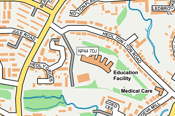
NP44 7DJ is located in the Coed Eva electoral ward, within the unitary authority of Torfaen and the Welsh Parliamentary constituency of Torfaen. The Local Health Board is Aneurin Bevan University and the police force is Gwent. This postcode has been in use since August 2010.


GetTheData
Source: OS OpenMap – Local (Ordnance Survey)
Source: OS VectorMap District (Ordnance Survey)
Licence: Open Government Licence (requires attribution)
| Easting | 328206 |
| Northing | 194240 |
| Latitude | 51.642359 |
| Longitude | -3.038921 |
GetTheData
Source: Open Postcode Geo
Licence: Open Government Licence
| Country | Wales |
| Postcode District | NP44 |
| ➜ NP44 open data dashboard ➜ See where NP44 is on a map ➜ Where is Cwmbrân? | |
GetTheData
Source: Land Registry Price Paid Data
Licence: Open Government Licence
Elevation or altitude of NP44 7DJ as distance above sea level:
| Metres | Feet | |
|---|---|---|
| Elevation | 80m | 262ft |
Elevation is measured from the approximate centre of the postcode, to the nearest point on an OS contour line from OS Terrain 50, which has contour spacing of ten vertical metres.
➜ How high above sea level am I? Find the elevation of your current position using your device's GPS.
GetTheData
Source: Open Postcode Elevation
Licence: Open Government Licence
| Ward | Coed Eva |
| Constituency | Torfaen |
GetTheData
Source: ONS Postcode Database
Licence: Open Government Licence
| June 2022 | Possession of weapons | On or near Ton Road | 149m |
| June 2022 | Other theft | On or near Nolton Place | 180m |
| June 2022 | Violence and sexual offences | On or near Nolton Place | 180m |
| ➜ Get more crime data in our Crime section | |||
GetTheData
Source: data.police.uk
Licence: Open Government Licence
| Hollybush School (Ton Road) | Fairwater | 118m |
| Sandybrook Close (Ton Road) | Hollybush | 151m |
| Hollybush School (Henllys Way) | Fairwater | 174m |
| Fairwater Way (Henllys Way) | Coed Eva | 231m |
| Rede Road (Henllys Way) | Coed Eva | 239m |
| Cwmbran Station | 2.2km |
| Risca & Pontymister Station | 5.5km |
GetTheData
Source: NaPTAN
Licence: Open Government Licence
GetTheData
Source: ONS Postcode Database
Licence: Open Government Licence


➜ Get more ratings from the Food Standards Agency
GetTheData
Source: Food Standards Agency
Licence: FSA terms & conditions
| Last Collection | |||
|---|---|---|---|
| Location | Mon-Fri | Sat | Distance |
| Radnor Way | 17:30 | 11:00 | 1,427m |
| Llantarnam Road | 17:30 | 11:00 | 1,591m |
| Five Locks Close | 17:30 | 11:00 | 2,584m |
GetTheData
Source: Dracos
Licence: Creative Commons Attribution-ShareAlike
| School | Phase of Education | Distance |
|---|---|---|
| Blenheim Road Community Primary School Blenheim Road, St Dial's, Cwmbran, NP44 4SZ | Not applicable | 566m |
| Ysgol Gymraeg Cwmbran Henllys Way, St Dial's, Cwmbran, Torfaen, NP44 3NB | Not applicable | 938m |
| Our Lady of the Angels R.C School Victoria Street, Cwmbran, Torfaen, NP44 3JR | Not applicable | 1.3km |
GetTheData
Source: Edubase
Licence: Open Government Licence
The below table lists the International Territorial Level (ITL) codes (formerly Nomenclature of Territorial Units for Statistics (NUTS) codes) and Local Administrative Units (LAU) codes for NP44 7DJ:
| ITL 1 Code | Name |
|---|---|
| TLL | Wales |
| ITL 2 Code | Name |
| TLL1 | West Wales and The Valleys |
| ITL 3 Code | Name |
| TLL16 | Gwent Valleys |
| LAU 1 Code | Name |
| W06000020 | Torfaen |
GetTheData
Source: ONS Postcode Directory
Licence: Open Government Licence
The below table lists the Census Output Area (OA), Lower Layer Super Output Area (LSOA), and Middle Layer Super Output Area (MSOA) for NP44 7DJ:
| Code | Name | |
|---|---|---|
| OA | W00007792 | |
| LSOA | W01001492 | Torfaen 012A |
| MSOA | W02000334 | Torfaen 012 |
GetTheData
Source: ONS Postcode Directory
Licence: Open Government Licence
| NP44 7LE | Ton Road | 79m |
| NP44 7LT | Heol Y Groes | 120m |
| NP44 7LA | Nolton Place | 168m |
| NP44 7EL | Coed Lee | 176m |
| NP44 7JZ | Langstone Court | 177m |
| NP44 7JA | Sandybrook Close | 190m |
| NP44 7LF | Ton Road | 206m |
| NP44 7LB | Henllys Way | 207m |
| NP44 4DN | Kingslea | 216m |
| NP44 4DE | Sevins | 221m |
GetTheData
Source: Open Postcode Geo; Land Registry Price Paid Data
Licence: Open Government Licence