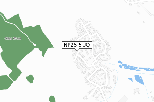
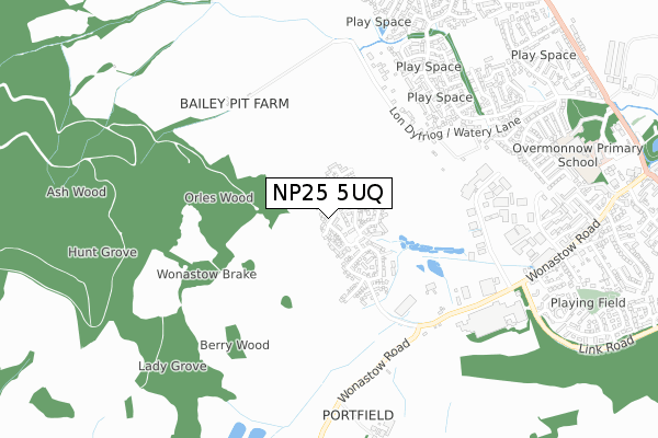
NP25 5UQ is located in the Overmonnow electoral ward, within the unitary authority of Monmouthshire and the Welsh Parliamentary constituency of Monmouth. The Local Health Board is Aneurin Bevan University and the police force is Gwent. This postcode has been in use since February 2018.


GetTheData
Source: OS Open Zoomstack (Ordnance Survey)
Licence: Open Government Licence (requires attribution)
Attribution: Contains OS data © Crown copyright and database right 2024
Source: Open Postcode Geo
Licence: Open Government Licence (requires attribution)
Attribution: Contains OS data © Crown copyright and database right 2024; Contains Royal Mail data © Royal Mail copyright and database right 2024; Source: Office for National Statistics licensed under the Open Government Licence v.3.0
| Easting | 349078 |
| Northing | 212386 |
| Latitude | 51.807784 |
| Longitude | -2.739987 |
GetTheData
Source: Open Postcode Geo
Licence: Open Government Licence
| Country | Wales |
| Postcode District | NP25 |
| ➜ NP25 open data dashboard ➜ See where NP25 is on a map ➜ Where is Monmouth? | |
GetTheData
Source: Land Registry Price Paid Data
Licence: Open Government Licence
| Ward | Overmonnow |
| Constituency | Monmouth |
GetTheData
Source: ONS Postcode Database
Licence: Open Government Licence
2023 25 AUG £545,000 |
2023 7 JUL £387,000 |
2022 21 DEC £400,000 |
2022 25 FEB £445,000 |
2022 11 JAN £387,500 |
2021 1 OCT £485,000 |
2019 25 SEP £340,000 |
93, ACER WAY, MONMOUTH, NP25 5UQ 2019 23 AUG £333,995 |
97, ACER WAY, MONMOUTH, NP25 5UQ 2019 19 AUG £330,500 |
87, ACER WAY, MONMOUTH, NP25 5UQ 2019 8 AUG £281,500 |
GetTheData
Source: HM Land Registry Price Paid Data
Licence: Contains HM Land Registry data © Crown copyright and database right 2024. This data is licensed under the Open Government Licence v3.0.
| Willow Drive (Jordan Way) | Monmouth | 737m |
| Ash Lane (St Thomas Road) | Over Monnow | 847m |
| Apex (Wonastow Road) | Over Monnow | 878m |
| Carbonne Close (Link Road) | Over Monnow | 881m |
| Carbonne Close (Link Road) | Over Monnow | 889m |
GetTheData
Source: NaPTAN
Licence: Open Government Licence
| Percentage of properties with Next Generation Access | 100.0% |
| Percentage of properties with Superfast Broadband | 100.0% |
| Percentage of properties with Ultrafast Broadband | 100.0% |
| Percentage of properties with Full Fibre Broadband | 100.0% |
Superfast Broadband is between 30Mbps and 300Mbps
Ultrafast Broadband is > 300Mbps
| Percentage of properties unable to receive 2Mbps | 0.0% |
| Percentage of properties unable to receive 5Mbps | 0.0% |
| Percentage of properties unable to receive 10Mbps | 0.0% |
| Percentage of properties unable to receive 30Mbps | 0.0% |
GetTheData
Source: Ofcom
Licence: Ofcom Terms of Use (requires attribution)
GetTheData
Source: ONS Postcode Database
Licence: Open Government Licence


➜ Get more ratings from the Food Standards Agency
GetTheData
Source: Food Standards Agency
Licence: FSA terms & conditions
| Last Collection | |||
|---|---|---|---|
| Location | Mon-Fri | Sat | Distance |
| Kings Fee | 17:00 | 12:00 | 975m |
| Carbonne Close | 17:00 | 11:00 | 980m |
| Victoria Estate | 17:00 | 11:30 | 991m |
GetTheData
Source: Dracos
Licence: Creative Commons Attribution-ShareAlike
| School | Phase of Education | Distance |
|---|---|---|
| Talocher School Talocher Farm, Wonastow Road, Monmouth, Monmouthshire, NP25 4DN | Not applicable | 1.5km |
| Monmouth School Almshouse Street, Monmouth, Monmouthshire, NP25 3XP | Not applicable | 1.9km |
| Osbaston V.C. Primary Osbaston Road, Osbaston, Monmouth, NP25 3AX | Not applicable | 2km |
GetTheData
Source: Edubase
Licence: Open Government Licence
The below table lists the International Territorial Level (ITL) codes (formerly Nomenclature of Territorial Units for Statistics (NUTS) codes) and Local Administrative Units (LAU) codes for NP25 5UQ:
| ITL 1 Code | Name |
|---|---|
| TLL | Wales |
| ITL 2 Code | Name |
| TLL2 | East Wales |
| ITL 3 Code | Name |
| TLL21 | Monmouthshire and Newport |
| LAU 1 Code | Name |
| W06000021 | Monmouthshire |
GetTheData
Source: ONS Postcode Directory
Licence: Open Government Licence
The below table lists the Census Output Area (OA), Lower Layer Super Output Area (LSOA), and Middle Layer Super Output Area (MSOA) for NP25 5UQ:
| Code | Name | |
|---|---|---|
| OA | W00009812 | |
| LSOA | W01001553 | Monmouthshire 004B |
| MSOA | W02000339 | Monmouthshire 004 |
GetTheData
Source: ONS Postcode Directory
Licence: Open Government Licence
| NP25 5ED | Jordan Gardens | 583m |
| NP25 5DZ | Maple Drive | 586m |
| NP25 5AT | Watery Lane | 612m |
| NP25 5DY | Lilac Drive | 619m |
| NP25 5EA | Jordan Way | 619m |
| NP25 5EB | Jordan Close | 674m |
| NP25 5DW | Willow Drive | 691m |
| NP25 5JA | Wonastow Road Industrial Estate (West) | 699m |
| NP25 5DT | Oaklands Drive | 730m |
| NP25 4DQ | Wonastow Road | 753m |
GetTheData
Source: Open Postcode Geo; Land Registry Price Paid Data
Licence: Open Government Licence