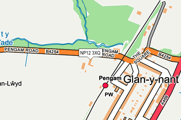
NP12 3XQ is located in the St Cattwg electoral ward, within the unitary authority of Caerphilly and the Welsh Parliamentary constituency of Caerphilly. The Local Health Board is Aneurin Bevan University and the police force is Gwent. This postcode has been in use since June 1999.


GetTheData
Source: OS OpenMap – Local (Ordnance Survey)
Source: OS VectorMap District (Ordnance Survey)
Licence: Open Government Licence (requires attribution)
| Easting | 314979 |
| Northing | 197608 |
| Latitude | 51.670790 |
| Longitude | -3.230856 |
GetTheData
Source: Open Postcode Geo
Licence: Open Government Licence
| Country | Wales |
| Postcode District | NP12 |
| ➜ NP12 open data dashboard ➜ See where NP12 is on a map | |
GetTheData
Source: Land Registry Price Paid Data
Licence: Open Government Licence
Elevation or altitude of NP12 3XQ as distance above sea level:
| Metres | Feet | |
|---|---|---|
| Elevation | 150m | 492ft |
Elevation is measured from the approximate centre of the postcode, to the nearest point on an OS contour line from OS Terrain 50, which has contour spacing of ten vertical metres.
➜ How high above sea level am I? Find the elevation of your current position using your device's GPS.
GetTheData
Source: Open Postcode Elevation
Licence: Open Government Licence
| Ward | St Cattwg |
| Constituency | Caerphilly |
GetTheData
Source: ONS Postcode Database
Licence: Open Government Licence
| November 2023 | Criminal damage and arson | On or near Lewis Crescent | 468m |
| September 2023 | Anti-social behaviour | On or near Lewis Crescent | 468m |
| August 2023 | Violence and sexual offences | On or near Lewis Crescent | 468m |
| ➜ Get more crime data in our Crime section | |||
GetTheData
Source: data.police.uk
Licence: Open Government Licence
| Glan Y Nant Square (The Square) | Glan-y-nant | 147m |
| Spirit Of The Stream Statue (B4254) | Glan-y-nant | 253m |
| Cardiff Road | Glan-y-nant | 273m |
| Cardiff Road | Glan-y-nant | 294m |
| Lewis School (Cardiff Road) | Glan-y-nant | 321m |
| Pengam Station | 0.1km |
| Gilfach Fargoed Station | 1.5km |
| Bargoed Station | 2.4km |
GetTheData
Source: NaPTAN
Licence: Open Government Licence
| Percentage of properties with Next Generation Access | 100.0% |
| Percentage of properties with Superfast Broadband | 100.0% |
| Percentage of properties with Ultrafast Broadband | 0.0% |
| Percentage of properties with Full Fibre Broadband | 0.0% |
Superfast Broadband is between 30Mbps and 300Mbps
Ultrafast Broadband is > 300Mbps
| Percentage of properties unable to receive 2Mbps | 0.0% |
| Percentage of properties unable to receive 5Mbps | 0.0% |
| Percentage of properties unable to receive 10Mbps | 0.0% |
| Percentage of properties unable to receive 30Mbps | 0.0% |
GetTheData
Source: Ofcom
Licence: Ofcom Terms of Use (requires attribution)
GetTheData
Source: ONS Postcode Database
Licence: Open Government Licence


➜ Get more ratings from the Food Standards Agency
GetTheData
Source: Food Standards Agency
Licence: FSA terms & conditions
| Last Collection | |||
|---|---|---|---|
| Location | Mon-Fri | Sat | Distance |
| Glanynant Post Office | 16:15 | 11:00 | 158m |
| Fleur De Lys Village | 16:00 | 11:00 | 732m |
| St Davids Industrial Estate | 16:15 | 11:00 | 831m |
GetTheData
Source: Dracos
Licence: Creative Commons Attribution-ShareAlike
| School | Phase of Education | Distance |
|---|---|---|
| Glanynant Learning Centre (PRU) Hanbury Street, Glanynant, Caerphilly, NP12 3XP | Not applicable | 284m |
| Lewis School Pengam Gilfach, Bargoed, CF81 8LJ | Not applicable | 499m |
| Pengam Primary School Commercial Street, Pengam, Blackwood, Caerphilly, NP12 3ST | Not applicable | 566m |
GetTheData
Source: Edubase
Licence: Open Government Licence
The below table lists the International Territorial Level (ITL) codes (formerly Nomenclature of Territorial Units for Statistics (NUTS) codes) and Local Administrative Units (LAU) codes for NP12 3XQ:
| ITL 1 Code | Name |
|---|---|
| TLL | Wales |
| ITL 2 Code | Name |
| TLL1 | West Wales and The Valleys |
| ITL 3 Code | Name |
| TLL16 | Gwent Valleys |
| LAU 1 Code | Name |
| W06000018 | Caerphilly |
GetTheData
Source: ONS Postcode Directory
Licence: Open Government Licence
The below table lists the Census Output Area (OA), Lower Layer Super Output Area (LSOA), and Middle Layer Super Output Area (MSOA) for NP12 3XQ:
| Code | Name | |
|---|---|---|
| OA | W00007420 | |
| LSOA | W01001415 | Caerphilly 008B |
| MSOA | W02000297 | Caerphilly 008 |
GetTheData
Source: ONS Postcode Directory
Licence: Open Government Licence
| NP12 3XL | Station Road | 126m |
| NP12 3XN | Station Cottages | 149m |
| NP12 3XH | Pengam Street | 164m |
| NP12 3XJ | Pengam Street | 180m |
| NP12 3XF | The Square | 188m |
| NP12 3XW | Hanbury Street | 224m |
| NP12 3XE | Cardiff Road | 226m |
| NP12 3XP | Hanbury Street | 284m |
| CF81 8JT | Gwerthonor Lane | 358m |
| CF82 8FR | Pwll Yr Allt | 361m |
GetTheData
Source: Open Postcode Geo; Land Registry Price Paid Data
Licence: Open Government Licence