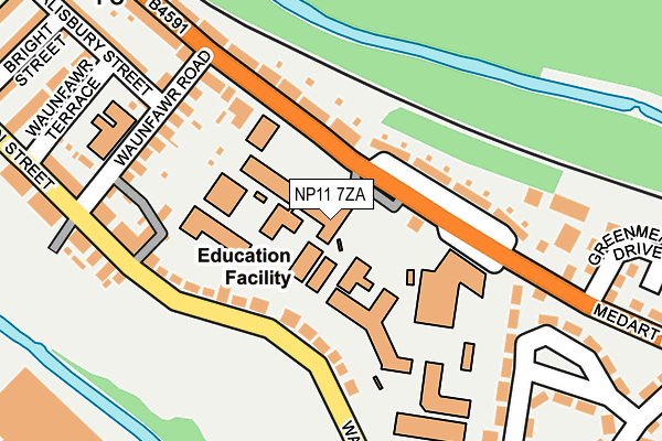
NP11 7ZA is located in the Crosskeys electoral ward, within the unitary authority of Caerphilly and the Welsh Parliamentary constituency of Islwyn. The Local Health Board is Aneurin Bevan University and the police force is Gwent. This postcode has been in use since June 1999.


GetTheData
Source: OS OpenMap – Local (Ordnance Survey)
Source: OS VectorMap District (Ordnance Survey)
Licence: Open Government Licence (requires attribution)
| Easting | 322347 |
| Northing | 191669 |
| Latitude | 51.618467 |
| Longitude | -3.123004 |
GetTheData
Source: Open Postcode Geo
Licence: Open Government Licence
| Country | Wales |
| Postcode District | NP11 |
| ➜ NP11 open data dashboard ➜ See where NP11 is on a map ➜ Where is Risca? | |
GetTheData
Source: Land Registry Price Paid Data
Licence: Open Government Licence
Elevation or altitude of NP11 7ZA as distance above sea level:
| Metres | Feet | |
|---|---|---|
| Elevation | 60m | 197ft |
Elevation is measured from the approximate centre of the postcode, to the nearest point on an OS contour line from OS Terrain 50, which has contour spacing of ten vertical metres.
➜ How high above sea level am I? Find the elevation of your current position using your device's GPS.
GetTheData
Source: Open Postcode Elevation
Licence: Open Government Licence
| Ward | Crosskeys |
| Constituency | Islwyn |
GetTheData
Source: ONS Postcode Database
Licence: Open Government Licence
| January 2024 | Violence and sexual offences | On or near Greenmeadow Drive | 282m |
| January 2024 | Shoplifting | On or near Parking Area | 387m |
| January 2024 | Violence and sexual offences | On or near Parking Area | 387m |
| ➜ Get more crime data in our Crime section | |||
GetTheData
Source: data.police.uk
Licence: Open Government Licence
| Coleg Gwent (Risca Road) | Crosskeys | 116m |
| Coleg Gwent (Risca Road) | Crosskeys | 119m |
| Station (Risca Road) | Crosskeys | 307m |
| Station (Risca Road) | Crosskeys | 327m |
| Gladstone Street | Crosskeys | 354m |
| Crosskeys Station | 0.3km |
| Risca & Pontymister Station | 2.6km |
| Rogerstone Station | 4.7km |
GetTheData
Source: NaPTAN
Licence: Open Government Licence
GetTheData
Source: ONS Postcode Database
Licence: Open Government Licence


➜ Get more ratings from the Food Standards Agency
GetTheData
Source: Food Standards Agency
Licence: FSA terms & conditions
| Last Collection | |||
|---|---|---|---|
| Location | Mon-Fri | Sat | Distance |
| Ridgeway | 16:00 | 11:15 | 4,460m |
| Rogerstone Post Office | 17:30 | 12:00 | 5,288m |
| Pentwynmawr | 16:00 | 11:30 | 5,298m |
GetTheData
Source: Dracos
Licence: Creative Commons Attribution-ShareAlike
| School | Phase of Education | Distance |
|---|---|---|
| Waunfawr Primary School Waunfawr Road, Crosskeys, Caerphilly, NP11 7PG | Not applicable | 220m |
| Risca Primary School Danygraig Road, Risca, Caerphilly, NP11 6DB | Not applicable | 1.8km |
| Cwmcarn Primary School Newport Road, Cwmcarn, Crosskeys, NP11 7LZ | Not applicable | 1.9km |
GetTheData
Source: Edubase
Licence: Open Government Licence
The below table lists the International Territorial Level (ITL) codes (formerly Nomenclature of Territorial Units for Statistics (NUTS) codes) and Local Administrative Units (LAU) codes for NP11 7ZA:
| ITL 1 Code | Name |
|---|---|
| TLL | Wales |
| ITL 2 Code | Name |
| TLL1 | West Wales and The Valleys |
| ITL 3 Code | Name |
| TLL16 | Gwent Valleys |
| LAU 1 Code | Name |
| W06000018 | Caerphilly |
GetTheData
Source: ONS Postcode Directory
Licence: Open Government Licence
The below table lists the Census Output Area (OA), Lower Layer Super Output Area (LSOA), and Middle Layer Super Output Area (MSOA) for NP11 7ZA:
| Code | Name | |
|---|---|---|
| OA | W00007095 | |
| LSOA | W01001354 | Caerphilly 014D |
| MSOA | W02000303 | Caerphilly 014 |
GetTheData
Source: ONS Postcode Directory
Licence: Open Government Licence
| NP11 7PH | Waunfawr Park Road | 111m |
| NP11 7DH | Risca Road | 121m |
| NP11 7PG | Waunfawr Road | 174m |
| NP11 7DG | Risca Road | 177m |
| NP11 7BT | Risca Road | 224m |
| NP11 7PF | Cobden Street | 249m |
| NP11 7AJ | Waunfawr Gardens | 250m |
| NP11 7PD | Salisbury Street | 277m |
| NP11 7PE | Waunfawr Terrace | 280m |
| NP11 7AL | Waunfawr Gardens | 310m |
GetTheData
Source: Open Postcode Geo; Land Registry Price Paid Data
Licence: Open Government Licence