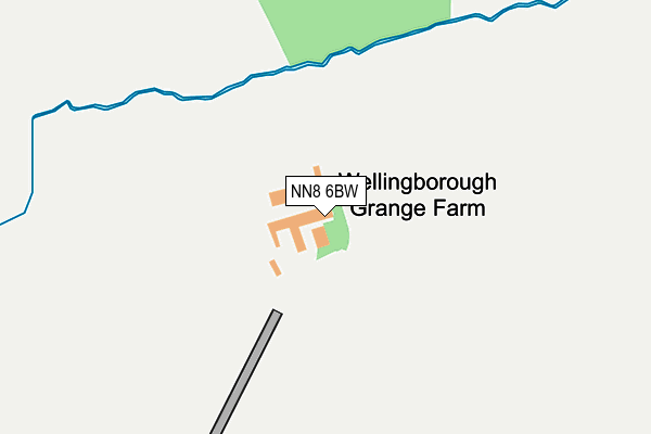
NN8 6BW is located in the Hatton Park electoral ward, within the unitary authority of North Northamptonshire and the English Parliamentary constituency of Wellingborough. The Sub Integrated Care Board (ICB) Location is NHS Northamptonshire ICB - 78H and the police force is Northamptonshire. This postcode has been in use since September 1991.


GetTheData
Source: OS OpenMap – Local (Ordnance Survey)
Source: OS VectorMap District (Ordnance Survey)
Licence: Open Government Licence (requires attribution)
| Easting | 486672 |
| Northing | 269581 |
| Latitude | 52.317501 |
| Longitude | -0.729908 |
GetTheData
Source: Open Postcode Geo
Licence: Open Government Licence
| Country | England |
| Postcode District | NN8 |
| ➜ NN8 open data dashboard ➜ See where NN8 is on a map | |
GetTheData
Source: Land Registry Price Paid Data
Licence: Open Government Licence
Elevation or altitude of NN8 6BW as distance above sea level:
| Metres | Feet | |
|---|---|---|
| Elevation | 100m | 328ft |
Elevation is measured from the approximate centre of the postcode, to the nearest point on an OS contour line from OS Terrain 50, which has contour spacing of ten vertical metres.
➜ How high above sea level am I? Find the elevation of your current position using your device's GPS.
GetTheData
Source: Open Postcode Elevation
Licence: Open Government Licence
| Ward | Hatton Park |
| Constituency | Wellingborough |
GetTheData
Source: ONS Postcode Database
Licence: Open Government Licence
| Fleming Close (Sinclair Drive) | Wellingborough | 623m |
| Fleming Close (Sinclair Drive) | Wellingborough | 624m |
| Watson Close (Muirfield Road) | Wellingborough | 625m |
| 23 Muirfield Road (Muirfield Road) | Wellingborough | 773m |
| Green Close (Wentworth Avenue) | Wellingborough | 798m |
| Wellingborough Station | 3.9km |
GetTheData
Source: NaPTAN
Licence: Open Government Licence
GetTheData
Source: ONS Postcode Database
Licence: Open Government Licence


➜ Get more ratings from the Food Standards Agency
GetTheData
Source: Food Standards Agency
Licence: FSA terms & conditions
| Last Collection | |||
|---|---|---|---|
| Location | Mon-Fri | Sat | Distance |
| Fallowfield | 17:00 | 11:00 | 1,730m |
| Hatton Street | 17:15 | 11:00 | 2,248m |
| High Street Tso | 17:00 | 11:00 | 2,686m |
GetTheData
Source: Dracos
Licence: Creative Commons Attribution-ShareAlike
| Facility | Distance |
|---|---|
| Wellingborough Old Grammarians Memorial Sports Field Sywell Road, Wellingborough Grass Pitches, Outdoor Tennis Courts, Sports Hall | 1.2km |
| Redwell Leisure Centre Barnwell Road, Wellingborough Sports Hall, Health and Fitness Gym, Grass Pitches, Studio, Squash Courts, Artificial Grass Pitch | 1.5km |
| Glamis Hall Goldsmith Road, Wellingborough Grass Pitches, Sports Hall | 1.6km |
GetTheData
Source: Active Places
Licence: Open Government Licence
| School | Phase of Education | Distance |
|---|---|---|
| Redwell Primary School Barnwell Road, Wellingborough, NN8 5LQ | Primary | 1.4km |
| Olympic Primary Olympic Way, Wellingborough, NN8 3QA | Primary | 1.5km |
| Ruskin Academy Ruskin Avenue, Wellingborough, NN8 3EG | Primary | 2.1km |
GetTheData
Source: Edubase
Licence: Open Government Licence
The below table lists the International Territorial Level (ITL) codes (formerly Nomenclature of Territorial Units for Statistics (NUTS) codes) and Local Administrative Units (LAU) codes for NN8 6BW:
| ITL 1 Code | Name |
|---|---|
| TLF | East Midlands (England) |
| ITL 2 Code | Name |
| TLF2 | Leicestershire, Rutland and Northamptonshire |
| ITL 3 Code | Name |
| TLF25 | North Northamptonshire |
| LAU 1 Code | Name |
| E07000156 | Wellingborough |
GetTheData
Source: ONS Postcode Directory
Licence: Open Government Licence
The below table lists the Census Output Area (OA), Lower Layer Super Output Area (LSOA), and Middle Layer Super Output Area (MSOA) for NN8 6BW:
| Code | Name | |
|---|---|---|
| OA | E00139123 | |
| LSOA | E01027346 | Wellingborough 003D |
| MSOA | E02005694 | Wellingborough 003 |
GetTheData
Source: ONS Postcode Directory
Licence: Open Government Licence
| NN8 6UF | Fleming Close | 521m |
| NN8 6ZB | Trinity Centre | 559m |
| NN8 5UE | Turnberry Court | 563m |
| NN8 5UH | Watson Close | 591m |
| NN8 5UA | Chepstow Drive | 598m |
| NN8 5FD | Chatsworth Drive | 623m |
| NN8 5FB | Chatsworth Drive | 623m |
| NN8 3FG | Hatfield Close | 631m |
| NN8 5QU | Taylor Close | 659m |
| NN8 5WG | Troon Crescent | 667m |
GetTheData
Source: Open Postcode Geo; Land Registry Price Paid Data
Licence: Open Government Licence