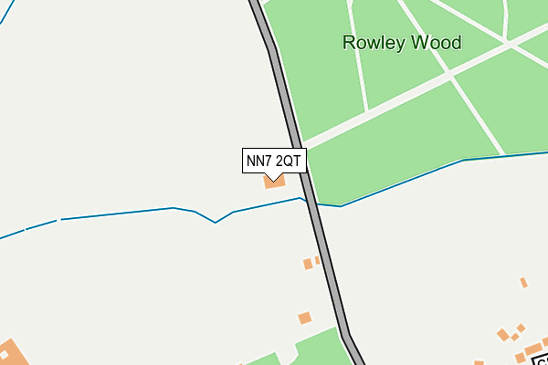
NN7 2QT is located in the Deanshanger electoral ward, within the unitary authority of West Northamptonshire and the English Parliamentary constituency of South Northamptonshire. The Sub Integrated Care Board (ICB) Location is NHS Northamptonshire ICB - 78H and the police force is Northamptonshire. This postcode has been in use since December 1997.


GetTheData
Source: OS OpenMap – Local (Ordnance Survey)
Source: OS VectorMap District (Ordnance Survey)
Licence: Open Government Licence (requires attribution)
| Easting | 478208 |
| Northing | 250725 |
| Latitude | 52.149283 |
| Longitude | -0.858406 |
GetTheData
Source: Open Postcode Geo
Licence: Open Government Licence
| Country | England |
| Postcode District | NN7 |
| ➜ NN7 open data dashboard ➜ See where NN7 is on a map ➜ Where is Hartwell? | |
GetTheData
Source: Land Registry Price Paid Data
Licence: Open Government Licence
Elevation or altitude of NN7 2QT as distance above sea level:
| Metres | Feet | |
|---|---|---|
| Elevation | 110m | 361ft |
Elevation is measured from the approximate centre of the postcode, to the nearest point on an OS contour line from OS Terrain 50, which has contour spacing of ten vertical metres.
➜ How high above sea level am I? Find the elevation of your current position using your device's GPS.
GetTheData
Source: Open Postcode Elevation
Licence: Open Government Licence
| Ward | Deanshanger |
| Constituency | South Northamptonshire |
GetTheData
Source: ONS Postcode Database
Licence: Open Government Licence
| June 2022 | Violence and sexual offences | On or near Swyncombe Green | 383m |
| June 2022 | Violence and sexual offences | On or near Swyncombe Green | 383m |
| June 2022 | Violence and sexual offences | On or near Church Close | 410m |
| ➜ Get more crime data in our Crime section | |||
GetTheData
Source: data.police.uk
Licence: Open Government Licence
| The Rockeries (Ashton Road) | Hartwell | 297m |
| The Rockeries (Ashton Road) | Hartwell | 303m |
| St John The Baptist's Church (Ashton Road) | Hartwell | 447m |
| St John The Baptist's Church (Forest Road) | Hartwell | 458m |
| Ashton Road (Park Road) | Hartwell | 479m |
GetTheData
Source: NaPTAN
Licence: Open Government Licence
GetTheData
Source: ONS Postcode Database
Licence: Open Government Licence


➜ Get more ratings from the Food Standards Agency
GetTheData
Source: Food Standards Agency
Licence: FSA terms & conditions
| Last Collection | |||
|---|---|---|---|
| Location | Mon-Fri | Sat | Distance |
| Hartwell | 17:00 | 09:30 | 474m |
| Lower End | 16:00 | 10:00 | 688m |
| Salcey Avenue | 17:00 | 09:30 | 724m |
GetTheData
Source: Dracos
Licence: Creative Commons Attribution-ShareAlike
| Facility | Distance |
|---|---|
| Hartwell Community Centre Playing Fields School Lane, Hartwell Grass Pitches, Cycling, Sports Hall | 721m |
| Salcey Forest Salcey Forest, Salcey Forest, Hartwell, Northampton Cycling | 1.6km |
| Northampton Mens Own Rfc Stoke Road, Ashton, Northampton Grass Pitches | 2.2km |
GetTheData
Source: Active Places
Licence: Open Government Licence
| School | Phase of Education | Distance |
|---|---|---|
| Hartwell Primary School School Lane, Hartwell, Northampton, NN7 2HL | Primary | 596m |
| Ashton CofE Primary School Roade Hill, Ashton, Northampton, NN7 2JH | Primary | 1.8km |
| Roade Primary School Hartwell Road, Roade, Northampton, NN7 2NT | Primary | 2.4km |
GetTheData
Source: Edubase
Licence: Open Government Licence
The below table lists the International Territorial Level (ITL) codes (formerly Nomenclature of Territorial Units for Statistics (NUTS) codes) and Local Administrative Units (LAU) codes for NN7 2QT:
| ITL 1 Code | Name |
|---|---|
| TLF | East Midlands (England) |
| ITL 2 Code | Name |
| TLF2 | Leicestershire, Rutland and Northamptonshire |
| ITL 3 Code | Name |
| TLF24 | West Northamptonshire |
| LAU 1 Code | Name |
| E07000155 | South Northamptonshire |
GetTheData
Source: ONS Postcode Directory
Licence: Open Government Licence
The below table lists the Census Output Area (OA), Lower Layer Super Output Area (LSOA), and Middle Layer Super Output Area (MSOA) for NN7 2QT:
| Code | Name | |
|---|---|---|
| OA | E00138795 | |
| LSOA | E01027284 | South Northamptonshire 003D |
| MSOA | E02005683 | South Northamptonshire 003 |
GetTheData
Source: ONS Postcode Directory
Licence: Open Government Licence
| NN7 2HW | Ashton Road | 326m |
| NN7 2EY | Ashton Road | 346m |
| NN7 2JB | Amberley Road | 346m |
| NN7 2JA | Swyncombe Green | 366m |
| NN7 2HU | Church Close | 380m |
| NN7 2JD | Stonehurst Close | 438m |
| NN7 2HZ | Robins Close | 439m |
| NN7 2HY | Blacksmiths Way | 470m |
| NN7 2FB | Forest Road | 502m |
| NN7 2HH | Forest View | 504m |
GetTheData
Source: Open Postcode Geo; Land Registry Price Paid Data
Licence: Open Government Licence