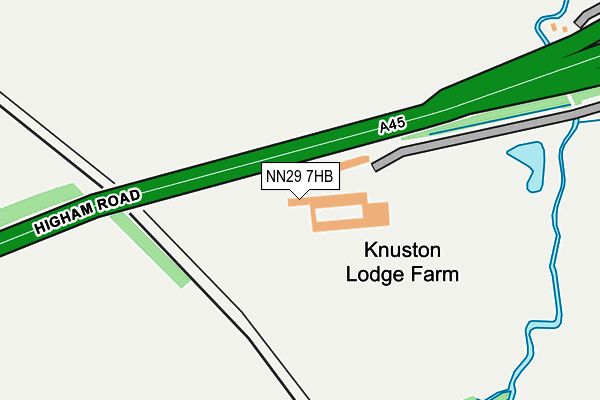
NN29 7HB is located in the Irchester electoral ward, within the unitary authority of North Northamptonshire and the English Parliamentary constituency of Wellingborough. The Sub Integrated Care Board (ICB) Location is NHS Northamptonshire ICB - 78H and the police force is Northamptonshire. This postcode has been in use since May 1994.


GetTheData
Source: OS OpenMap – Local (Ordnance Survey)
Source: OS VectorMap District (Ordnance Survey)
Licence: Open Government Licence (requires attribution)
| Easting | 492655 |
| Northing | 267014 |
| Latitude | 52.293454 |
| Longitude | -0.642867 |
GetTheData
Source: Open Postcode Geo
Licence: Open Government Licence
| Country | England |
| Postcode District | NN29 |
| ➜ NN29 open data dashboard ➜ See where NN29 is on a map | |
GetTheData
Source: Land Registry Price Paid Data
Licence: Open Government Licence
Elevation or altitude of NN29 7HB as distance above sea level:
| Metres | Feet | |
|---|---|---|
| Elevation | 50m | 164ft |
Elevation is measured from the approximate centre of the postcode, to the nearest point on an OS contour line from OS Terrain 50, which has contour spacing of ten vertical metres.
➜ How high above sea level am I? Find the elevation of your current position using your device's GPS.
GetTheData
Source: Open Postcode Elevation
Licence: Open Government Licence
| Ward | Irchester |
| Constituency | Wellingborough |
GetTheData
Source: ONS Postcode Database
Licence: Open Government Licence
| St Katherines Church (High Street) | Irchester | 979m |
| St Katherines Church (High Street) | Irchester | 1,001m |
| Station House (Station Road) | Irchester | 1,246m |
| Station House (Station Road) | Irchester | 1,252m |
| Vicarage (Station Road) | Irchester | 1,267m |
| Wellingborough Station | 2.6km |
GetTheData
Source: NaPTAN
Licence: Open Government Licence
| Percentage of properties with Next Generation Access | 100.0% |
| Percentage of properties with Superfast Broadband | 0.0% |
| Percentage of properties with Ultrafast Broadband | 0.0% |
| Percentage of properties with Full Fibre Broadband | 0.0% |
Superfast Broadband is between 30Mbps and 300Mbps
Ultrafast Broadband is > 300Mbps
| Percentage of properties unable to receive 2Mbps | 0.0% |
| Percentage of properties unable to receive 5Mbps | 0.0% |
| Percentage of properties unable to receive 10Mbps | 0.0% |
| Percentage of properties unable to receive 30Mbps | 100.0% |
GetTheData
Source: Ofcom
Licence: Ofcom Terms of Use (requires attribution)
GetTheData
Source: ONS Postcode Database
Licence: Open Government Licence


➜ Get more ratings from the Food Standards Agency
GetTheData
Source: Food Standards Agency
Licence: FSA terms & conditions
| Last Collection | |||
|---|---|---|---|
| Location | Mon-Fri | Sat | Distance |
| Station Road | 16:30 | 08:45 | 1,307m |
| Mazefield Road | 17:15 | 11:00 | 1,629m |
| Irchester Road | 17:15 | 11:00 | 1,786m |
GetTheData
Source: Dracos
Licence: Creative Commons Attribution-ShareAlike
| Facility | Distance |
|---|---|
| Irchester Sports Association Alfred Street, Irchester Grass Pitches | 1.5km |
| Stanton Cross Primary School Waverley Drive, Wellingborough Grass Pitches | 2.1km |
| Pemberton Centre H E Bates Way, Rushden Sports Hall, Health and Fitness Gym, Studio, Squash Courts | 2.3km |
GetTheData
Source: Active Places
Licence: Open Government Licence
| School | Phase of Education | Distance |
|---|---|---|
| Irchester Community Primary School School Lane, Irchester, Wellingborough, NN29 7AZ | Primary | 1.3km |
| Stanton Cross Primary School Waverley Drive, Stanton Cross, Wellingborough, NN8 1GN | Primary | 2.1km |
| Whitefriars Primary School Boughton Drive, Rushden, NN10 9HX | Primary | 2.6km |
GetTheData
Source: Edubase
Licence: Open Government Licence
The below table lists the International Territorial Level (ITL) codes (formerly Nomenclature of Territorial Units for Statistics (NUTS) codes) and Local Administrative Units (LAU) codes for NN29 7HB:
| ITL 1 Code | Name |
|---|---|
| TLF | East Midlands (England) |
| ITL 2 Code | Name |
| TLF2 | Leicestershire, Rutland and Northamptonshire |
| ITL 3 Code | Name |
| TLF25 | North Northamptonshire |
| LAU 1 Code | Name |
| E07000156 | Wellingborough |
GetTheData
Source: ONS Postcode Directory
Licence: Open Government Licence
The below table lists the Census Output Area (OA), Lower Layer Super Output Area (LSOA), and Middle Layer Super Output Area (MSOA) for NN29 7HB:
| Code | Name | |
|---|---|---|
| OA | E00139064 | |
| LSOA | E01027336 | Wellingborough 010B |
| MSOA | E02005701 | Wellingborough 010 |
GetTheData
Source: ONS Postcode Directory
Licence: Open Government Licence
| NN29 7EZ | Higham Road | 930m |
| NN29 7AL | Barringers Gardens | 946m |
| NN29 7AJ | St Katherines Way | 971m |
| NN29 7AB | High Street | 1028m |
| NN29 7AA | High Street | 1104m |
| NN29 7AN | School Hill | 1140m |
| NN29 7AH | Townwell Lane | 1140m |
| NN29 7EP | Station Road | 1228m |
| NN10 6BQ | Sanders Lodge Industrial Estate | 1244m |
| NN29 7FD | Biscay Close | 1247m |
GetTheData
Source: Open Postcode Geo; Land Registry Price Paid Data
Licence: Open Government Licence