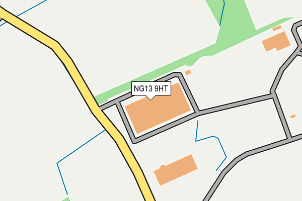
NG13 9HT is located in the Nevile & Langar electoral ward, within the local authority district of Rushcliffe and the English Parliamentary constituency of Rushcliffe. The Sub Integrated Care Board (ICB) Location is NHS Nottingham and Nottinghamshire ICB - 52R and the police force is Nottinghamshire. This postcode has been in use since January 1980.


GetTheData
Source: OS OpenMap – Local (Ordnance Survey)
Source: OS VectorMap District (Ordnance Survey)
Licence: Open Government Licence (requires attribution)
| Easting | 473279 |
| Northing | 333746 |
| Latitude | 52.896175 |
| Longitude | -0.912153 |
GetTheData
Source: Open Postcode Geo
Licence: Open Government Licence
| Country | England |
| Postcode District | NG13 |
| ➜ NG13 open data dashboard ➜ See where NG13 is on a map | |
GetTheData
Source: Land Registry Price Paid Data
Licence: Open Government Licence
Elevation or altitude of NG13 9HT as distance above sea level:
| Metres | Feet | |
|---|---|---|
| Elevation | 30m | 98ft |
Elevation is measured from the approximate centre of the postcode, to the nearest point on an OS contour line from OS Terrain 50, which has contour spacing of ten vertical metres.
➜ How high above sea level am I? Find the elevation of your current position using your device's GPS.
GetTheData
Source: Open Postcode Elevation
Licence: Open Government Licence
| Ward | Nevile & Langar |
| Constituency | Rushcliffe |
GetTheData
Source: ONS Postcode Database
Licence: Open Government Licence
| March 2022 | Burglary | On or near Coach Gap Lane | 494m |
| March 2022 | Burglary | On or near Coach Gap Lane | 494m |
| February 2022 | Burglary | On or near Coach Gap Lane | 494m |
| ➜ Get more crime data in our Crime section | |||
GetTheData
Source: data.police.uk
Licence: Open Government Licence
| Earl Howe Crescent (Main Street) | Langar | 1,226m |
| Earl Howe Crescent (Main Street) | Langar | 1,226m |
| Butlers Field (Barnstone Road) | Langar | 1,341m |
| Butlers Field (Barnstone Road) | Langar | 1,347m |
| Bingham Road | Langar | 1,437m |
GetTheData
Source: NaPTAN
Licence: Open Government Licence
GetTheData
Source: ONS Postcode Database
Licence: Open Government Licence


➜ Get more ratings from the Food Standards Agency
GetTheData
Source: Food Standards Agency
Licence: FSA terms & conditions
| Last Collection | |||
|---|---|---|---|
| Location | Mon-Fri | Sat | Distance |
| Langar Post Office | 16:30 | 09:00 | 1,193m |
| Barnstone | 17:00 | 09:00 | 1,718m |
| Granby | 16:30 | 09:30 | 2,980m |
GetTheData
Source: Dracos
Licence: Creative Commons Attribution-ShareAlike
| Facility | Distance |
|---|---|
| Langar C Of E Primary School Barnstone Road, Langar, Nottingham Grass Pitches | 1.4km |
| Colston Bassett Cricket Club Hall Lane, Colston Bassett, Nottingham Grass Pitches | 3.6km |
| Hose Village Hall Harby Lane, Hose, Melton Mowbray Sports Hall, Grass Pitches, Outdoor Tennis Courts | 4.5km |
GetTheData
Source: Active Places
Licence: Open Government Licence
| School | Phase of Education | Distance |
|---|---|---|
| Langar CofE Primary School Barnstone Road, Langar, Nottingham, NG13 9HH | Primary | 1.4km |
| Harby Church of England Primary School School Lane, Harby, Melton Mowbray, LE14 4BZ | Primary | 2.9km |
| Colston Bassett School Limited School Lane, Colston Bassett, Nottingham, NG12 3FD | Not applicable | 3.6km |
GetTheData
Source: Edubase
Licence: Open Government Licence
The below table lists the International Territorial Level (ITL) codes (formerly Nomenclature of Territorial Units for Statistics (NUTS) codes) and Local Administrative Units (LAU) codes for NG13 9HT:
| ITL 1 Code | Name |
|---|---|
| TLF | East Midlands (England) |
| ITL 2 Code | Name |
| TLF1 | Derbyshire and Nottinghamshire |
| ITL 3 Code | Name |
| TLF16 | South Nottinghamshire |
| LAU 1 Code | Name |
| E07000176 | Rushcliffe |
GetTheData
Source: ONS Postcode Directory
Licence: Open Government Licence
The below table lists the Census Output Area (OA), Lower Layer Super Output Area (LSOA), and Middle Layer Super Output Area (MSOA) for NG13 9HT:
| Code | Name | |
|---|---|---|
| OA | E00144823 | |
| LSOA | E01028420 | Rushcliffe 010C |
| MSOA | E02005915 | Rushcliffe 010 |
GetTheData
Source: ONS Postcode Directory
Licence: Open Government Licence
| NG13 9HP | Coachgap Lane | 460m |
| NG13 9HL | Willow Lane | 1126m |
| NG13 9HD | Cropwell Road | 1158m |
| NG13 9HN | Musters Road | 1203m |
| NG13 9HU | Belvoir Crescent | 1239m |
| NG13 9HE | Main Street | 1259m |
| NG13 9HS | Butlers Field | 1271m |
| NG13 9HF | Earl Howe Crescent | 1293m |
| NG13 9JN | Works Lane | 1298m |
| NG13 9HH | Barnstone Road | 1310m |
GetTheData
Source: Open Postcode Geo; Land Registry Price Paid Data
Licence: Open Government Licence