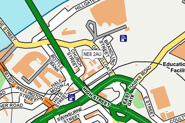
NE8 2AU is located in the Bridges electoral ward, within the metropolitan district of Gateshead and the English Parliamentary constituency of Gateshead. The Sub Integrated Care Board (ICB) Location is NHS North East and North Cumbria ICB - 13T and the police force is Northumbria. This postcode has been in use since January 1980.


GetTheData
Source: OS OpenMap – Local (Ordnance Survey)
Source: OS VectorMap District (Ordnance Survey)
Licence: Open Government Licence (requires attribution)
| Easting | 425447 |
| Northing | 563682 |
| Latitude | 54.967125 |
| Longitude | -1.604075 |
GetTheData
Source: Open Postcode Geo
Licence: Open Government Licence
| Country | England |
| Postcode District | NE8 |
| ➜ NE8 open data dashboard ➜ See where NE8 is on a map ➜ Where is Gateshead? | |
GetTheData
Source: Land Registry Price Paid Data
Licence: Open Government Licence
Elevation or altitude of NE8 2AU as distance above sea level:
| Metres | Feet | |
|---|---|---|
| Elevation | 30m | 98ft |
Elevation is measured from the approximate centre of the postcode, to the nearest point on an OS contour line from OS Terrain 50, which has contour spacing of ten vertical metres.
➜ How high above sea level am I? Find the elevation of your current position using your device's GPS.
GetTheData
Source: Open Postcode Elevation
Licence: Open Government Licence
| Ward | Bridges |
| Constituency | Gateshead |
GetTheData
Source: ONS Postcode Database
Licence: Open Government Licence
| January 2024 | Violence and sexual offences | On or near Parking Area | 321m |
| January 2024 | Violence and sexual offences | On or near Parking Area | 422m |
| January 2024 | Violence and sexual offences | On or near Parking Area | 422m |
| ➜ Get more crime data in our Crime section | |||
GetTheData
Source: data.police.uk
Licence: Open Government Licence
| Hillgate Quay (Hillgate Quay Westbound) | Gateshead Quays | 48m |
| Bridge Street | Gateshead Quays | 53m |
| The Sage Gateshead (St Marys Square) | Gateshead Quays | 89m |
| Hillgate Quay | Gateshead Quays | 98m |
| Bridge Street | Gateshead | 127m |
| Gateshead (Tyne And Wear Metro Station) (Bensham Road) | Gateshead | 644m |
| Manors (Tyne And Wear Metro Station) (Argyll Street) | Manors | 770m |
| Central Station (Tyne And Wear Metro Station) (Neville Street) | Newcastle Upon Tyne | 804m |
| Monument (Tyne And Wear Metro Station) (Blackett Street) | Newcastle Upon Tyne | 950m |
| Haymarket (Tyne And Wear Metro Station) (Percy Street) | Newcastle Upon Tyne | 1,316m |
| Manors Station | 0.6km |
| Newcastle Station | 0.9km |
| Dunston Station | 3.1km |
GetTheData
Source: NaPTAN
Licence: Open Government Licence
GetTheData
Source: ONS Postcode Database
Licence: Open Government Licence


➜ Get more ratings from the Food Standards Agency
GetTheData
Source: Food Standards Agency
Licence: FSA terms & conditions
| Last Collection | |||
|---|---|---|---|
| Location | Mon-Fri | Sat | Distance |
| Quayside | 18:30 | 12:00 | 258m |
| Swinburne Street | 17:30 | 12:30 | 263m |
| Gateshead Branch Post Office | 17:30 | 12:30 | 368m |
GetTheData
Source: Dracos
Licence: Creative Commons Attribution-ShareAlike
| Facility | Distance |
|---|---|
| Livingwell Health Club (Newcastle Gateshead) Bottle Bank, Gateshead Swimming Pool, Health and Fitness Gym | 178m |
| Vigour Gym 2 (Closed) Wellington Street, Gateshead Health and Fitness Gym | 256m |
| Anytime Fitness (Gateshead) High Street, Gateshead Health and Fitness Gym, Studio | 360m |
GetTheData
Source: Active Places
Licence: Open Government Licence
| School | Phase of Education | Distance |
|---|---|---|
| Gateshead College Baltic Campus, Quarryfield Road, Gateshead, NE8 3BE | 16 plus | 386m |
| North East Futures UTC Stephenson Square, Stephenson Quarter, Newcastle Upon Tyne, NE1 3AS | Secondary | 771m |
| Christ Church CofE Primary School Shieldfield Green, Newcastle upon Tyne, NE2 1XA | Primary | 911m |
GetTheData
Source: Edubase
Licence: Open Government Licence
The below table lists the International Territorial Level (ITL) codes (formerly Nomenclature of Territorial Units for Statistics (NUTS) codes) and Local Administrative Units (LAU) codes for NE8 2AU:
| ITL 1 Code | Name |
|---|---|
| TLC | North East (England) |
| ITL 2 Code | Name |
| TLC2 | Northumberland, and Tyne and Wear |
| ITL 3 Code | Name |
| TLC22 | Tyneside |
| LAU 1 Code | Name |
| E08000037 | Gateshead |
GetTheData
Source: ONS Postcode Directory
Licence: Open Government Licence
The below table lists the Census Output Area (OA), Lower Layer Super Output Area (LSOA), and Middle Layer Super Output Area (MSOA) for NE8 2AU:
| Code | Name | |
|---|---|---|
| OA | E00166205 | |
| LSOA | E01008166 | Gateshead 027C |
| MSOA | E02006841 | Gateshead 027 |
GetTheData
Source: ONS Postcode Directory
Licence: Open Government Licence
| NE8 2ER | Curzon Place | 150m |
| NE8 2ES | Curzon Place | 178m |
| NE8 2AS | Hills Street | 186m |
| NE1 3DE | Quayside | 240m |
| NE8 2AJ | Wellington Street | 247m |
| NE8 2AB | Hudson Street | 269m |
| NE1 3HE | Broad Garth | 274m |
| NE1 3AE | Lombard Street | 276m |
| NE1 3HD | Peppercorn Court | 278m |
| NE1 3DQ | Broad Chare | 282m |
GetTheData
Source: Open Postcode Geo; Land Registry Price Paid Data
Licence: Open Government Licence