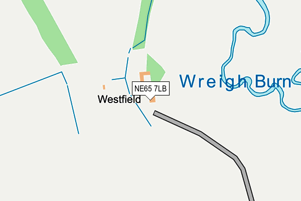
NE65 7LB is located in the Rothbury electoral ward, within the unitary authority of Northumberland and the English Parliamentary constituency of Berwick-upon-Tweed. The Sub Integrated Care Board (ICB) Location is NHS North East and North Cumbria ICB - 00L and the police force is Northumbria. This postcode has been in use since January 1980.


GetTheData
Source: OS OpenMap – Local (Ordnance Survey)
Source: OS VectorMap District (Ordnance Survey)
Licence: Open Government Licence (requires attribution)
| Easting | 401346 |
| Northing | 603289 |
| Latitude | 55.323668 |
| Longitude | -1.980346 |
GetTheData
Source: Open Postcode Geo
Licence: Open Government Licence
| Country | England |
| Postcode District | NE65 |
| ➜ NE65 open data dashboard ➜ See where NE65 is on a map | |
GetTheData
Source: Land Registry Price Paid Data
Licence: Open Government Licence
Elevation or altitude of NE65 7LB as distance above sea level:
| Metres | Feet | |
|---|---|---|
| Elevation | 100m | 328ft |
Elevation is measured from the approximate centre of the postcode, to the nearest point on an OS contour line from OS Terrain 50, which has contour spacing of ten vertical metres.
➜ How high above sea level am I? Find the elevation of your current position using your device's GPS.
GetTheData
Source: Open Postcode Elevation
Licence: Open Government Licence
| Ward | Rothbury |
| Constituency | Berwick-upon-tweed |
GetTheData
Source: ONS Postcode Database
Licence: Open Government Licence
| Warton Road End (B6341) | Thropton | 961m |
| Warton Road End (B6341) | Thropton | 963m |
| The Cottage (C176) | Snitter | 1,136m |
| Three Wheat Heads (B6341) | Thropton | 1,802m |
GetTheData
Source: NaPTAN
Licence: Open Government Licence
| Percentage of properties with Next Generation Access | 0.0% |
| Percentage of properties with Superfast Broadband | 0.0% |
| Percentage of properties with Ultrafast Broadband | 0.0% |
| Percentage of properties with Full Fibre Broadband | 0.0% |
Superfast Broadband is between 30Mbps and 300Mbps
Ultrafast Broadband is > 300Mbps
| Percentage of properties unable to receive 2Mbps | 0.0% |
| Percentage of properties unable to receive 5Mbps | 100.0% |
| Percentage of properties unable to receive 10Mbps | 100.0% |
| Percentage of properties unable to receive 30Mbps | 100.0% |
GetTheData
Source: Ofcom
Licence: Ofcom Terms of Use (requires attribution)
GetTheData
Source: ONS Postcode Database
Licence: Open Government Licence


➜ Get more ratings from the Food Standards Agency
GetTheData
Source: Food Standards Agency
Licence: FSA terms & conditions
| Last Collection | |||
|---|---|---|---|
| Location | Mon-Fri | Sat | Distance |
| Snitter | 16:15 | 09:00 | 1,103m |
| Low Trewhitt | 16:00 | 08:45 | 1,592m |
| Thropton Main Road | 16:45 | 11:15 | 1,604m |
GetTheData
Source: Dracos
Licence: Creative Commons Attribution-ShareAlike
| Facility | Distance |
|---|---|
| Rothbury Golf Club Rothbury, Morpeth Golf | 4.6km |
| Rothbury Recreation Club Rothbury, Morpeth Artificial Grass Pitch, Outdoor Tennis Courts | 5.1km |
| Rothbury Pool & Gym Silverton Lane, Rothbury, Morpeth Swimming Pool, Health and Fitness Gym | 5.4km |
GetTheData
Source: Active Places
Licence: Open Government Licence
| School | Phase of Education | Distance |
|---|---|---|
| Thropton Village First School Thropton, Morpeth, NE65 7JD | Primary | 2.1km |
| Rothbury First School Addycombe, Rothbury, Morpeth, NE65 7PG | Primary | 4.7km |
| Dr Thomlinson Church of England Middle School Silverton Lane, Rothbury, Morpeth, NE65 7RJ | Middle deemed secondary | 5.4km |
GetTheData
Source: Edubase
Licence: Open Government Licence
The below table lists the International Territorial Level (ITL) codes (formerly Nomenclature of Territorial Units for Statistics (NUTS) codes) and Local Administrative Units (LAU) codes for NE65 7LB:
| ITL 1 Code | Name |
|---|---|
| TLC | North East (England) |
| ITL 2 Code | Name |
| TLC2 | Northumberland, and Tyne and Wear |
| ITL 3 Code | Name |
| TLC21 | Northumberland |
| LAU 1 Code | Name |
| E06000057 | Northumberland |
GetTheData
Source: ONS Postcode Directory
Licence: Open Government Licence
The below table lists the Census Output Area (OA), Lower Layer Super Output Area (LSOA), and Middle Layer Super Output Area (MSOA) for NE65 7LB:
| Code | Name | |
|---|---|---|
| OA | E00139267 | |
| LSOA | E01027369 | Northumberland 007C |
| MSOA | E02005705 | Northumberland 007 |
GetTheData
Source: ONS Postcode Directory
Licence: Open Government Licence
| NE65 7LD | 887m | |
| NE65 7EJ | 1138m | |
| NE65 7EL | 1194m | |
| NE65 7EH | 1269m | |
| NE65 7EQ | 1503m | |
| NE65 7LP | Wreighburn Fields | 1532m |
| NE65 7LA | West Lea | 1548m |
| NE65 7LT | 1617m | |
| NE65 7LU | 1634m | |
| NE65 7HR | Meadowcroft Park | 1659m |
GetTheData
Source: Open Postcode Geo; Land Registry Price Paid Data
Licence: Open Government Licence