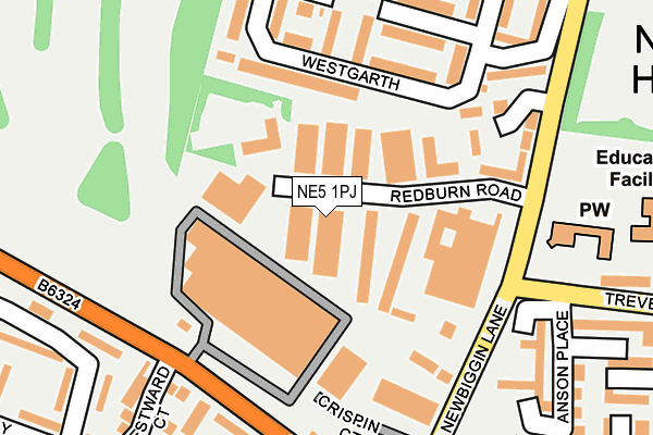
NE5 1PJ is located in the Kingston Park South & Newbiggin Hall electoral ward, within the metropolitan district of Newcastle upon Tyne and the English Parliamentary constituency of Newcastle upon Tyne North. The Sub Integrated Care Board (ICB) Location is NHS North East and North Cumbria ICB - 13T and the police force is Northumbria. This postcode has been in use since January 1980.


GetTheData
Source: OS OpenMap – Local (Ordnance Survey)
Source: OS VectorMap District (Ordnance Survey)
Licence: Open Government Licence (requires attribution)
| Easting | 419545 |
| Northing | 567608 |
| Latitude | 55.002662 |
| Longitude | -1.695981 |
GetTheData
Source: Open Postcode Geo
Licence: Open Government Licence
| Country | England |
| Postcode District | NE5 |
| ➜ NE5 open data dashboard ➜ See where NE5 is on a map ➜ Where is Newcastle upon Tyne? | |
GetTheData
Source: Land Registry Price Paid Data
Licence: Open Government Licence
Elevation or altitude of NE5 1PJ as distance above sea level:
| Metres | Feet | |
|---|---|---|
| Elevation | 110m | 361ft |
Elevation is measured from the approximate centre of the postcode, to the nearest point on an OS contour line from OS Terrain 50, which has contour spacing of ten vertical metres.
➜ How high above sea level am I? Find the elevation of your current position using your device's GPS.
GetTheData
Source: Open Postcode Elevation
Licence: Open Government Licence
| Ward | Kingston Park South & Newbiggin Hall |
| Constituency | Newcastle Upon Tyne North |
GetTheData
Source: ONS Postcode Database
Licence: Open Government Licence
| January 2024 | Violence and sexual offences | On or near Trevelyan Drive | 413m |
| January 2024 | Violence and sexual offences | On or near Bedeburn Road | 496m |
| January 2024 | Other crime | On or near Bedeburn Road | 496m |
| ➜ Get more crime data in our Crime section | |||
GetTheData
Source: data.police.uk
Licence: Open Government Licence
| Newbiggin Lane-trevelyan Drive (Newbiggin Lane) | Newbiggin Hall | 189m |
| Stamfordham Road-kensington Villas (Stamfordham Road) | Westerhope | 191m |
| Stamfordham Road-kensington Villas (Stamfordham Road) | Westerhope | 192m |
| Newbiggin Lane-redburn Road (Newbiggin Lane) | Newbiggin Hall | 196m |
| Newbiggin Lane - Crispin Court (Newbiggin Lane) | Westerhope | 226m |
| Bank Foot (Tyne And Wear Metro Station) (Station Road) | Kenton Bank Foot | 1,705m |
| Newcastle Airport Metro | 3.8km |
| Blaydon Station | 4.2km |
| Metrocentre Station | 5.3km |
GetTheData
Source: NaPTAN
Licence: Open Government Licence
GetTheData
Source: ONS Postcode Database
Licence: Open Government Licence

➜ Get more ratings from the Food Standards Agency
GetTheData
Source: Food Standards Agency
Licence: FSA terms & conditions
| Last Collection | |||
|---|---|---|---|
| Location | Mon-Fri | Sat | Distance |
| Grosvenor Way | 16:00 | 11:00 | 689m |
| Chapel House Post Office | 17:45 | 12:15 | 1,598m |
| Hillheads Post Office | 17:45 | 11:15 | 1,627m |
GetTheData
Source: Dracos
Licence: Creative Commons Attribution-ShareAlike
| Facility | Distance |
|---|---|
| St. Marks Rc Primary School Bardon Close, Westerhope, Newcastle Upon Tyne Grass Pitches, Artificial Grass Pitch | 308m |
| Gala Field Newbiggin Lane, Newcastle Upon Tyne Grass Pitches | 414m |
| Westerhope Golf Club Whorlton Grange, Newcastle Upon Tyne Golf | 484m |
GetTheData
Source: Active Places
Licence: Open Government Licence
| School | Phase of Education | Distance |
|---|---|---|
| St Mark's Catholic Primary School, Westerhope Bardon Close, Westerhope, Newcastle-upon-Tyne, NE5 4BT | Primary | 323m |
| Westerhope Primary School Hillhead Road, Westerhope, Newcastle-upon-Tyne, NE5 1NE | Primary | 569m |
| Simonside Primary School Bedeburn Road, Westerhope, Newcastle-upon-Tyne, NE5 4LG | Primary | 585m |
GetTheData
Source: Edubase
Licence: Open Government Licence
The below table lists the International Territorial Level (ITL) codes (formerly Nomenclature of Territorial Units for Statistics (NUTS) codes) and Local Administrative Units (LAU) codes for NE5 1PJ:
| ITL 1 Code | Name |
|---|---|
| TLC | North East (England) |
| ITL 2 Code | Name |
| TLC2 | Northumberland, and Tyne and Wear |
| ITL 3 Code | Name |
| TLC22 | Tyneside |
| LAU 1 Code | Name |
| E08000021 | Newcastle upon Tyne |
GetTheData
Source: ONS Postcode Directory
Licence: Open Government Licence
The below table lists the Census Output Area (OA), Lower Layer Super Output Area (LSOA), and Middle Layer Super Output Area (MSOA) for NE5 1PJ:
| Code | Name | |
|---|---|---|
| OA | E00042928 | |
| LSOA | E01008457 | Newcastle upon Tyne 004C |
| MSOA | E02001711 | Newcastle upon Tyne 004 |
GetTheData
Source: ONS Postcode Directory
Licence: Open Government Licence
| NE5 1NB | Redburn Road | 58m |
| NE5 4NT | Westgarth | 133m |
| NE5 4PD | Westgarth | 183m |
| NE5 4PE | Westgarth | 192m |
| NE5 4AZ | St Marks Court | 195m |
| NE5 5HH | Stamfordham Road | 208m |
| NE5 4PB | Westgarth | 215m |
| NE5 5HN | Kensington Villas | 220m |
| NE5 4PH | Westgarth | 222m |
| NE5 4NU | Westgarth | 227m |
GetTheData
Source: Open Postcode Geo; Land Registry Price Paid Data
Licence: Open Government Licence