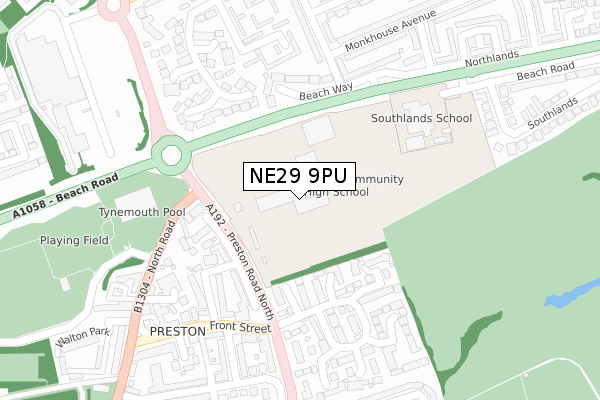
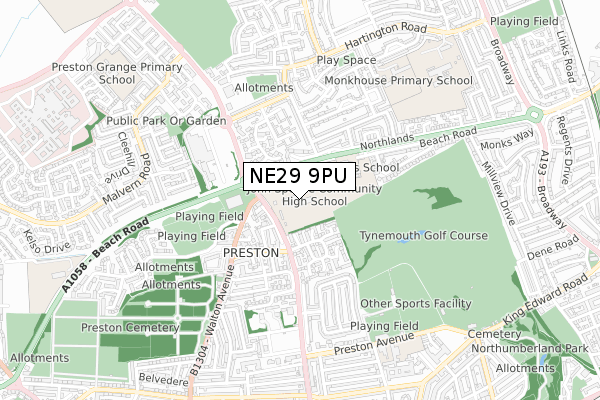
NE29 9PU is located in the Preston electoral ward, within the metropolitan district of North Tyneside and the English Parliamentary constituency of Tynemouth. The Sub Integrated Care Board (ICB) Location is NHS North East and North Cumbria ICB - 99C and the police force is Northumbria. This postcode has been in use since January 1980.


GetTheData
Source: OS Open Zoomstack (Ordnance Survey)
Licence: Open Government Licence (requires attribution)
Attribution: Contains OS data © Crown copyright and database right 2024
Source: Open Postcode Geo
Licence: Open Government Licence (requires attribution)
Attribution: Contains OS data © Crown copyright and database right 2024; Contains Royal Mail data © Royal Mail copyright and database right 2024; Source: Office for National Statistics licensed under the Open Government Licence v.3.0
| Easting | 435276 |
| Northing | 569972 |
| Latitude | 55.023050 |
| Longitude | -1.449786 |
GetTheData
Source: Open Postcode Geo
Licence: Open Government Licence
| Country | England |
| Postcode District | NE29 |
| ➜ NE29 open data dashboard ➜ See where NE29 is on a map ➜ Where is Tynemouth? | |
GetTheData
Source: Land Registry Price Paid Data
Licence: Open Government Licence
Elevation or altitude of NE29 9PU as distance above sea level:
| Metres | Feet | |
|---|---|---|
| Elevation | 40m | 131ft |
Elevation is measured from the approximate centre of the postcode, to the nearest point on an OS contour line from OS Terrain 50, which has contour spacing of ten vertical metres.
➜ How high above sea level am I? Find the elevation of your current position using your device's GPS.
GetTheData
Source: Open Postcode Elevation
Licence: Open Government Licence
| Ward | Preston |
| Constituency | Tynemouth |
GetTheData
Source: ONS Postcode Database
Licence: Open Government Licence
| December 2022 | Violence and sexual offences | On or near Kelvin Grove | 272m |
| June 2022 | Anti-social behaviour | On or near Edington Grove | 135m |
| June 2022 | Public order | On or near Edington Grove | 135m |
| ➜ Get more crime data in our Crime section | |||
GetTheData
Source: data.police.uk
Licence: Open Government Licence
| John Spence Community High School (Beach Road) | Preston Grange | 67m |
| Beach Road-preston Road (Beach Road) | Preston Grange | 143m |
| Preston Village (Preston Road) | North Shields | 210m |
| Preston Village (North Road) | North Shields | 273m |
| Beach Road | Tynemouth | 305m |
| Tynemouth (Tyne And Wear Metro Station) (Station Terrace) | Tynemouth | 1,505m |
| Cullercoats (Tyne And Wear Metro Station) (Station Road) | Cullercoats | 1,592m |
GetTheData
Source: NaPTAN
Licence: Open Government Licence
GetTheData
Source: ONS Postcode Database
Licence: Open Government Licence


➜ Get more ratings from the Food Standards Agency
GetTheData
Source: Food Standards Agency
Licence: FSA terms & conditions
| Last Collection | |||
|---|---|---|---|
| Location | Mon-Fri | Sat | Distance |
| Edington Road | 16:00 | 11:45 | 326m |
| Barton Close | 16:00 | 11:45 | 445m |
| Marden Post Office | 16:15 | 12:00 | 631m |
GetTheData
Source: Dracos
Licence: Creative Commons Attribution-ShareAlike
| Facility | Distance |
|---|---|
| John Spence Community High School Preston North Road, North Shields Health and Fitness Gym, Grass Pitches, Artificial Grass Pitch, Sports Hall, Outdoor Tennis Courts, Studio | 146m |
| Tynemouth Swimming Pool Preston North Road, North Shields Swimming Pool, Health and Fitness Gym, Studio | 334m |
| Preston Playing Fields Preston Avenue, North Shields Grass Pitches | 521m |
GetTheData
Source: Active Places
Licence: Open Government Licence
| School | Phase of Education | Distance |
|---|---|---|
| John Spence Community High School Preston Road, North Shields, NE29 9PU | Secondary | 135m |
| Southlands School Beach Road, Tynemouth, North Shields, NE30 2QR | Not applicable | 179m |
| Monkhouse Primary School Wallington Avenue, North Shields, NE30 3SH | Primary | 536m |
GetTheData
Source: Edubase
Licence: Open Government Licence
The below table lists the International Territorial Level (ITL) codes (formerly Nomenclature of Territorial Units for Statistics (NUTS) codes) and Local Administrative Units (LAU) codes for NE29 9PU:
| ITL 1 Code | Name |
|---|---|
| TLC | North East (England) |
| ITL 2 Code | Name |
| TLC2 | Northumberland, and Tyne and Wear |
| ITL 3 Code | Name |
| TLC22 | Tyneside |
| LAU 1 Code | Name |
| E08000022 | North Tyneside |
GetTheData
Source: ONS Postcode Directory
Licence: Open Government Licence
The below table lists the Census Output Area (OA), Lower Layer Super Output Area (LSOA), and Middle Layer Super Output Area (MSOA) for NE29 9PU:
| Code | Name | |
|---|---|---|
| OA | E00043275 | |
| LSOA | E01008525 | North Tyneside 017A |
| MSOA | E02001754 | North Tyneside 017 |
GetTheData
Source: ONS Postcode Directory
Licence: Open Government Licence
| NE30 3ED | Beach Way | 99m |
| NE30 3QT | Edington Grove | 107m |
| NE30 3QX | Edington Road | 152m |
| NE30 2TR | Beach Road | 152m |
| NE30 3RL | Cambo Place | 164m |
| NE30 3QU | Monkhouse Avenue | 176m |
| NE30 3QZ | Edington Road | 220m |
| NE30 3LT | Preston Wood | 223m |
| NE30 3RJ | Cambo Place | 238m |
| NE30 3QS | Campsie Crescent | 246m |
GetTheData
Source: Open Postcode Geo; Land Registry Price Paid Data
Licence: Open Government Licence