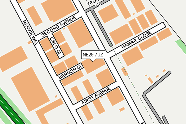
NE29 7UZ is located in the Chirton electoral ward, within the metropolitan district of North Tyneside and the English Parliamentary constituency of Tynemouth. The Sub Integrated Care Board (ICB) Location is NHS North East and North Cumbria ICB - 99C and the police force is Northumbria. This postcode has been in use since January 1993.


GetTheData
Source: OS OpenMap – Local (Ordnance Survey)
Source: OS VectorMap District (Ordnance Survey)
Licence: Open Government Licence (requires attribution)
| Easting | 433020 |
| Northing | 567835 |
| Latitude | 55.003994 |
| Longitude | -1.485303 |
GetTheData
Source: Open Postcode Geo
Licence: Open Government Licence
| Country | England |
| Postcode District | NE29 |
| ➜ NE29 open data dashboard ➜ See where NE29 is on a map ➜ Where is Tynemouth? | |
GetTheData
Source: Land Registry Price Paid Data
Licence: Open Government Licence
Elevation or altitude of NE29 7UZ as distance above sea level:
| Metres | Feet | |
|---|---|---|
| Elevation | 40m | 131ft |
Elevation is measured from the approximate centre of the postcode, to the nearest point on an OS contour line from OS Terrain 50, which has contour spacing of ten vertical metres.
➜ How high above sea level am I? Find the elevation of your current position using your device's GPS.
GetTheData
Source: Open Postcode Elevation
Licence: Open Government Licence
| Ward | Chirton |
| Constituency | Tynemouth |
GetTheData
Source: ONS Postcode Database
Licence: Open Government Licence
| June 2022 | Violence and sexual offences | On or near Bournemouth Road | 453m |
| June 2022 | Violence and sexual offences | On or near Bournemouth Road | 453m |
| June 2022 | Anti-social behaviour | On or near Ridley Avenue | 477m |
| ➜ Get more crime data in our Crime section | |||
GetTheData
Source: data.police.uk
Licence: Open Government Licence
| Tyne Tunnel Trading Estate (High Flatworth) | West Chirton | 134m |
| Tyne Tunnel Trading Estate (High Flatworth) | West Chirton | 168m |
| High Flatworth-second Avenue (High Flatworth) | West Chirton | 178m |
| High Flatworth-tromso Close (High Flatworth) | West Chirton | 191m |
| Tyne Tunnel Trading Estate (Narvick Way) | West Chirton | 362m |
| Percy Main (Tyne And Wear Metro Station) (Burdon Street) | Percy Main | 875m |
| Howdon (Tyne And Wear Metro Station) (Howdon Lane) | Howdon | 1,100m |
| Meadow Well (Tyne And Wear Metro Station) (Ripley Avenue) | Meadow Well | 1,306m |
| Brockley Whins Station | 5.2km |
GetTheData
Source: NaPTAN
Licence: Open Government Licence
Estimated total energy consumption in NE29 7UZ by fuel type, 2015.
| Consumption (kWh) | 343,377 |
|---|---|
| Meter count | 13 |
| Mean (kWh/meter) | 26,414 |
| Median (kWh/meter) | 20,525 |
GetTheData
Source: Postcode level gas estimates: 2015 (experimental)
Source: Postcode level electricity estimates: 2015 (experimental)
Licence: Open Government Licence
GetTheData
Source: ONS Postcode Database
Licence: Open Government Licence


➜ Get more ratings from the Food Standards Agency
GetTheData
Source: Food Standards Agency
Licence: FSA terms & conditions
| Last Collection | |||
|---|---|---|---|
| Location | Mon-Fri | Sat | Distance |
| High Howdon Post Office | 17:45 | 11:00 | 1,386m |
| Silverlink Industrial Estate | 18:45 | 10:30 | 1,636m |
| Norham Road North | 16:45 | 12:15 | 1,695m |
GetTheData
Source: Dracos
Licence: Creative Commons Attribution-ShareAlike
| Facility | Distance |
|---|---|
| High Flatworth Playing Fields High Flatworth, Tyne Tunnel Trading Estate, North Shields Grass Pitches | 287m |
| Norham High School Alnwick Avenue, West Chirton, North Shields Sports Hall, Health and Fitness Gym, Grass Pitches | 704m |
| Meadow Well Primary (Closed) Wantage Avenue, North Shields Grass Pitches | 793m |
GetTheData
Source: Active Places
Licence: Open Government Licence
| School | Phase of Education | Distance |
|---|---|---|
| Norham High School Alnwick Avenue, North Shields, NE29 7BU | Secondary | 823m |
| Silverdale School Langdale Gardens, Howdon, Wallsend, NE28 0HG | Not applicable | 846m |
| Denbigh Community Primary School Denbigh Avenue, Howdon, Denbigh Ave, Howdon, Ne28 0ds, WALLSEND, NE28 0DS | Primary | 864m |
GetTheData
Source: Edubase
Licence: Open Government Licence
The below table lists the International Territorial Level (ITL) codes (formerly Nomenclature of Territorial Units for Statistics (NUTS) codes) and Local Administrative Units (LAU) codes for NE29 7UZ:
| ITL 1 Code | Name |
|---|---|
| TLC | North East (England) |
| ITL 2 Code | Name |
| TLC2 | Northumberland, and Tyne and Wear |
| ITL 3 Code | Name |
| TLC22 | Tyneside |
| LAU 1 Code | Name |
| E08000022 | North Tyneside |
GetTheData
Source: ONS Postcode Directory
Licence: Open Government Licence
The below table lists the Census Output Area (OA), Lower Layer Super Output Area (LSOA), and Middle Layer Super Output Area (MSOA) for NE29 7UZ:
| Code | Name | |
|---|---|---|
| OA | E00043047 | |
| LSOA | E01008481 | North Tyneside 023A |
| MSOA | E02001760 | North Tyneside 023 |
GetTheData
Source: ONS Postcode Directory
Licence: Open Government Licence
| NE28 0HW | Melrose Gardens | 429m |
| NE28 0DL | Henley Gardens | 443m |
| NE28 0DX | Ridley Avenue | 458m |
| NE28 0DY | Ridley Avenue | 498m |
| NE29 7AP | Rothbury Terrace | 512m |
| NE29 7AW | Berwick Terrace | 530m |
| NE28 0DU | Ridley Avenue | 534m |
| NE28 0HN | Lonsdale Gardens | 547m |
| NE28 0DG | Saltburn Gardens | 551m |
| NE29 7AN | Morpeth Terrace | 556m |
GetTheData
Source: Open Postcode Geo; Land Registry Price Paid Data
Licence: Open Government Licence