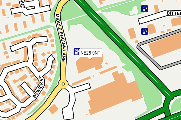
NE28 9NT is located in the Battle Hill electoral ward, within the metropolitan district of North Tyneside and the English Parliamentary constituency of North Tyneside. The Sub Integrated Care Board (ICB) Location is NHS North East and North Cumbria ICB - 99C and the police force is Northumbria. This postcode has been in use since January 1980.


GetTheData
Source: OS OpenMap – Local (Ordnance Survey)
Source: OS VectorMap District (Ordnance Survey)
Licence: Open Government Licence (requires attribution)
| Easting | 431914 |
| Northing | 568581 |
| Latitude | 55.010769 |
| Longitude | -1.502511 |
GetTheData
Source: Open Postcode Geo
Licence: Open Government Licence
| Country | England |
| Postcode District | NE28 |
| ➜ NE28 open data dashboard ➜ See where NE28 is on a map ➜ Where is Wallsend? | |
GetTheData
Source: Land Registry Price Paid Data
Licence: Open Government Licence
Elevation or altitude of NE28 9NT as distance above sea level:
| Metres | Feet | |
|---|---|---|
| Elevation | 60m | 197ft |
Elevation is measured from the approximate centre of the postcode, to the nearest point on an OS contour line from OS Terrain 50, which has contour spacing of ten vertical metres.
➜ How high above sea level am I? Find the elevation of your current position using your device's GPS.
GetTheData
Source: Open Postcode Elevation
Licence: Open Government Licence
| Ward | Battle Hill |
| Constituency | North Tyneside |
GetTheData
Source: ONS Postcode Database
Licence: Open Government Licence
| January 2024 | Violence and sexual offences | On or near Blackhill Avenue | 442m |
| January 2024 | Violence and sexual offences | On or near Blackhill Avenue | 442m |
| January 2024 | Public order | On or near Blackhill Avenue | 442m |
| ➜ Get more crime data in our Crime section | |||
GetTheData
Source: data.police.uk
Licence: Open Government Licence
| Middle Engine Lane-b&q-n (Middle Engine Lane) | High Howdon | 99m |
| Middle Engine Lane Atmel (Middle Engine Lane) | Silverlink | 238m |
| Middle Engine Lane Atmel (Middle Engine Lane) | Silverlink | 262m |
| Middle Engine Lane Bewick Park (Middle Engine Lane) | Battle Hill | 286m |
| Tyne Met Coast Road Campus (Middle Engine Lane) | Battle Hill | 321m |
GetTheData
Source: NaPTAN
Licence: Open Government Licence
GetTheData
Source: ONS Postcode Database
Licence: Open Government Licence


➜ Get more ratings from the Food Standards Agency
GetTheData
Source: Food Standards Agency
Licence: FSA terms & conditions
| Last Collection | |||
|---|---|---|---|
| Location | Mon-Fri | Sat | Distance |
| Silverlink Industrial Estate | 18:45 | 10:30 | 1,272m |
| North Tyneside Delivery Office | 18:45 | 12:45 | 1,449m |
| High Howdon Post Office | 17:45 | 11:00 | 1,582m |
GetTheData
Source: Dracos
Licence: Creative Commons Attribution-ShareAlike
| Facility | Distance |
|---|---|
| Kicks Leisure - Silverlink Park (Closed) Coast Road, Wallsend Swimming Pool, Health and Fitness Gym, Studio | 259m |
| The Langdale Centre Langdale Gardens, Wallsend Grass Pitches | 571m |
| Churchill Community College Churchill Street, Wallsend Health and Fitness Gym, Grass Pitches, Sports Hall, Studio, Indoor Tennis Centre | 701m |
GetTheData
Source: Active Places
Licence: Open Government Licence
| School | Phase of Education | Distance |
|---|---|---|
| Silverdale School Langdale Gardens, Howdon, Wallsend, NE28 0HG | Not applicable | 524m |
| St Aidan's Catholic Primary School, Wallsend Coniston Road, Wallsend, NE28 0EP | Primary | 621m |
| Churchill Community College Churchill Street, Wallsend, NE28 7TN | Secondary | 701m |
GetTheData
Source: Edubase
Licence: Open Government Licence
The below table lists the International Territorial Level (ITL) codes (formerly Nomenclature of Territorial Units for Statistics (NUTS) codes) and Local Administrative Units (LAU) codes for NE28 9NT:
| ITL 1 Code | Name |
|---|---|
| TLC | North East (England) |
| ITL 2 Code | Name |
| TLC2 | Northumberland, and Tyne and Wear |
| ITL 3 Code | Name |
| TLC22 | Tyneside |
| LAU 1 Code | Name |
| E08000022 | North Tyneside |
GetTheData
Source: ONS Postcode Directory
Licence: Open Government Licence
The below table lists the Census Output Area (OA), Lower Layer Super Output Area (LSOA), and Middle Layer Super Output Area (MSOA) for NE28 9NT:
| Code | Name | |
|---|---|---|
| OA | E00042953 | |
| LSOA | E01008468 | North Tyneside 021D |
| MSOA | E02001758 | North Tyneside 021 |
GetTheData
Source: ONS Postcode Directory
Licence: Open Government Licence
| NE28 9RY | Bewick Park | 185m |
| NE28 9XU | Blackhill Avenue | 250m |
| NE28 9TZ | Bewick Park | 254m |
| NE28 9XT | Blackhill Avenue | 285m |
| NE28 9RZ | Bewick Park | 308m |
| NE28 9XX | Blackhill Avenue | 315m |
| NE28 9RU | Bewick Park | 317m |
| NE28 9XQ | Bellshill Close | 333m |
| NE28 9XH | Bellshill Close | 389m |
| NE28 9XG | Bellshill Close | 394m |
GetTheData
Source: Open Postcode Geo; Land Registry Price Paid Data
Licence: Open Government Licence