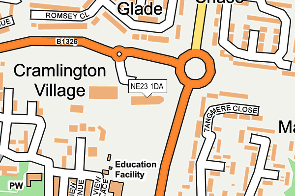
NE23 1DA is located in the Cramlington Village electoral ward, within the unitary authority of Northumberland and the English Parliamentary constituency of Blyth Valley. The Sub Integrated Care Board (ICB) Location is NHS North East and North Cumbria ICB - 00L and the police force is Northumbria. This postcode has been in use since January 2008.


GetTheData
Source: OS OpenMap – Local (Ordnance Survey)
Source: OS VectorMap District (Ordnance Survey)
Licence: Open Government Licence (requires attribution)
| Easting | 426864 |
| Northing | 577083 |
| Latitude | 55.087470 |
| Longitude | -1.580690 |
GetTheData
Source: Open Postcode Geo
Licence: Open Government Licence
| Country | England |
| Postcode District | NE23 |
| ➜ NE23 open data dashboard ➜ See where NE23 is on a map ➜ Where is Cramlington? | |
GetTheData
Source: Land Registry Price Paid Data
Licence: Open Government Licence
Elevation or altitude of NE23 1DA as distance above sea level:
| Metres | Feet | |
|---|---|---|
| Elevation | 70m | 230ft |
Elevation is measured from the approximate centre of the postcode, to the nearest point on an OS contour line from OS Terrain 50, which has contour spacing of ten vertical metres.
➜ How high above sea level am I? Find the elevation of your current position using your device's GPS.
GetTheData
Source: Open Postcode Elevation
Licence: Open Government Licence
| Ward | Cramlington Village |
| Constituency | Blyth Valley |
GetTheData
Source: ONS Postcode Database
Licence: Open Government Licence
| January 2024 | Criminal damage and arson | On or near Tangmere Close | 246m |
| December 2023 | Criminal damage and arson | On or near Tangmere Close | 246m |
| November 2023 | Anti-social behaviour | On or near Tangmere Close | 246m |
| ➜ Get more crime data in our Crime section | |||
GetTheData
Source: data.police.uk
Licence: Open Government Licence
| Telephone Exchange (Northumbrian Road) | Cramlington | 154m |
| Telephone Exchange (Northumbrian Road) | Cramlington | 167m |
| East West Link Road | Cramlington | 192m |
| Parkside Glade (Northumbrian Road) | Parkside | 223m |
| East West Link Road | Cramlington | 241m |
| Cramlington Station | 1.1km |
GetTheData
Source: NaPTAN
Licence: Open Government Licence
| Percentage of properties with Next Generation Access | 100.0% |
| Percentage of properties with Superfast Broadband | 100.0% |
| Percentage of properties with Ultrafast Broadband | 0.0% |
| Percentage of properties with Full Fibre Broadband | 0.0% |
Superfast Broadband is between 30Mbps and 300Mbps
Ultrafast Broadband is > 300Mbps
| Percentage of properties unable to receive 2Mbps | 0.0% |
| Percentage of properties unable to receive 5Mbps | 0.0% |
| Percentage of properties unable to receive 10Mbps | 0.0% |
| Percentage of properties unable to receive 30Mbps | 0.0% |
GetTheData
Source: Ofcom
Licence: Ofcom Terms of Use (requires attribution)
GetTheData
Source: ONS Postcode Database
Licence: Open Government Licence


➜ Get more ratings from the Food Standards Agency
GetTheData
Source: Food Standards Agency
Licence: FSA terms & conditions
| Last Collection | |||
|---|---|---|---|
| Location | Mon-Fri | Sat | Distance |
| Station Road | 17:45 | 11:45 | 257m |
| Northumbrian Row | 16:00 | 11:00 | 478m |
| Filton Close | 16:00 | 11:00 | 540m |
GetTheData
Source: Dracos
Licence: Creative Commons Attribution-ShareAlike
| Facility | Distance |
|---|---|
| Hillcrest School East View Avenue, Cramlington Grass Pitches | 206m |
| Central Park (Cramlington) Norwich Way, Cramlington Grass Pitches | 630m |
| Concordia Leisure Centre Forum Way, Cramlington Sports Hall, Indoor Bowls, Swimming Pool, Health and Fitness Gym, Studio, Squash Courts | 758m |
GetTheData
Source: Active Places
Licence: Open Government Licence
| School | Phase of Education | Distance |
|---|---|---|
| Cramlington Hillcrest School East View Avenue, East Farm, Cramlington, NE23 1DY | Not applicable | 221m |
| Cramlington Shanklea Primary School Nairn Road, Parkside Chase, Cramlington, NE23 1RQ | Primary | 324m |
| Cramlington Village Primary School Bowmont Drive, Cramlington, NE23 2SN | Primary | 828m |
GetTheData
Source: Edubase
Licence: Open Government Licence
The below table lists the International Territorial Level (ITL) codes (formerly Nomenclature of Territorial Units for Statistics (NUTS) codes) and Local Administrative Units (LAU) codes for NE23 1DA:
| ITL 1 Code | Name |
|---|---|
| TLC | North East (England) |
| ITL 2 Code | Name |
| TLC2 | Northumberland, and Tyne and Wear |
| ITL 3 Code | Name |
| TLC21 | Northumberland |
| LAU 1 Code | Name |
| E06000057 | Northumberland |
GetTheData
Source: ONS Postcode Directory
Licence: Open Government Licence
The below table lists the Census Output Area (OA), Lower Layer Super Output Area (LSOA), and Middle Layer Super Output Area (MSOA) for NE23 1DA:
| Code | Name | |
|---|---|---|
| OA | E00139496 | |
| LSOA | E01027409 | Northumberland 029B |
| MSOA | E02005715 | Northumberland 029 |
GetTheData
Source: ONS Postcode Directory
Licence: Open Government Licence
| NE23 1LF | East Farm Court | 79m |
| NE23 1NF | Ringwood Drive | 133m |
| NE23 1DT | East Farm Terrace | 146m |
| NE23 1DP | Middle Farm Court | 180m |
| NE23 1NG | Ringwood Drive | 181m |
| NE23 1NQ | Romsey Close | 195m |
| NE23 1DY | East View Avenue | 207m |
| NE23 1DN | 214m | |
| NE23 1DU | Blagdon Terrace | 225m |
| NE23 1NH | Ryde Place | 228m |
GetTheData
Source: Open Postcode Geo; Land Registry Price Paid Data
Licence: Open Government Licence