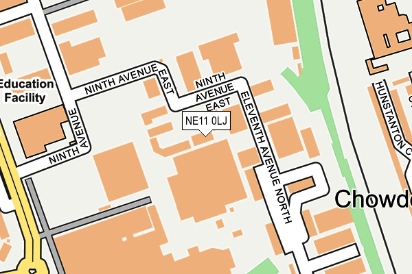
NE11 0LJ is located in the Lamesley electoral ward, within the metropolitan district of Gateshead and the English Parliamentary constituency of Blaydon. The Sub Integrated Care Board (ICB) Location is NHS North East and North Cumbria ICB - 13T and the police force is Northumbria. This postcode has been in use since August 1992.


GetTheData
Source: OS OpenMap – Local (Ordnance Survey)
Source: OS VectorMap District (Ordnance Survey)
Licence: Open Government Licence (requires attribution)
| Easting | 425044 |
| Northing | 559174 |
| Latitude | 54.926629 |
| Longitude | -1.610748 |
GetTheData
Source: Open Postcode Geo
Licence: Open Government Licence
| Country | England |
| Postcode District | NE11 |
| ➜ NE11 open data dashboard ➜ See where NE11 is on a map ➜ Where is Gateshead? | |
GetTheData
Source: Land Registry Price Paid Data
Licence: Open Government Licence
Elevation or altitude of NE11 0LJ as distance above sea level:
| Metres | Feet | |
|---|---|---|
| Elevation | 20m | 66ft |
Elevation is measured from the approximate centre of the postcode, to the nearest point on an OS contour line from OS Terrain 50, which has contour spacing of ten vertical metres.
➜ How high above sea level am I? Find the elevation of your current position using your device's GPS.
GetTheData
Source: Open Postcode Elevation
Licence: Open Government Licence
| Ward | Lamesley |
| Constituency | Blaydon |
GetTheData
Source: ONS Postcode Database
Licence: Open Government Licence
| June 2022 | Shoplifting | On or near Ninth Avenue East | 86m |
| June 2022 | Burglary | On or near Ninth Avenue East | 86m |
| June 2022 | Vehicle crime | On or near Ninth Avenue East | 86m |
| ➜ Get more crime data in our Crime section | |||
GetTheData
Source: data.police.uk
Licence: Open Government Licence
| Kingsway South - Ninth Avenue (Kingsway South) | Team Valley | 292m |
| Joseph Swan School (Saltwell Road South) | Chowdene | 294m |
| Kingsway South | Team Valley | 332m |
| Saltwell Road South-joseph Swan (Saltwell Road) | Chowdene | 372m |
| Saltwell Road South-joseph Swan (Saltwell Road) | Chowdene | 377m |
| Dunston Station | 3.3km |
| Heworth Station | 4.5km |
| Newcastle Station | 4.7km |
GetTheData
Source: NaPTAN
Licence: Open Government Licence
GetTheData
Source: ONS Postcode Database
Licence: Open Government Licence


➜ Get more ratings from the Food Standards Agency
GetTheData
Source: Food Standards Agency
Licence: FSA terms & conditions
| Last Collection | |||
|---|---|---|---|
| Location | Mon-Fri | Sat | Distance |
| St Andrews Drive | 17:45 | 12:00 | 414m |
| Safeways, Kingsway | 19:15 | 12:30 | 480m |
| Safeways Supermarket | 18:30 | 567m | |
GetTheData
Source: Dracos
Licence: Creative Commons Attribution-ShareAlike
| Facility | Distance |
|---|---|
| Grace College Saltwell Road South, Gateshead Sports Hall, Grass Pitches, Outdoor Tennis Courts | 321m |
| Oakfield Infant School Chowdene Bank, Gateshead Grass Pitches | 542m |
| Harlow Green Primary School Harlow Green Lane, Gateshead Grass Pitches | 1.3km |
GetTheData
Source: Active Places
Licence: Open Government Licence
| School | Phase of Education | Distance |
|---|---|---|
| Grace College Saltwell Road South, Gateshead, NE9 6LE | Secondary | 390m |
| Oakfield Infant School Chowdene Bank, Low Fell, Gateshead, NE9 6JH | Primary | 553m |
| Oakfield Junior School Chowdene Bank, Gateshead, NE9 6JH | Primary | 592m |
GetTheData
Source: Edubase
Licence: Open Government Licence
The below table lists the International Territorial Level (ITL) codes (formerly Nomenclature of Territorial Units for Statistics (NUTS) codes) and Local Administrative Units (LAU) codes for NE11 0LJ:
| ITL 1 Code | Name |
|---|---|
| TLC | North East (England) |
| ITL 2 Code | Name |
| TLC2 | Northumberland, and Tyne and Wear |
| ITL 3 Code | Name |
| TLC22 | Tyneside |
| LAU 1 Code | Name |
| E08000037 | Gateshead |
GetTheData
Source: ONS Postcode Directory
Licence: Open Government Licence
The below table lists the Census Output Area (OA), Lower Layer Super Output Area (LSOA), and Middle Layer Super Output Area (MSOA) for NE11 0LJ:
| Code | Name | |
|---|---|---|
| OA | E00041888 | |
| LSOA | E01008259 | Gateshead 007D |
| MSOA | E02001688 | Gateshead 007 |
GetTheData
Source: ONS Postcode Directory
Licence: Open Government Licence
| NE11 0EH | Ninth Avenue | 38m |
| NE11 0NJ | Eleventh Avenue North | 151m |
| NE11 0SH | Kingsway South | 244m |
| NE9 6LA | Hunstanton Court | 258m |
| NE11 0BQ | Jedburgh Court | 320m |
| NE9 6JT | St Andrews Drive | 323m |
| NE9 6JY | Cramond Court | 333m |
| NE11 0XW | Seventh Avenue | 372m |
| NE9 6JX | Longniddry Court | 373m |
| NE9 6HF | Greenacre Park | 432m |
GetTheData
Source: Open Postcode Geo; Land Registry Price Paid Data
Licence: Open Government Licence