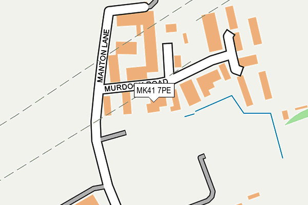
MK41 7PE lies on Murdock Road in Manton Industrial Estate, Bedford. MK41 7PE is located in the Harpur electoral ward, within the unitary authority of Bedford and the English Parliamentary constituency of Bedford. The Sub Integrated Care Board (ICB) Location is NHS Bedfordshire, Luton and Milton Keynes ICB - M1J4Y and the police force is Bedfordshire. This postcode has been in use since January 1980.


GetTheData
Source: OS OpenMap – Local (Ordnance Survey)
Source: OS VectorMap District (Ordnance Survey)
Licence: Open Government Licence (requires attribution)
| Easting | 504376 |
| Northing | 251679 |
| Latitude | 52.153537 |
| Longitude | -0.475796 |
GetTheData
Source: Open Postcode Geo
Licence: Open Government Licence
| Street | Murdock Road |
| Locality | Manton Industrial Estate |
| Town/City | Bedford |
| Country | England |
| Postcode District | MK41 |
| ➜ MK41 open data dashboard ➜ See where MK41 is on a map ➜ Where is Bedford? | |
GetTheData
Source: Land Registry Price Paid Data
Licence: Open Government Licence
Elevation or altitude of MK41 7PE as distance above sea level:
| Metres | Feet | |
|---|---|---|
| Elevation | 70m | 230ft |
Elevation is measured from the approximate centre of the postcode, to the nearest point on an OS contour line from OS Terrain 50, which has contour spacing of ten vertical metres.
➜ How high above sea level am I? Find the elevation of your current position using your device's GPS.
GetTheData
Source: Open Postcode Elevation
Licence: Open Government Licence
| Ward | Harpur |
| Constituency | Bedford |
GetTheData
Source: ONS Postcode Database
Licence: Open Government Licence
21, MURDOCK ROAD, MANTON INDUSTRIAL ESTATE, BEDFORD, MK41 7PE 1998 1 JUL £165,000 |
GetTheData
Source: HM Land Registry Price Paid Data
Licence: Contains HM Land Registry data © Crown copyright and database right 2024. This data is licensed under the Open Government Licence v3.0.
| January 2024 | Violence and sexual offences | On or near Goldcrest Way | 451m |
| January 2024 | Vehicle crime | On or near Goldcrest Way | 451m |
| January 2024 | Burglary | On or near Goldcrest Way | 451m |
| ➜ Murdock Road crime map and outcomes | |||
GetTheData
Source: data.police.uk
Licence: Open Government Licence
| Eagle Gardens (Brickhill Drive) | Bedford | 380m |
| Gainsborough Rise (Brickhill Drive) | Bedford | 380m |
| Rooksmead (Brickhill Drive) | Brickhill | 429m |
| Morland Way (Gainsborough Rise) | Bedford | 438m |
| Morland Way (Gainsborough Rise) | Bedford | 481m |
| Bedford Station | 1.9km |
| Bedford St Johns Station | 2.7km |
GetTheData
Source: NaPTAN
Licence: Open Government Licence
GetTheData
Source: ONS Postcode Database
Licence: Open Government Licence


➜ Get more ratings from the Food Standards Agency
GetTheData
Source: Food Standards Agency
Licence: FSA terms & conditions
| Last Collection | |||
|---|---|---|---|
| Location | Mon-Fri | Sat | Distance |
| Gainsborough Rise | 18:30 | 11:15 | 618m |
| Post Office Brickhill Drive | 17:30 | 12:00 | 748m |
| Hawk Drive | 18:30 | 11:30 | 824m |
GetTheData
Source: Dracos
Licence: Creative Commons Attribution-ShareAlike
| Facility | Distance |
|---|---|
| Mcmullen Park Meadow Lane, Manton Industrial Estate, Bedford Grass Pitches | 194m |
| Puregym (Bedford Heights) Brickhill Drive, Bedford Swimming Pool, Health and Fitness Gym, Studio | 313m |
| Towers Health And Racquets Club Clapham Road, Clapham, Bedford Outdoor Tennis Courts, Indoor Tennis Centre, Squash Courts, Health and Fitness Gym, Swimming Pool, Studio | 617m |
GetTheData
Source: Active Places
Licence: Open Government Licence
| School | Phase of Education | Distance |
|---|---|---|
| Edith Cavell Primary School Manton Lane, Bedford, MK41 7NH | Primary | 653m |
| Bedford Modern School Manton Lane, Bedford, MK41 7NT | Not applicable | 715m |
| Scott Primary School Hawk Drive, Brickhill, Bedford, MK41 7JA | Primary | 784m |
GetTheData
Source: Edubase
Licence: Open Government Licence
The below table lists the International Territorial Level (ITL) codes (formerly Nomenclature of Territorial Units for Statistics (NUTS) codes) and Local Administrative Units (LAU) codes for MK41 7PE:
| ITL 1 Code | Name |
|---|---|
| TLH | East |
| ITL 2 Code | Name |
| TLH2 | Bedfordshire and Hertfordshire |
| ITL 3 Code | Name |
| TLH24 | Bedford |
| LAU 1 Code | Name |
| E06000055 | Bedford |
GetTheData
Source: ONS Postcode Directory
Licence: Open Government Licence
The below table lists the Census Output Area (OA), Lower Layer Super Output Area (LSOA), and Middle Layer Super Output Area (MSOA) for MK41 7PE:
| Code | Name | |
|---|---|---|
| OA | E00088357 | |
| LSOA | E01017499 | Bedford 010C |
| MSOA | E02003625 | Bedford 010 |
GetTheData
Source: ONS Postcode Directory
Licence: Open Government Licence
| MK41 7PB | Manton Lane | 126m |
| MK41 7PT | Murdoch Road | 181m |
| MK41 7QH | Brickhill Drive | 394m |
| MK41 7HY | Curlew Crescent | 434m |
| MK41 7QJ | Brickhill Drive | 437m |
| MK41 7FF | Goldcrest Way | 445m |
| MK41 7QQ | Brickhill Drive | 446m |
| MK41 7NX | Brickhill Drive | 448m |
| MK41 7NS | Gainsborough Rise | 448m |
| MK41 7HZ | Curlew Crescent | 456m |
GetTheData
Source: Open Postcode Geo; Land Registry Price Paid Data
Licence: Open Government Licence