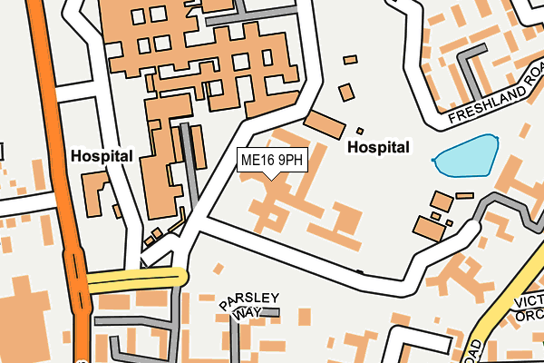
ME16 9PH is located in the Heath electoral ward, within the local authority district of Maidstone and the English Parliamentary constituency of Maidstone and The Weald. The Sub Integrated Care Board (ICB) Location is NHS Kent and Medway ICB - 91Q and the police force is Kent. This postcode has been in use since June 2001.


GetTheData
Source: OS OpenMap – Local (Ordnance Survey)
Source: OS VectorMap District (Ordnance Survey)
Licence: Open Government Licence (requires attribution)
| Easting | 573484 |
| Northing | 155608 |
| Latitude | 51.273212 |
| Longitude | 0.485699 |
GetTheData
Source: Open Postcode Geo
Licence: Open Government Licence
| Country | England |
| Postcode District | ME16 |
| ➜ ME16 open data dashboard ➜ See where ME16 is on a map ➜ Where is Maidstone? | |
GetTheData
Source: Land Registry Price Paid Data
Licence: Open Government Licence
Elevation or altitude of ME16 9PH as distance above sea level:
| Metres | Feet | |
|---|---|---|
| Elevation | 80m | 262ft |
Elevation is measured from the approximate centre of the postcode, to the nearest point on an OS contour line from OS Terrain 50, which has contour spacing of ten vertical metres.
➜ How high above sea level am I? Find the elevation of your current position using your device's GPS.
GetTheData
Source: Open Postcode Elevation
Licence: Open Government Licence
| Ward | Heath |
| Constituency | Maidstone And The Weald |
GetTheData
Source: ONS Postcode Database
Licence: Open Government Licence
| November 2023 | Criminal damage and arson | On or near Edmund Close | 494m |
| November 2023 | Public order | On or near Edmund Close | 494m |
| May 2023 | Anti-social behaviour | On or near Edmund Close | 494m |
| ➜ Get more crime data in our Crime section | |||
GetTheData
Source: data.police.uk
Licence: Open Government Licence
| Maidstone Hospital (Maidstone Hospital Grounds) | Barming Heath | 179m |
| Maidstone Hospital (Maidstone Hospital Grounds) | Barming Heath | 183m |
| Maidstone Hospital (Maidstone Hospital Grounds) | Barming Heath | 191m |
| Bramble Close (Queen's Road) | Maidstone | 293m |
| Bramble Close (Queen's Road) | Maidstone | 321m |
| Barming Station | 1.4km |
| East Farleigh Station | 2km |
| Maidstone Barracks Station | 2km |
GetTheData
Source: NaPTAN
Licence: Open Government Licence
GetTheData
Source: ONS Postcode Database
Licence: Open Government Licence


➜ Get more ratings from the Food Standards Agency
GetTheData
Source: Food Standards Agency
Licence: FSA terms & conditions
| Last Collection | |||
|---|---|---|---|
| Location | Mon-Fri | Sat | Distance |
| Marigold Way | 17:45 | 12:15 | 302m |
| Tonbridge Road | 17:15 | 12:00 | 623m |
| Hazelwood Drive | 17:45 | 12:15 | 671m |
GetTheData
Source: Dracos
Licence: Creative Commons Attribution-ShareAlike
| Facility | Distance |
|---|---|
| Beechwood Community Hall Tarragon Road, Maidstone Sports Hall | 249m |
| Barming Heath Springwood Road, Barming, Maidstone Grass Pitches | 627m |
| St Simon Stock Catholic School Oakwood Park, Maidstone Grass Pitches, Sports Hall, Studio, Outdoor Tennis Courts | 760m |
GetTheData
Source: Active Places
Licence: Open Government Licence
| School | Phase of Education | Distance |
|---|---|---|
| West Borough Primary School Greenway, Maidstone, ME16 8TL | Primary | 609m |
| St Francis' Catholic Primary School, Maidstone Queen's Road, Maidstone, ME16 0LB | Primary | 675m |
| St Simon Stock Catholic School Oakwood Park, Maidstone, ME16 0JP | Secondary | 767m |
GetTheData
Source: Edubase
Licence: Open Government Licence
The below table lists the International Territorial Level (ITL) codes (formerly Nomenclature of Territorial Units for Statistics (NUTS) codes) and Local Administrative Units (LAU) codes for ME16 9PH:
| ITL 1 Code | Name |
|---|---|
| TLJ | South East (England) |
| ITL 2 Code | Name |
| TLJ4 | Kent |
| ITL 3 Code | Name |
| TLJ45 | Mid Kent |
| LAU 1 Code | Name |
| E07000110 | Maidstone |
GetTheData
Source: ONS Postcode Directory
Licence: Open Government Licence
The below table lists the Census Output Area (OA), Lower Layer Super Output Area (LSOA), and Middle Layer Super Output Area (MSOA) for ME16 9PH:
| Code | Name | |
|---|---|---|
| OA | E00170344 | |
| LSOA | E01033088 | Maidstone 008F |
| MSOA | E02005075 | Maidstone 008 |
GetTheData
Source: ONS Postcode Directory
Licence: Open Government Licence
| ME16 0FW | Parsley Way | 155m |
| ME16 0FS | Parsley Way | 166m |
| ME16 0FT | Angelica Square | 182m |
| ME16 0ZG | Sandlewood Court | 194m |
| ME16 0FX | Angelica Square | 203m |
| ME16 0UF | Tarragon Road | 208m |
| ME16 0FP | Tarragon Road | 223m |
| ME16 0FY | Angelica Square | 228m |
| ME16 0NG | Tarragon Road | 231m |
| ME16 0FG | Fennel Close | 237m |
GetTheData
Source: Open Postcode Geo; Land Registry Price Paid Data
Licence: Open Government Licence