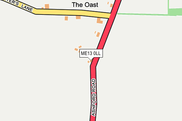
ME13 0LL lies on Ashford Road in Sheldwich, Faversham. ME13 0LL is located in the Boughton and Courtenay electoral ward, within the local authority district of Swale and the English Parliamentary constituency of Faversham and Mid Kent. The Sub Integrated Care Board (ICB) Location is NHS Kent and Medway ICB - 91Q and the police force is Kent. This postcode has been in use since January 1980.


GetTheData
Source: OS OpenMap – Local (Ordnance Survey)
Source: OS VectorMap District (Ordnance Survey)
Licence: Open Government Licence (requires attribution)
| Easting | 601412 |
| Northing | 158643 |
| Latitude | 51.291292 |
| Longitude | 0.887310 |
GetTheData
Source: Open Postcode Geo
Licence: Open Government Licence
| Street | Ashford Road |
| Locality | Sheldwich |
| Town/City | Faversham |
| Country | England |
| Postcode District | ME13 |
➜ See where ME13 is on a map | |
GetTheData
Source: Land Registry Price Paid Data
Licence: Open Government Licence
Elevation or altitude of ME13 0LL as distance above sea level:
| Metres | Feet | |
|---|---|---|
| Elevation | 50m | 164ft |
Elevation is measured from the approximate centre of the postcode, to the nearest point on an OS contour line from OS Terrain 50, which has contour spacing of ten vertical metres.
➜ How high above sea level am I? Find the elevation of your current position using your device's GPS.
GetTheData
Source: Open Postcode Elevation
Licence: Open Government Licence
| Ward | Boughton And Courtenay |
| Constituency | Faversham And Mid Kent |
GetTheData
Source: ONS Postcode Database
Licence: Open Government Licence
| Ashford Road | North Street | 631m |
| Ashford Road | North Street | 668m |
| Waterworks (Ashford Road) | Faversham | 956m |
| Waterworks (Ashford Road) | Faversham | 1,142m |
| Faversham Station | 2.3km |
| Selling Station | 4km |
GetTheData
Source: NaPTAN
Licence: Open Government Licence
| Percentage of properties with Next Generation Access | 100.0% |
| Percentage of properties with Superfast Broadband | 0.0% |
| Percentage of properties with Ultrafast Broadband | 0.0% |
| Percentage of properties with Full Fibre Broadband | 0.0% |
Superfast Broadband is between 30Mbps and 300Mbps
Ultrafast Broadband is > 300Mbps
| Percentage of properties unable to receive 2Mbps | 0.0% |
| Percentage of properties unable to receive 5Mbps | 0.0% |
| Percentage of properties unable to receive 10Mbps | 40.0% |
| Percentage of properties unable to receive 30Mbps | 100.0% |
GetTheData
Source: Ofcom
Licence: Ofcom Terms of Use (requires attribution)
GetTheData
Source: ONS Postcode Database
Licence: Open Government Licence


➜ Get more ratings from the Food Standards Agency
GetTheData
Source: Food Standards Agency
Licence: FSA terms & conditions
| Last Collection | |||
|---|---|---|---|
| Location | Mon-Fri | Sat | Distance |
| North Street | 16:00 | 10:00 | 709m |
| Brogdale Road | 16:30 | 10:30 | 1,368m |
| Whitehill | 16:30 | 10:30 | 1,513m |
GetTheData
Source: Dracos
Licence: Creative Commons Attribution-ShareAlike
The below table lists the International Territorial Level (ITL) codes (formerly Nomenclature of Territorial Units for Statistics (NUTS) codes) and Local Administrative Units (LAU) codes for ME13 0LL:
| ITL 1 Code | Name |
|---|---|
| TLJ | South East (England) |
| ITL 2 Code | Name |
| TLJ4 | Kent |
| ITL 3 Code | Name |
| TLJ43 | Kent Thames Gateway |
| LAU 1 Code | Name |
| E07000113 | Swale |
GetTheData
Source: ONS Postcode Directory
Licence: Open Government Licence
The below table lists the Census Output Area (OA), Lower Layer Super Output Area (LSOA), and Middle Layer Super Output Area (MSOA) for ME13 0LL:
| Code | Name | |
|---|---|---|
| OA | E00124659 | |
| LSOA | E01024555 | Swale 017A |
| MSOA | E02005131 | Swale 017 |
GetTheData
Source: ONS Postcode Directory
Licence: Open Government Licence
| ME13 0DL | Ashford Road | 556m |
| ME13 0LN | North Street | 664m |
| ME13 0LP | North Street | 698m |
| ME13 0LW | North Street | 722m |
| ME13 0LS | North Street | 829m |
| ME13 0LR | North Street | 831m |
| ME13 8XL | Ashford Road | 915m |
| ME13 9QE | Westwood Court | 996m |
| ME13 0DS | 1214m | |
| ME13 8XW | Ashford Road | 1253m |
GetTheData
Source: Open Postcode Geo; Land Registry Price Paid Data
Licence: Open Government Licence