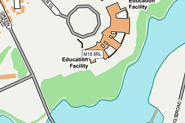
M18 8RL is located in the Gorton & Abbey Hey electoral ward, within the metropolitan district of Manchester and the English Parliamentary constituency of Manchester, Gorton. The Sub Integrated Care Board (ICB) Location is NHS Greater Manchester ICB - 14L and the police force is Greater Manchester. This postcode has been in use since January 1980.


GetTheData
Source: OS OpenMap – Local (Ordnance Survey)
Source: OS VectorMap District (Ordnance Survey)
Licence: Open Government Licence (requires attribution)
| Easting | 389961 |
| Northing | 396651 |
| Latitude | 53.466518 |
| Longitude | -2.152686 |
GetTheData
Source: Open Postcode Geo
Licence: Open Government Licence
| Country | England |
| Postcode District | M18 |
➜ See where M18 is on a map ➜ Where is Manchester? | |
GetTheData
Source: Land Registry Price Paid Data
Licence: Open Government Licence
Elevation or altitude of M18 8RL as distance above sea level:
| Metres | Feet | |
|---|---|---|
| Elevation | 80m | 262ft |
Elevation is measured from the approximate centre of the postcode, to the nearest point on an OS contour line from OS Terrain 50, which has contour spacing of ten vertical metres.
➜ How high above sea level am I? Find the elevation of your current position using your device's GPS.
GetTheData
Source: Open Postcode Elevation
Licence: Open Government Licence
| Ward | Gorton & Abbey Hey |
| Constituency | Manchester, Gorton |
GetTheData
Source: ONS Postcode Database
Licence: Open Government Licence
| Wright Robinson H.s. (Falmer St) | Abbey Hey | 91m |
| Abbey Hey Ln (Nbnd) (Abbey Hey Ln) | Abbey Hey | 220m |
| Jetson St/Sandown St (Jetson St) | Abbey Hey | 342m |
| Abbey Hey Lane (Sbnd) (Abbey Hey Ln) | Abbey Hey | 348m |
| Jetson St/Sandown St (Jetson St) | Abbey Hey | 366m |
| Cemetery Road (Manchester Metrolink) (Manchester Road) | Droylsden | 1,493m |
| Droylsden (Manchester Metrolink) (Ashton Road) | Droylsden | 1,534m |
| Audenshaw (Manchester Metrolink) (Droylesden Rd) | Audenshaw | 1,936m |
| Fairfield Station | 0.7km |
| Gorton Station | 0.9km |
| Ryder Brow Station | 1.7km |
GetTheData
Source: NaPTAN
Licence: Open Government Licence
GetTheData
Source: ONS Postcode Database
Licence: Open Government Licence


➜ Get more ratings from the Food Standards Agency
GetTheData
Source: Food Standards Agency
Licence: FSA terms & conditions
| Last Collection | |||
|---|---|---|---|
| Location | Mon-Fri | Sat | Distance |
| Abbey Hey Lane Jetson Street | 17:30 | 12:00 | 332m |
| Abbey Hey P.o. | 17:30 | 12:00 | 478m |
| 428 Abbey Hey Lane | 17:30 | 12:00 | 669m |
GetTheData
Source: Dracos
Licence: Creative Commons Attribution-ShareAlike
The below table lists the International Territorial Level (ITL) codes (formerly Nomenclature of Territorial Units for Statistics (NUTS) codes) and Local Administrative Units (LAU) codes for M18 8RL:
| ITL 1 Code | Name |
|---|---|
| TLD | North West (England) |
| ITL 2 Code | Name |
| TLD3 | Greater Manchester |
| ITL 3 Code | Name |
| TLD33 | Manchester |
| LAU 1 Code | Name |
| E08000003 | Manchester |
GetTheData
Source: ONS Postcode Directory
Licence: Open Government Licence
The below table lists the Census Output Area (OA), Lower Layer Super Output Area (LSOA), and Middle Layer Super Output Area (MSOA) for M18 8RL:
| Code | Name | |
|---|---|---|
| OA | E00026267 | |
| LSOA | E01005188 | Manchester 021B |
| MSOA | E02001065 | Manchester 021 |
GetTheData
Source: ONS Postcode Directory
Licence: Open Government Licence
| M18 8XJ | Falmer Close | 144m |
| M18 8UY | Underwood Close | 164m |
| M18 8QZ | Lakeside Close | 179m |
| M18 8TU | Violet Street | 211m |
| M18 8RJ | Green Fold | 224m |
| M18 8XN | Coram Street | 253m |
| M18 8TW | Abbey Hey Lane | 257m |
| M18 8TN | Abbey Hey Lane | 261m |
| M18 8TE | Fleet Street | 283m |
| M18 8XH | Rookery Avenue | 296m |
GetTheData
Source: Open Postcode Geo; Land Registry Price Paid Data
Licence: Open Government Licence