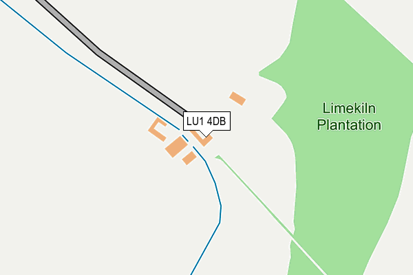
LU1 4DB is located in the Watling electoral ward, within the local authority district of Dacorum and the English Parliamentary constituency of Hemel Hempstead. The Sub Integrated Care Board (ICB) Location is NHS Hertfordshire and West Essex ICB - 06N and the police force is Hertfordshire. This postcode has been in use since January 1980.


GetTheData
Source: OS OpenMap – Local (Ordnance Survey)
Source: OS VectorMap District (Ordnance Survey)
Licence: Open Government Licence (requires attribution)
| Easting | 507716 |
| Northing | 217699 |
| Latitude | 51.847507 |
| Longitude | -0.437665 |
GetTheData
Source: Open Postcode Geo
Licence: Open Government Licence
| Country | England |
| Postcode District | LU1 |
➜ See where LU1 is on a map | |
GetTheData
Source: Land Registry Price Paid Data
Licence: Open Government Licence
Elevation or altitude of LU1 4DB as distance above sea level:
| Metres | Feet | |
|---|---|---|
| Elevation | 140m | 459ft |
Elevation is measured from the approximate centre of the postcode, to the nearest point on an OS contour line from OS Terrain 50, which has contour spacing of ten vertical metres.
➜ How high above sea level am I? Find the elevation of your current position using your device's GPS.
GetTheData
Source: Open Postcode Elevation
Licence: Open Government Licence
| Ward | Watling |
| Constituency | Hemel Hempstead |
GetTheData
Source: ONS Postcode Database
Licence: Open Government Licence
| Caravan Park (Half Moon Lane) | Pepperstock | 553m |
| Mancroft Road South-end (Mancroft Road) | Aley Green | 566m |
| Woodside View (Mancroft Road) | Woodside | 740m |
| Claydown Way (Markyate Road) | Slip End | 742m |
| Woodside View (Woodside Road) | Woodside | 758m |
| Luton Airport Parkway Station | 4km |
| Luton Station | 4.2km |
GetTheData
Source: NaPTAN
Licence: Open Government Licence
GetTheData
Source: ONS Postcode Database
Licence: Open Government Licence


➜ Get more ratings from the Food Standards Agency
GetTheData
Source: Food Standards Agency
Licence: FSA terms & conditions
| Last Collection | |||
|---|---|---|---|
| Location | Mon-Fri | Sat | Distance |
| Brickhill Farm | 17:15 | 08:15 | 571m |
| Post Office Markyate Road | 17:15 | 11:45 | 833m |
| Lower Woodside | 17:00 | 08:30 | 896m |
GetTheData
Source: Dracos
Licence: Creative Commons Attribution-ShareAlike
The below table lists the International Territorial Level (ITL) codes (formerly Nomenclature of Territorial Units for Statistics (NUTS) codes) and Local Administrative Units (LAU) codes for LU1 4DB:
| ITL 1 Code | Name |
|---|---|
| TLH | East |
| ITL 2 Code | Name |
| TLH2 | Bedfordshire and Hertfordshire |
| ITL 3 Code | Name |
| TLH23 | Hertfordshire CC |
| LAU 1 Code | Name |
| E07000096 | Dacorum |
GetTheData
Source: ONS Postcode Directory
Licence: Open Government Licence
The below table lists the Census Output Area (OA), Lower Layer Super Output Area (LSOA), and Middle Layer Super Output Area (MSOA) for LU1 4DB:
| Code | Name | |
|---|---|---|
| OA | E00119030 | |
| LSOA | E01023430 | Dacorum 001A |
| MSOA | E02004856 | Dacorum 001 |
GetTheData
Source: ONS Postcode Directory
Licence: Open Government Licence
| LU1 4BX | Markyate Road | 606m |
| LU1 4LL | Halfmoon Lane | 613m |
| LU1 4DE | St Andrews Close | 649m |
| LU1 4BT | Crawley Close | 656m |
| AL3 8QE | Luton Road | 672m |
| LU1 4BU | Markyate Road | 701m |
| LU1 4DD | Ross Way | 702m |
| LU1 4DU | Claydown Way | 708m |
| LU1 4BE | St Andrews Walk | 722m |
| LU1 4DG | Mancroft Road | 750m |
GetTheData
Source: Open Postcode Geo; Land Registry Price Paid Data
Licence: Open Government Licence