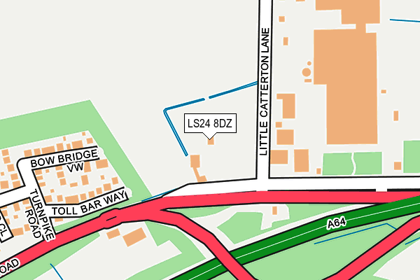
LS24 8DZ is located in the Tadcaster electoral ward, within the unitary authority of North Yorkshire and the English Parliamentary constituency of Selby and Ainsty. The Sub Integrated Care Board (ICB) Location is NHS Humber and North Yorkshire ICB - 03Q and the police force is North Yorkshire. This postcode has been in use since January 1980.


GetTheData
Source: OS OpenMap – Local (Ordnance Survey)
Source: OS VectorMap District (Ordnance Survey)
Licence: Open Government Licence (requires attribution)
| Easting | 449979 |
| Northing | 444116 |
| Latitude | 53.890842 |
| Longitude | -1.241033 |
GetTheData
Source: Open Postcode Geo
Licence: Open Government Licence
| Country | England |
| Postcode District | LS24 |
| ➜ LS24 open data dashboard ➜ See where LS24 is on a map ➜ Where is Tadcaster? | |
GetTheData
Source: Land Registry Price Paid Data
Licence: Open Government Licence
Elevation or altitude of LS24 8DZ as distance above sea level:
| Metres | Feet | |
|---|---|---|
| Elevation | 20m | 66ft |
Elevation is measured from the approximate centre of the postcode, to the nearest point on an OS contour line from OS Terrain 50, which has contour spacing of ten vertical metres.
➜ How high above sea level am I? Find the elevation of your current position using your device's GPS.
GetTheData
Source: Open Postcode Elevation
Licence: Open Government Licence
| Ward | Tadcaster |
| Constituency | Selby And Ainsty |
GetTheData
Source: ONS Postcode Database
Licence: Open Government Licence
| December 2023 | Public order | On or near Field Drive | 361m |
| October 2023 | Violence and sexual offences | On or near Field Drive | 361m |
| August 2023 | Criminal damage and arson | On or near Field Drive | 361m |
| ➜ Get more crime data in our Crime section | |||
GetTheData
Source: data.police.uk
Licence: Open Government Licence
| Tadcaster Industrial Estate (A659) | Oxton | 70m |
| Little Catterton Lane (A659) | Oxton | 140m |
| Auster Bank (York Road) | Tadcaster | 526m |
| Auster Bank (York Road) | Tadcaster | 550m |
| Oxton Lane End (A64) | Oxton | 730m |
| Ulleskelf Station | 4.5km |
GetTheData
Source: NaPTAN
Licence: Open Government Licence
| Percentage of properties with Next Generation Access | 100.0% |
| Percentage of properties with Superfast Broadband | 100.0% |
| Percentage of properties with Ultrafast Broadband | 0.0% |
| Percentage of properties with Full Fibre Broadband | 0.0% |
Superfast Broadband is between 30Mbps and 300Mbps
Ultrafast Broadband is > 300Mbps
| Percentage of properties unable to receive 2Mbps | 0.0% |
| Percentage of properties unable to receive 5Mbps | 0.0% |
| Percentage of properties unable to receive 10Mbps | 0.0% |
| Percentage of properties unable to receive 30Mbps | 0.0% |
GetTheData
Source: Ofcom
Licence: Ofcom Terms of Use (requires attribution)
GetTheData
Source: ONS Postcode Database
Licence: Open Government Licence


➜ Get more ratings from the Food Standards Agency
GetTheData
Source: Food Standards Agency
Licence: FSA terms & conditions
| Last Collection | |||
|---|---|---|---|
| Location | Mon-Fri | Sat | Distance |
| Islington | 16:45 | 09:30 | 101m |
| Auster Bank | 17:30 | 12:00 | 652m |
| Hill Top P.o. | 17:15 | 12:00 | 1,008m |
GetTheData
Source: Dracos
Licence: Creative Commons Attribution-ShareAlike
| Facility | Distance |
|---|---|
| Tadcaster Albion Fc Wharfe Bank, Tadcaster Grass Pitches | 1.5km |
| The Ings (Tadcaster Albion Fc) Tadcaster Grass Pitches | 1.6km |
| Tadcaster Community Swimming Pool Westgate, Tadcaster Swimming Pool, Health and Fitness Gym | 1.7km |
GetTheData
Source: Active Places
Licence: Open Government Licence
| School | Phase of Education | Distance |
|---|---|---|
| Tadcaster Primary Academy Grange Avenue, Tadcaster, LS24 8AN | Primary | 909m |
| St Joseph's Catholic Primary School, a Voluntary Academy Station Road, St Joseph's Catholic Primary School, Tadcaster, LS24 9JG | Primary | 1.8km |
| Riverside School, Tadcaster Wetherby Road, Tadcaster, LS24 9JN | Primary | 1.9km |
GetTheData
Source: Edubase
Licence: Open Government Licence
The below table lists the International Territorial Level (ITL) codes (formerly Nomenclature of Territorial Units for Statistics (NUTS) codes) and Local Administrative Units (LAU) codes for LS24 8DZ:
| ITL 1 Code | Name |
|---|---|
| TLE | Yorkshire and The Humber |
| ITL 2 Code | Name |
| TLE2 | North Yorkshire |
| ITL 3 Code | Name |
| TLE22 | North Yorkshire CC |
| LAU 1 Code | Name |
| E07000169 | Selby |
GetTheData
Source: ONS Postcode Directory
Licence: Open Government Licence
The below table lists the Census Output Area (OA), Lower Layer Super Output Area (LSOA), and Middle Layer Super Output Area (MSOA) for LS24 8DZ:
| Code | Name | |
|---|---|---|
| OA | E00142241 | |
| LSOA | E01027920 | Selby 001C |
| MSOA | E02005809 | Selby 001 |
GetTheData
Source: ONS Postcode Directory
Licence: Open Government Licence
| LS24 8EA | Little Catterton Lane | 137m |
| LS24 8JT | Toll Bar Way | 171m |
| LS24 8JU | Bow Bridge View | 196m |
| LS24 8JS | Turnpike Road | 262m |
| LS24 8JX | Eastfield Close | 327m |
| LS24 8BD | Eastfield Walk | 367m |
| LS24 8BB | Field Drive | 398m |
| LS24 8AU | York Road | 506m |
| LS24 8AX | Auster Bank Road | 544m |
| LS24 8BA | Auster Bank View | 646m |
GetTheData
Source: Open Postcode Geo; Land Registry Price Paid Data
Licence: Open Government Licence