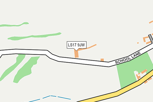
LS17 9JW is located in the Harewood electoral ward, within the metropolitan district of Leeds and the English Parliamentary constituency of Elmet and Rothwell. The Sub Integrated Care Board (ICB) Location is NHS West Yorkshire ICB - 15F and the police force is West Yorkshire. This postcode has been in use since August 1993.


GetTheData
Source: OS OpenMap – Local (Ordnance Survey)
Source: OS VectorMap District (Ordnance Survey)
Licence: Open Government Licence (requires attribution)
| Easting | 433333 |
| Northing | 441985 |
| Latitude | 53.873005 |
| Longitude | -1.494523 |
GetTheData
Source: Open Postcode Geo
Licence: Open Government Licence
| Country | England |
| Postcode District | LS17 |
| ➜ LS17 open data dashboard ➜ See where LS17 is on a map | |
GetTheData
Source: Land Registry Price Paid Data
Licence: Open Government Licence
Elevation or altitude of LS17 9JW as distance above sea level:
| Metres | Feet | |
|---|---|---|
| Elevation | 130m | 427ft |
Elevation is measured from the approximate centre of the postcode, to the nearest point on an OS contour line from OS Terrain 50, which has contour spacing of ten vertical metres.
➜ How high above sea level am I? Find the elevation of your current position using your device's GPS.
GetTheData
Source: Open Postcode Elevation
Licence: Open Government Licence
| Ward | Harewood |
| Constituency | Elmet And Rothwell |
GetTheData
Source: ONS Postcode Database
Licence: Open Government Licence
| May 2022 | Violence and sexual offences | On or near Forge Lane | 419m |
| March 2022 | Public order | On or near Forge Lane | 419m |
| December 2021 | Possession of weapons | On or near Forge Lane | 419m |
| ➜ Get more crime data in our Crime section | |||
GetTheData
Source: data.police.uk
Licence: Open Government Licence
| Forge Lane | Wike | 389m |
| Forge Lane | Wike | 525m |
| Coal Road | Wike | 875m |
| Wikefield Farm (Harrogate Road) | Wike | 1,173m |
| Wikefield Farm (Harrogate Road) | Wike | 1,178m |
GetTheData
Source: NaPTAN
Licence: Open Government Licence
GetTheData
Source: ONS Postcode Database
Licence: Open Government Licence


➜ Get more ratings from the Food Standards Agency
GetTheData
Source: Food Standards Agency
Licence: FSA terms & conditions
| Last Collection | |||
|---|---|---|---|
| Location | Mon-Fri | Sat | Distance |
| Mill Lane/Margaret Ave | 17:30 | 09:30 | 1,497m |
| Shopping Parade Slaid Hill | 17:30 | 11:30 | 1,861m |
| Bracken Park/Skye Lane | 17:45 | 09:00 | 1,910m |
GetTheData
Source: Dracos
Licence: Creative Commons Attribution-ShareAlike
| Facility | Distance |
|---|---|
| Leeds Golf Centre Wike Ridge Lane, Wike, Leeds Golf | 0m |
| The Village Golf Course Backstone Gill Lane, Wike, Leeds Golf | 900m |
| Moor Allerton Golf Club Coal Road, Wike, Leeds Golf | 992m |
GetTheData
Source: Active Places
Licence: Open Government Licence
| School | Phase of Education | Distance |
|---|---|---|
| The Grammar School At Leeds Alwoodley Gates, Harrogate Road, Leeds, LS17 8GS | Not applicable | 1.9km |
| Wigton Moor Primary School Barfield Crescent, Leeds, LS17 8RU | Primary | 2.4km |
| Shadwell Primary School Main Street, Shadwell, Leeds, LS17 8JF | Primary | 2.7km |
GetTheData
Source: Edubase
Licence: Open Government Licence
The below table lists the International Territorial Level (ITL) codes (formerly Nomenclature of Territorial Units for Statistics (NUTS) codes) and Local Administrative Units (LAU) codes for LS17 9JW:
| ITL 1 Code | Name |
|---|---|
| TLE | Yorkshire and The Humber |
| ITL 2 Code | Name |
| TLE4 | West Yorkshire |
| ITL 3 Code | Name |
| TLE42 | Leeds |
| LAU 1 Code | Name |
| E08000035 | Leeds |
GetTheData
Source: ONS Postcode Directory
Licence: Open Government Licence
The below table lists the Census Output Area (OA), Lower Layer Super Output Area (LSOA), and Middle Layer Super Output Area (MSOA) for LS17 9JW:
| Code | Name | |
|---|---|---|
| OA | E00058295 | |
| LSOA | E01011561 | Leeds 006A |
| MSOA | E02002335 | Leeds 006 |
GetTheData
Source: ONS Postcode Directory
Licence: Open Government Licence
| LS17 9JT | Wike Ridge Lane | 311m |
| LS17 9JU | Forge Lane | 499m |
| LS17 9JS | Backstone Gill Lane | 533m |
| LS17 9JF | Wikeridge Lane | 843m |
| LS17 9JG | Tarn Lane | 1056m |
| LS17 9NL | Wike Ridge Avenue | 1589m |
| LS17 9JD | Manor House Lane | 1594m |
| LS17 9JE | Slaid Hill | 1608m |
| LS17 9NX | Wike Ridge Court | 1621m |
| LS17 9NP | Wike Ridge Mount | 1624m |
GetTheData
Source: Open Postcode Geo; Land Registry Price Paid Data
Licence: Open Government Licence