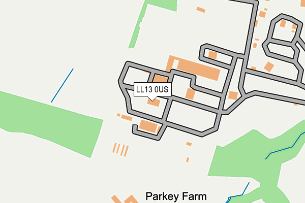
LL13 0US is located in the Marchwiel electoral ward, within the unitary authority of Wrexham and the Welsh Parliamentary constituency of Clwyd South. The Local Health Board is Betsi Cadwaladr University and the police force is North Wales. This postcode has been in use since December 1997.


GetTheData
Source: OS OpenMap – Local (Ordnance Survey)
Source: OS VectorMap District (Ordnance Survey)
Licence: Open Government Licence (requires attribution)
| Easting | 338030 |
| Northing | 348066 |
| Latitude | 53.026277 |
| Longitude | -2.925399 |
GetTheData
Source: Open Postcode Geo
Licence: Open Government Licence
| Country | Wales |
| Postcode District | LL13 |
➜ See where LL13 is on a map | |
GetTheData
Source: Land Registry Price Paid Data
Licence: Open Government Licence
Elevation or altitude of LL13 0US as distance above sea level:
| Metres | Feet | |
|---|---|---|
| Elevation | 40m | 131ft |
Elevation is measured from the approximate centre of the postcode, to the nearest point on an OS contour line from OS Terrain 50, which has contour spacing of ten vertical metres.
➜ How high above sea level am I? Find the elevation of your current position using your device's GPS.
GetTheData
Source: Open Postcode Elevation
Licence: Open Government Licence
| Ward | Marchwiel |
| Constituency | Clwyd South |
GetTheData
Source: ONS Postcode Database
Licence: Open Government Licence
| Pentre Maelor (Bridge Road South) | Pentre Maelor | 1,060m |
| Pentre Maelor (Bridge Road South) | Pentre Maelor | 1,070m |
| Bridge Road | Pentre Maelor | 1,143m |
| Cross Lanes (Bangor Road) | Cross Lanes | 1,204m |
| Cross Lanes (Bangor Road) | Cross Lanes | 1,230m |
| Wrexham Central Station | 5.4km |
GetTheData
Source: NaPTAN
Licence: Open Government Licence
GetTheData
Source: ONS Postcode Database
Licence: Open Government Licence


➜ Get more ratings from the Food Standards Agency
GetTheData
Source: Food Standards Agency
Licence: FSA terms & conditions
| Last Collection | |||
|---|---|---|---|
| Location | Mon-Fri | Sat | Distance |
| Cross Lanes | 09:45 | 09:00 | 937m |
| Bowling Bank | 09:30 | 08:45 | 1,925m |
| Wrexham Industrial Estate | 18:30 | 2,027m | |
GetTheData
Source: Dracos
Licence: Creative Commons Attribution-ShareAlike
The below table lists the International Territorial Level (ITL) codes (formerly Nomenclature of Territorial Units for Statistics (NUTS) codes) and Local Administrative Units (LAU) codes for LL13 0US:
| ITL 1 Code | Name |
|---|---|
| TLL | Wales |
| ITL 2 Code | Name |
| TLL2 | East Wales |
| ITL 3 Code | Name |
| TLL23 | Flintshire and Wrexham |
| LAU 1 Code | Name |
| W06000006 | Wrexham |
GetTheData
Source: ONS Postcode Directory
Licence: Open Government Licence
The below table lists the Census Output Area (OA), Lower Layer Super Output Area (LSOA), and Middle Layer Super Output Area (MSOA) for LL13 0US:
| Code | Name | |
|---|---|---|
| OA | W00002106 | |
| LSOA | W01000394 | Wrexham 016A |
| MSOA | W02000093 | Wrexham 016 |
GetTheData
Source: ONS Postcode Directory
Licence: Open Government Licence
| LL13 0UA | 501m | |
| LL13 0UN | 529m | |
| LL13 0TS | Bedwell Road | 578m |
| LL13 0UP | 696m | |
| LL13 0UR | Holt Road | 734m |
| LL13 0QB | Briar Close | 794m |
| LL13 0UZ | Farm View | 810m |
| LL13 0TY | Holt Road | 816m |
| LL13 0UL | 832m | |
| LL13 0RZ | Fern Close | 856m |
GetTheData
Source: Open Postcode Geo; Land Registry Price Paid Data
Licence: Open Government Licence