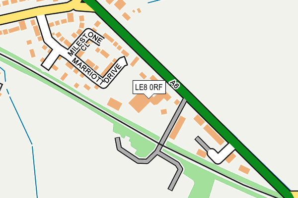
LE8 0RF is located in the Kibworths electoral ward, within the local authority district of Harborough and the English Parliamentary constituency of Harborough. The Sub Integrated Care Board (ICB) Location is NHS Leicester, Leicestershire and Rutland ICB - 03W and the police force is Leicestershire. This postcode has been in use since January 1980.


GetTheData
Source: OS OpenMap – Local (Ordnance Survey)
Source: OS VectorMap District (Ordnance Survey)
Licence: Open Government Licence (requires attribution)
| Easting | 469140 |
| Northing | 293623 |
| Latitude | 52.536090 |
| Longitude | -0.982096 |
GetTheData
Source: Open Postcode Geo
Licence: Open Government Licence
| Country | England |
| Postcode District | LE8 |
| ➜ LE8 open data dashboard ➜ See where LE8 is on a map ➜ Where is Kibworth Harcourt? | |
GetTheData
Source: Land Registry Price Paid Data
Licence: Open Government Licence
Elevation or altitude of LE8 0RF as distance above sea level:
| Metres | Feet | |
|---|---|---|
| Elevation | 100m | 328ft |
Elevation is measured from the approximate centre of the postcode, to the nearest point on an OS contour line from OS Terrain 50, which has contour spacing of ten vertical metres.
➜ How high above sea level am I? Find the elevation of your current position using your device's GPS.
GetTheData
Source: Open Postcode Elevation
Licence: Open Government Licence
| Ward | Kibworths |
| Constituency | Harborough |
GetTheData
Source: ONS Postcode Database
Licence: Open Government Licence
| May 2022 | Drugs | On or near Nursery Court | 186m |
| April 2022 | Possession of weapons | On or near Nursery Court | 186m |
| April 2022 | Drugs | On or near Nursery Court | 186m |
| ➜ Get more crime data in our Crime section | |||
GetTheData
Source: data.police.uk
Licence: Open Government Licence
| Brookfield Way (New Road) | Kibworth Harcourt | 319m |
| Brookfield Way (New Road) | Kibworth Harcourt | 323m |
| Kibworth Cemetery (Harborough Road) | Kibworth Beauchamp | 504m |
| The Square (High Street) | Kibworth Beauchamp | 863m |
| The Square (High Street) | Kibworth Beauchamp | 900m |
GetTheData
Source: NaPTAN
Licence: Open Government Licence
GetTheData
Source: ONS Postcode Database
Licence: Open Government Licence


➜ Get more ratings from the Food Standards Agency
GetTheData
Source: Food Standards Agency
Licence: FSA terms & conditions
| Last Collection | |||
|---|---|---|---|
| Location | Mon-Fri | Sat | Distance |
| High Street | 17:30 | 12:30 | 1,127m |
| Buller Street | 17:00 | 08:45 | 1,374m |
| Pitt Hill | 17:00 | 09:30 | 1,730m |
GetTheData
Source: Dracos
Licence: Creative Commons Attribution-ShareAlike
| Facility | Distance |
|---|---|
| Kibworth Golf Club Ltd Weir Road, Kibworth Beauchamp, Leicester Golf | 680m |
| Kibworth School Smeeton Road, Kibworth, Leicester Sports Hall, Grass Pitches, Artificial Grass Pitch | 1km |
| Smeeton Road Recreation Ground Smeeton Road, Kibworth Beauchamp Outdoor Tennis Courts | 1.1km |
GetTheData
Source: Active Places
Licence: Open Government Licence
| School | Phase of Education | Distance |
|---|---|---|
| Kibworth Mead Academy Smeeton Road, Kibworth, Leicester, LE8 0LG | Secondary | 1km |
| Kibworth Church of England Primary School Hillcrest Avenue, Kibworth, Leicester, LE8 0NH | Primary | 1.2km |
| Church Langton Church of England Primary School Stonton Road, Church Langton, Market Harborough, LE16 7SZ | Primary | 3.4km |
GetTheData
Source: Edubase
Licence: Open Government Licence
The below table lists the International Territorial Level (ITL) codes (formerly Nomenclature of Territorial Units for Statistics (NUTS) codes) and Local Administrative Units (LAU) codes for LE8 0RF:
| ITL 1 Code | Name |
|---|---|
| TLF | East Midlands (England) |
| ITL 2 Code | Name |
| TLF2 | Leicestershire, Rutland and Northamptonshire |
| ITL 3 Code | Name |
| TLF22 | Leicestershire CC and Rutland |
| LAU 1 Code | Name |
| E07000131 | Harborough |
GetTheData
Source: ONS Postcode Directory
Licence: Open Government Licence
The below table lists the Census Output Area (OA), Lower Layer Super Output Area (LSOA), and Middle Layer Super Output Area (MSOA) for LE8 0RF:
| Code | Name | |
|---|---|---|
| OA | E00130833 | |
| LSOA | E01025784 | Harborough 005E |
| MSOA | E02005371 | Harborough 005 |
GetTheData
Source: ONS Postcode Directory
Licence: Open Government Licence
| LE8 0JX | Marriott Drive | 144m |
| LE8 0EX | Nursery Court | 152m |
| LE8 0UW | Milestone Close | 165m |
| LE8 0RU | Braymish Close | 207m |
| LE8 0SL | New Road | 291m |
| LE8 0RB | Harborough Road | 293m |
| LE8 0PW | Birdie Close | 348m |
| LE8 0LB | Fairway | 433m |
| LE8 0SA | Brookfield Way | 498m |
| LE8 0SB | Larkswood | 525m |
GetTheData
Source: Open Postcode Geo; Land Registry Price Paid Data
Licence: Open Government Licence