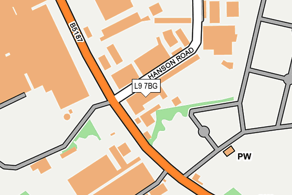
L9 7BG is located in the Fazakerley West electoral ward, within the metropolitan district of Liverpool and the English Parliamentary constituency of Liverpool, Walton. The Sub Integrated Care Board (ICB) Location is NHS Cheshire and Merseyside ICB - 99A and the police force is Merseyside. This postcode has been in use since June 2000.


GetTheData
Source: OS OpenMap – Local (Ordnance Survey)
Source: OS VectorMap District (Ordnance Survey)
Licence: Open Government Licence (requires attribution)
| Easting | 337310 |
| Northing | 395985 |
| Latitude | 53.456885 |
| Longitude | -2.945580 |
GetTheData
Source: Open Postcode Geo
Licence: Open Government Licence
| Country | England |
| Postcode District | L9 |
| ➜ L9 open data dashboard ➜ See where L9 is on a map ➜ Where is Liverpool? | |
GetTheData
Source: Land Registry Price Paid Data
Licence: Open Government Licence
Elevation or altitude of L9 7BG as distance above sea level:
| Metres | Feet | |
|---|---|---|
| Elevation | 30m | 98ft |
Elevation is measured from the approximate centre of the postcode, to the nearest point on an OS contour line from OS Terrain 50, which has contour spacing of ten vertical metres.
➜ How high above sea level am I? Find the elevation of your current position using your device's GPS.
GetTheData
Source: Open Postcode Elevation
Licence: Open Government Licence
| Ward | Fazakerley West |
| Constituency | Liverpool, Walton |
GetTheData
Source: ONS Postcode Database
Licence: Open Government Licence
| June 2022 | Violence and sexual offences | On or near Petrol Station | 99m |
| June 2022 | Burglary | On or near Petrol Station | 99m |
| June 2022 | Criminal damage and arson | On or near Petrol Station | 99m |
| ➜ Get more crime data in our Crime section | |||
GetTheData
Source: data.police.uk
Licence: Open Government Licence
| Hanson Road (Long Lane) | Fazakerley | 51m |
| Hanson Road (Long Lane) | Fazakerley | 81m |
| Stopgate Lane (Long Lane) | Fazakerley | 281m |
| Brookfield Drive (Long Lane) | Fazakerley | 305m |
| Brookfield Drive (Long Lane) | Fazakerley | 322m |
| Rice Lane Station | 1.1km |
| Orrell Park Station | 1.3km |
| Walton (Merseyside) Station | 1.3km |
GetTheData
Source: NaPTAN
Licence: Open Government Licence
| Median download speed | 40.0Mbps |
| Average download speed | 41.3Mbps |
| Maximum download speed | 80.00Mbps |
| Median upload speed | 2.0Mbps |
| Average upload speed | 8.8Mbps |
| Maximum upload speed | 20.00Mbps |
GetTheData
Source: Ofcom
Licence: Ofcom Terms of Use (requires attribution)
GetTheData
Source: ONS Postcode Database
Licence: Open Government Licence


➜ Get more ratings from the Food Standards Agency
GetTheData
Source: Food Standards Agency
Licence: FSA terms & conditions
| Last Collection | |||
|---|---|---|---|
| Location | Mon-Fri | Sat | Distance |
| Rice Lane | 16:00 | 12:00 | 1,081m |
| Walton Vale Post Office | 16:45 | 12:00 | 1,174m |
| Cavendish Drive | 16:00 | 12:00 | 1,259m |
GetTheData
Source: Dracos
Licence: Creative Commons Attribution-ShareAlike
| Facility | Distance |
|---|---|
| Jacobs Sports And Social Club Long Lane, Walton, Liverpool Grass Pitches | 220m |
| Leisure United Jeffrey Humble Long Lane, Walton, Liverpool Grass Pitches, Sports Hall, Health and Fitness Gym, Artificial Grass Pitch | 539m |
| Dyson Hall School (Closed) Higher Lane, Liverpool Grass Pitches | 671m |
GetTheData
Source: Active Places
Licence: Open Government Licence
| School | Phase of Education | Distance |
|---|---|---|
| New Heights High School 1a Dyson Hall Drive, Fazakerley, Liverpool, L9 7HA | Not applicable | 681m |
| Birtenshaw School Merseyside 82 Higher Lane, Liverpool, Liverpool, Merseyside, L9 7AB | Not applicable | 694m |
| Archbishop Beck Catholic College 55 Long Lane, Fazakerley, Liverpool, L9 7BF | Secondary | 707m |
GetTheData
Source: Edubase
Licence: Open Government Licence
The below table lists the International Territorial Level (ITL) codes (formerly Nomenclature of Territorial Units for Statistics (NUTS) codes) and Local Administrative Units (LAU) codes for L9 7BG:
| ITL 1 Code | Name |
|---|---|
| TLD | North West (England) |
| ITL 2 Code | Name |
| TLD7 | Merseyside |
| ITL 3 Code | Name |
| TLD72 | Liverpool |
| LAU 1 Code | Name |
| E08000012 | Liverpool |
GetTheData
Source: ONS Postcode Directory
Licence: Open Government Licence
The below table lists the Census Output Area (OA), Lower Layer Super Output Area (LSOA), and Middle Layer Super Output Area (MSOA) for L9 7BG:
| Code | Name | |
|---|---|---|
| OA | E00176728 | |
| LSOA | E01006659 | Liverpool 005B |
| MSOA | E02001351 | Liverpool 005 |
GetTheData
Source: ONS Postcode Directory
Licence: Open Government Licence
| L9 7BP | Hanson Road | 116m |
| L9 7AA | Long Lane | 195m |
| L9 7AJ | Brookfield Drive | 428m |
| L9 1LG | Citron Close | 480m |
| L9 1LF | Rosedale Close | 511m |
| L9 7EL | Atherton Road | 511m |
| L9 1LB | Betula Close | 534m |
| L9 1LA | Cassia Close | 542m |
| L9 1JN | Lavender Way | 554m |
| L9 2AR | Crescent Road | 598m |
GetTheData
Source: Open Postcode Geo; Land Registry Price Paid Data
Licence: Open Government Licence