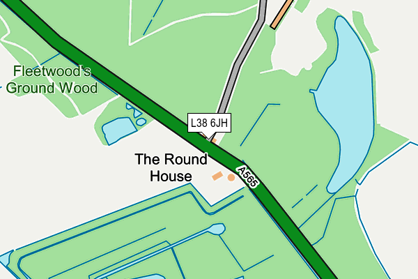
L38 6JH lies on Moor Lane in Ince Blundell, Liverpool. L38 6JH is located in the Ravenmeols electoral ward, within the metropolitan district of Sefton and the English Parliamentary constituency of Sefton Central. The Sub Integrated Care Board (ICB) Location is NHS Cheshire and Merseyside ICB - 01V and the police force is Merseyside. This postcode has been in use since January 1993.


GetTheData
Source: OS OpenMap – Local (Ordnance Survey)
Source: OS VectorMap District (Ordnance Survey)
Licence: Open Government Licence (requires attribution)
| Easting | 332519 |
| Northing | 402677 |
| Latitude | 53.516418 |
| Longitude | -3.019162 |
GetTheData
Source: Open Postcode Geo
Licence: Open Government Licence
| Street | Moor Lane |
| Locality | Ince Blundell |
| Town/City | Liverpool |
| Country | England |
| Postcode District | L38 |
| ➜ L38 open data dashboard ➜ See where L38 is on a map | |
GetTheData
Source: Land Registry Price Paid Data
Licence: Open Government Licence
Elevation or altitude of L38 6JH as distance above sea level:
| Metres | Feet | |
|---|---|---|
| Elevation | 10m | 33ft |
Elevation is measured from the approximate centre of the postcode, to the nearest point on an OS contour line from OS Terrain 50, which has contour spacing of ten vertical metres.
➜ How high above sea level am I? Find the elevation of your current position using your device's GPS.
GetTheData
Source: Open Postcode Elevation
Licence: Open Government Licence
| Ward | Ravenmeols |
| Constituency | Sefton Central |
GetTheData
Source: ONS Postcode Database
Licence: Open Government Licence
| The Round House (Moor Lane) | Ince Blundell | 24m |
| The Round House (Moor Lane) | Ince Blundell | 94m |
| Park Wall Road (Ince Lane) | Ince Blundell | 700m |
| Back O`th`town Lane (Back O'th'town Lane) | Ince Blundell | 798m |
| Moor Lane (Lady Green Lane) | Lady Green | 929m |
| Hightown Station | 2.7km |
| Hall Road Station | 2.9km |
| Blundellsands & Crosby Station | 3.5km |
GetTheData
Source: NaPTAN
Licence: Open Government Licence
| Percentage of properties with Next Generation Access | 100.0% |
| Percentage of properties with Superfast Broadband | 0.0% |
| Percentage of properties with Ultrafast Broadband | 0.0% |
| Percentage of properties with Full Fibre Broadband | 0.0% |
Superfast Broadband is between 30Mbps and 300Mbps
Ultrafast Broadband is > 300Mbps
| Percentage of properties unable to receive 2Mbps | 0.0% |
| Percentage of properties unable to receive 5Mbps | 0.0% |
| Percentage of properties unable to receive 10Mbps | 33.3% |
| Percentage of properties unable to receive 30Mbps | 100.0% |
GetTheData
Source: Ofcom
Licence: Ofcom Terms of Use (requires attribution)
GetTheData
Source: ONS Postcode Database
Licence: Open Government Licence


➜ Get more ratings from the Food Standards Agency
GetTheData
Source: Food Standards Agency
Licence: FSA terms & conditions
| Last Collection | |||
|---|---|---|---|
| Location | Mon-Fri | Sat | Distance |
| Little Crosby | 17:00 | 08:00 | 1,322m |
| Homer Green | 16:30 | 08:00 | 1,620m |
| Thornton Post Office | 17:30 | 12:00 | 2,064m |
GetTheData
Source: Dracos
Licence: Creative Commons Attribution-ShareAlike
| Facility | Distance |
|---|---|
| Holy Family Catholic High School Virgins Lane, Liverpool Grass Pitches, Sports Hall, Studio | 1.9km |
| The Northern Club Elm Avenue, Liverpool Grass Pitches, Artificial Grass Pitch, Squash Courts | 2.2km |
| Liverpool Ramblers Afc Moor Lane, Thornton, Liverpool Grass Pitches | 2.2km |
GetTheData
Source: Active Places
Licence: Open Government Licence
| School | Phase of Education | Distance |
|---|---|---|
| St Mary's Catholic Primary School Back Lane, Crosby, Liverpool, L23 4UA | Primary | 1.1km |
| Holy Family Catholic High School Virgins Lane, Thornton, Liverpool, L23 4UL | Secondary | 1.9km |
| Crosby High School De Villiers Avenue, Crosby, Liverpool, L23 2TH | Not applicable | 2.2km |
GetTheData
Source: Edubase
Licence: Open Government Licence
The below table lists the International Territorial Level (ITL) codes (formerly Nomenclature of Territorial Units for Statistics (NUTS) codes) and Local Administrative Units (LAU) codes for L38 6JH:
| ITL 1 Code | Name |
|---|---|
| TLD | North West (England) |
| ITL 2 Code | Name |
| TLD7 | Merseyside |
| ITL 3 Code | Name |
| TLD73 | Sefton |
| LAU 1 Code | Name |
| E08000014 | Sefton |
GetTheData
Source: ONS Postcode Directory
Licence: Open Government Licence
The below table lists the Census Output Area (OA), Lower Layer Super Output Area (LSOA), and Middle Layer Super Output Area (MSOA) for L38 6JH:
| Code | Name | |
|---|---|---|
| OA | E00035876 | |
| LSOA | E01007076 | Sefton 016B |
| MSOA | E02001444 | Sefton 016 |
GetTheData
Source: ONS Postcode Directory
Licence: Open Government Licence
| L38 6JD | Crossbarn Lane | 362m |
| L38 6JJ | Back Othe Town Lane | 711m |
| L38 6JE | Victoria Road | 756m |
| L38 6JF | Victoria Road | 759m |
| L38 6JA | The Close | 813m |
| L38 6JG | Moor Lane | 882m |
| L38 6JQ | Moor Lane | 908m |
| L38 1QH | The Cross | 979m |
| L38 1QG | Carr House Lane | 994m |
| L38 6JB | Hall Lane | 1007m |
GetTheData
Source: Open Postcode Geo; Land Registry Price Paid Data
Licence: Open Government Licence