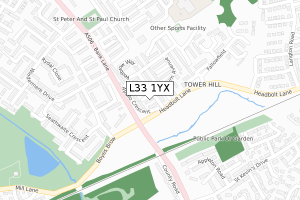
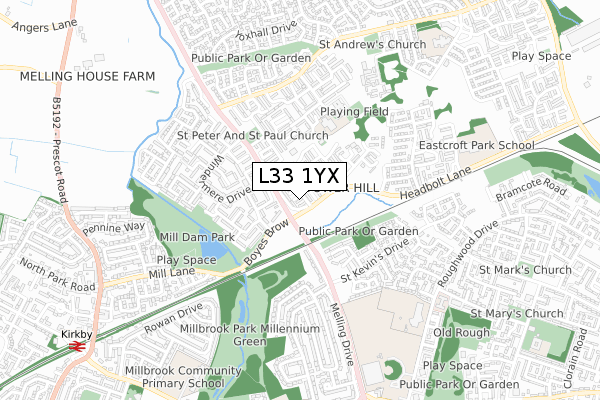
L33 1YX is located in the Shevington electoral ward, within the metropolitan district of Knowsley and the English Parliamentary constituency of Knowsley. The Sub Integrated Care Board (ICB) Location is NHS Cheshire and Merseyside ICB - 01J and the police force is Merseyside. This postcode has been in use since January 1993.


GetTheData
Source: OS Open Zoomstack (Ordnance Survey)
Licence: Open Government Licence (requires attribution)
Attribution: Contains OS data © Crown copyright and database right 2024
Source: Open Postcode Geo
Licence: Open Government Licence (requires attribution)
Attribution: Contains OS data © Crown copyright and database right 2024; Contains Royal Mail data © Royal Mail copyright and database right 2024; Source: Office for National Statistics licensed under the Open Government Licence v.3.0
| Easting | 341119 |
| Northing | 399841 |
| Latitude | 53.491965 |
| Longitude | -2.888949 |
GetTheData
Source: Open Postcode Geo
Licence: Open Government Licence
| Country | England |
| Postcode District | L33 |
| ➜ L33 open data dashboard ➜ See where L33 is on a map ➜ Where is Kirkby? | |
GetTheData
Source: Land Registry Price Paid Data
Licence: Open Government Licence
Elevation or altitude of L33 1YX as distance above sea level:
| Metres | Feet | |
|---|---|---|
| Elevation | 30m | 98ft |
Elevation is measured from the approximate centre of the postcode, to the nearest point on an OS contour line from OS Terrain 50, which has contour spacing of ten vertical metres.
➜ How high above sea level am I? Find the elevation of your current position using your device's GPS.
GetTheData
Source: Open Postcode Elevation
Licence: Open Government Licence
| Ward | Shevington |
| Constituency | Knowsley |
GetTheData
Source: ONS Postcode Database
Licence: Open Government Licence
| December 2023 | Possession of weapons | On or near Bassenthwaite Avenue | 185m |
| December 2023 | Other crime | On or near Bassenthwaite Avenue | 185m |
| December 2023 | Drugs | On or near Bassenthwaite Avenue | 185m |
| ➜ Get more crime data in our Crime section | |||
GetTheData
Source: data.police.uk
Licence: Open Government Licence
| Heathfield Drive (Headbolt Lane) | Tower Hill | 72m |
| Windermere Drive (Bank Lane) | Tower Hill | 140m |
| Fallowfield (Headbolt Lane) | Tower Hill | 145m |
| Windermere Drive (Bank Lane) | Tower Hill | 154m |
| Bassenthwaite Avenue (Boyes Brow) | Tower Hill | 178m |
| Kirkby Station | 1.1km |
| Maghull Station | 3.2km |
| Fazakerley Station | 4.1km |
GetTheData
Source: NaPTAN
Licence: Open Government Licence
➜ Broadband speed and availability dashboard for L33 1YX
| Percentage of properties with Next Generation Access | 100.0% |
| Percentage of properties with Superfast Broadband | 100.0% |
| Percentage of properties with Ultrafast Broadband | 100.0% |
| Percentage of properties with Full Fibre Broadband | 0.0% |
Superfast Broadband is between 30Mbps and 300Mbps
Ultrafast Broadband is > 300Mbps
| Median download speed | 6.9Mbps |
| Average download speed | 32.4Mbps |
| Maximum download speed | 77.58Mbps |
| Median upload speed | 1.3Mbps |
| Average upload speed | 8.4Mbps |
| Maximum upload speed | 19.53Mbps |
| Percentage of properties unable to receive 2Mbps | 0.0% |
| Percentage of properties unable to receive 5Mbps | 0.0% |
| Percentage of properties unable to receive 10Mbps | 0.0% |
| Percentage of properties unable to receive 30Mbps | 0.0% |
➜ Broadband speed and availability dashboard for L33 1YX
GetTheData
Source: Ofcom
Licence: Ofcom Terms of Use (requires attribution)
Estimated total energy consumption in L33 1YX by fuel type, 2015.
| Consumption (kWh) | 82,670 |
|---|---|
| Meter count | 8 |
| Mean (kWh/meter) | 10,334 |
| Median (kWh/meter) | 10,618 |
| Consumption (kWh) | 28,625 |
|---|---|
| Meter count | 8 |
| Mean (kWh/meter) | 3,578 |
| Median (kWh/meter) | 3,382 |
GetTheData
Source: Postcode level gas estimates: 2015 (experimental)
Source: Postcode level electricity estimates: 2015 (experimental)
Licence: Open Government Licence
GetTheData
Source: ONS Postcode Database
Licence: Open Government Licence


➜ Get more ratings from the Food Standards Agency
GetTheData
Source: Food Standards Agency
Licence: FSA terms & conditions
| Last Collection | |||
|---|---|---|---|
| Location | Mon-Fri | Sat | Distance |
| Kirkby Post Office | 18:00 | 12:00 | 1,219m |
| Spencers Lane | 17:00 | 12:00 | 1,508m |
| Saxon Way/Washington Drive | 17:00 | 12:00 | 1,630m |
GetTheData
Source: Dracos
Licence: Creative Commons Attribution-ShareAlike
| Facility | Distance |
|---|---|
| Ravenscroft Community Primary School Ebony Way, Kirkby, Liverpool Artificial Grass Pitch | 336m |
| Mill Dam Park Mill Lane, Kirkby, Liverpool Grass Pitches | 533m |
| All Saints Catholic High School Knowsley Roughwood Drive, Liverpool Sports Hall, Studio, Grass Pitches, Health and Fitness Gym, Artificial Grass Pitch | 805m |
GetTheData
Source: Active Places
Licence: Open Government Licence
| School | Phase of Education | Distance |
|---|---|---|
| Ravenscroft Community Primary School Ebony Way, Tower Hill, Kirkby, Liverpool, L33 1XT | Primary | 336m |
| Eastcroft Park School Hollinghurst Road, Tower Hill, Kirkby, Liverpool, L33 1EB | Primary | 734m |
| All Saints Catholic High School Roughwood Drive, Kirkby, Knowsley, L33 8XF | Secondary | 846m |
GetTheData
Source: Edubase
Licence: Open Government Licence
The below table lists the International Territorial Level (ITL) codes (formerly Nomenclature of Territorial Units for Statistics (NUTS) codes) and Local Administrative Units (LAU) codes for L33 1YX:
| ITL 1 Code | Name |
|---|---|
| TLD | North West (England) |
| ITL 2 Code | Name |
| TLD7 | Merseyside |
| ITL 3 Code | Name |
| TLD71 | East Merseyside |
| LAU 1 Code | Name |
| E08000011 | Knowsley |
GetTheData
Source: ONS Postcode Directory
Licence: Open Government Licence
The below table lists the Census Output Area (OA), Lower Layer Super Output Area (LSOA), and Middle Layer Super Output Area (MSOA) for L33 1YX:
| Code | Name | |
|---|---|---|
| OA | E00032897 | |
| LSOA | E01006495 | Knowsley 001E |
| MSOA | E02001327 | Knowsley 001 |
GetTheData
Source: ONS Postcode Directory
Licence: Open Government Licence
| L33 1YR | Apollo Crescent | 41m |
| L33 1WA | Ashburn Avenue | 80m |
| L33 1TJ | Davenport Grove | 83m |
| L33 1WF | Heathfield Drive | 107m |
| L33 1YL | Redbrow Way | 136m |
| L33 2DA | Coniston Close | 149m |
| L33 1YF | Redmoor Crescent | 150m |
| L33 1WD | Devonshire Close | 166m |
| L33 2DE | Windermere Drive | 185m |
| L33 2DZ | Boyes Brow | 199m |
GetTheData
Source: Open Postcode Geo; Land Registry Price Paid Data
Licence: Open Government Licence