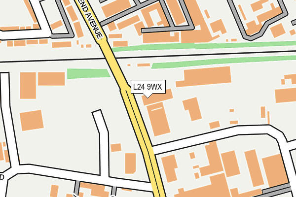
L24 9WX is located in the Speke electoral ward, within the metropolitan district of Liverpool and the English Parliamentary constituency of Garston and Halewood. The Sub Integrated Care Board (ICB) Location is NHS Cheshire and Merseyside ICB - 99A and the police force is Merseyside. This postcode has been in use since February 2004.


GetTheData
Source: OS OpenMap – Local (Ordnance Survey)
Source: OS VectorMap District (Ordnance Survey)
Licence: Open Government Licence (requires attribution)
| Easting | 343440 |
| Northing | 384357 |
| Latitude | 53.353057 |
| Longitude | -2.851185 |
GetTheData
Source: Open Postcode Geo
Licence: Open Government Licence
| Country | England |
| Postcode District | L24 |
| ➜ L24 open data dashboard ➜ See where L24 is on a map ➜ Where is Liverpool? | |
GetTheData
Source: Land Registry Price Paid Data
Licence: Open Government Licence
Elevation or altitude of L24 9WX as distance above sea level:
| Metres | Feet | |
|---|---|---|
| Elevation | 30m | 98ft |
Elevation is measured from the approximate centre of the postcode, to the nearest point on an OS contour line from OS Terrain 50, which has contour spacing of ten vertical metres.
➜ How high above sea level am I? Find the elevation of your current position using your device's GPS.
GetTheData
Source: Open Postcode Elevation
Licence: Open Government Licence
| Ward | Speke |
| Constituency | Garston And Halewood |
GetTheData
Source: ONS Postcode Database
Licence: Open Government Licence
| June 2022 | Violence and sexual offences | On or near Shaw Road | 359m |
| June 2022 | Violence and sexual offences | On or near Alderman Road | 409m |
| June 2022 | Violence and sexual offences | On or near Alderman Road | 409m |
| ➜ Get more crime data in our Crime section | |||
GetTheData
Source: data.police.uk
Licence: Open Government Licence
| Shaw Road (Woodend Avenue) | Speke | 134m |
| Alderman Road (Woodend Avenue) | Hunts Cross | 238m |
| Fleming Road (Woodend Avenue) | Hunts Cross | 247m |
| Shaw Road | Speke | 303m |
| Shaw Road | Speke | 313m |
| Hunts Cross Station | 0.9km |
| Halewood Station | 1.9km |
| Liverpool South Parkway Station | 2.6km |
GetTheData
Source: NaPTAN
Licence: Open Government Licence
GetTheData
Source: ONS Postcode Database
Licence: Open Government Licence


➜ Get more ratings from the Food Standards Agency
GetTheData
Source: Food Standards Agency
Licence: FSA terms & conditions
| Last Collection | |||
|---|---|---|---|
| Location | Mon-Fri | Sat | Distance |
| Woodend Avenue | 16:45 | 12:00 | 540m |
| Hunts Cross | 16:45 | 12:00 | 827m |
| Hunts Cross Spso, 269 Speke Road | 17:30 | 12:00 | 831m |
GetTheData
Source: Dracos
Licence: Creative Commons Attribution-ShareAlike
| Facility | Distance |
|---|---|
| Eli Lilly And Company Limited (Closed) Fleming Road, Liverpool Sports Hall | 199m |
| Hunts Cross Primary School Kingsthorne Road, Liverpool Grass Pitches | 565m |
| Halewood Doorstep Green Blackburne Drive, Halewood Grass Pitches | 591m |
GetTheData
Source: Active Places
Licence: Open Government Licence
| School | Phase of Education | Distance |
|---|---|---|
| Hunts Cross Primary School Kingsthorne Road, Liverpool, L25 0PJ | Primary | 564m |
| St Christopher's Catholic Primary School Tarbock Road, Speke, Liverpool, L24 0SN | Primary | 847m |
| St Andrew the Apostle Catholic Primary School Higher Road, Halewood, Liverpool, L26 1TD | Primary | 930m |
GetTheData
Source: Edubase
Licence: Open Government Licence
The below table lists the International Territorial Level (ITL) codes (formerly Nomenclature of Territorial Units for Statistics (NUTS) codes) and Local Administrative Units (LAU) codes for L24 9WX:
| ITL 1 Code | Name |
|---|---|
| TLD | North West (England) |
| ITL 2 Code | Name |
| TLD7 | Merseyside |
| ITL 3 Code | Name |
| TLD72 | Liverpool |
| LAU 1 Code | Name |
| E08000012 | Liverpool |
GetTheData
Source: ONS Postcode Directory
Licence: Open Government Licence
The below table lists the Census Output Area (OA), Lower Layer Super Output Area (LSOA), and Middle Layer Super Output Area (MSOA) for L24 9WX:
| Code | Name | |
|---|---|---|
| OA | E00034154 | |
| LSOA | E01006741 | Liverpool 058C |
| MSOA | E02001404 | Liverpool 058 |
GetTheData
Source: ONS Postcode Directory
Licence: Open Government Licence
| L24 9NB | Woodend Industrial Estate | 199m |
| L24 9LG | Hansby Drive | 282m |
| L24 9PB | Evans Road | 369m |
| L24 9LH | Cascade Road | 375m |
| L24 9LW | Hansby Drive | 439m |
| L24 9LL | Addenbrooke Drive | 461m |
| L24 9LD | Shadowbrook Drive | 474m |
| L24 9LJ | Alderman Road | 475m |
| L25 0QR | Kingsthorne Park | 485m |
| L25 0QS | Kingsthorne Park | 499m |
GetTheData
Source: Open Postcode Geo; Land Registry Price Paid Data
Licence: Open Government Licence