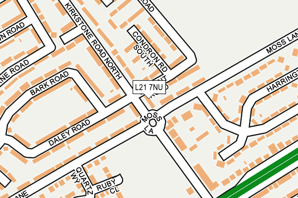
L21 7NU is located in the Ford electoral ward, within the metropolitan district of Sefton and the English Parliamentary constituency of Bootle. The Sub Integrated Care Board (ICB) Location is NHS Cheshire and Merseyside ICB - 01T and the police force is Merseyside. This postcode has been in use since January 1980.


GetTheData
Source: OS OpenMap – Local (Ordnance Survey)
Source: OS VectorMap District (Ordnance Survey)
Licence: Open Government Licence (requires attribution)
| Easting | 334470 |
| Northing | 398134 |
| Latitude | 53.475837 |
| Longitude | -2.988793 |
GetTheData
Source: Open Postcode Geo
Licence: Open Government Licence
| Country | England |
| Postcode District | L21 |
| ➜ L21 open data dashboard ➜ See where L21 is on a map ➜ Where is Litherland? | |
GetTheData
Source: Land Registry Price Paid Data
Licence: Open Government Licence
Elevation or altitude of L21 7NU as distance above sea level:
| Metres | Feet | |
|---|---|---|
| Elevation | 30m | 98ft |
Elevation is measured from the approximate centre of the postcode, to the nearest point on an OS contour line from OS Terrain 50, which has contour spacing of ten vertical metres.
➜ How high above sea level am I? Find the elevation of your current position using your device's GPS.
GetTheData
Source: Open Postcode Elevation
Licence: Open Government Licence
| Ward | Ford |
| Constituency | Bootle |
GetTheData
Source: ONS Postcode Database
Licence: Open Government Licence
| January 2024 | Burglary | On or near Moss Lane | 71m |
| January 2024 | Other theft | On or near Cumpsty Road | 393m |
| December 2023 | Other theft | On or near Moss Lane | 71m |
| ➜ Get more crime data in our Crime section | |||
GetTheData
Source: data.police.uk
Licence: Open Government Licence
| Kirkstone Road North (Church Road) | Litherland | 235m |
| Kirkstone Road South (Church Road) | Litherland | 268m |
| Thirlmere Drive (Kirkstone Road South) | Litherland | 348m |
| Eccleshall Avenue (Kirkstone Road South) | Litherland | 363m |
| Springfield Avenue (Church Road) | Litherland | 385m |
| Seaforth & Litherland Station | 1.5km |
| Aintree Station | 2.2km |
| Orrell Park Station | 2.3km |
GetTheData
Source: NaPTAN
Licence: Open Government Licence
| Percentage of properties with Next Generation Access | 100.0% |
| Percentage of properties with Superfast Broadband | 100.0% |
| Percentage of properties with Ultrafast Broadband | 100.0% |
| Percentage of properties with Full Fibre Broadband | 0.0% |
Superfast Broadband is between 30Mbps and 300Mbps
Ultrafast Broadband is > 300Mbps
| Percentage of properties unable to receive 2Mbps | 0.0% |
| Percentage of properties unable to receive 5Mbps | 0.0% |
| Percentage of properties unable to receive 10Mbps | 0.0% |
| Percentage of properties unable to receive 30Mbps | 0.0% |
GetTheData
Source: Ofcom
Licence: Ofcom Terms of Use (requires attribution)
GetTheData
Source: ONS Postcode Database
Licence: Open Government Licence


➜ Get more ratings from the Food Standards Agency
GetTheData
Source: Food Standards Agency
Licence: FSA terms & conditions
| Last Collection | |||
|---|---|---|---|
| Location | Mon-Fri | Sat | Distance |
| Mereton Village | 17:00 | 12:00 | 493m |
| Sterrix Lane | 17:00 | 12:00 | 745m |
| Poulsom Drive | 17:00 | 12:00 | 928m |
GetTheData
Source: Dracos
Licence: Creative Commons Attribution-ShareAlike
| Facility | Distance |
|---|---|
| Litherland Sports Park Boundary Road, Litherland, Liverpool Health and Fitness Gym, Grass Pitches, Athletics, Artificial Grass Pitch, Studio, Cycling | 379m |
| Litherland Moss Primary School Moss Lane, Litherland, Liverpool Grass Pitches | 507m |
| Litherland High School (Closed) Sterrix Lane, Liverpool Grass Pitches, Sports Hall, Health and Fitness Gym | 541m |
GetTheData
Source: Active Places
Licence: Open Government Licence
| School | Phase of Education | Distance |
|---|---|---|
| Litherland Moss Primary School Sterrix Lane, Litherland, Liverpool, L21 0DB | Primary | 507m |
| Litherland High School Sterrix Lane, Litherland, Liverpool, L21 0DB | Secondary | 541m |
| St Philip's Church of England Controlled Primary School Church Road, Litherland, Liverpool, L21 8NZ | Primary | 592m |
GetTheData
Source: Edubase
Licence: Open Government Licence
The below table lists the International Territorial Level (ITL) codes (formerly Nomenclature of Territorial Units for Statistics (NUTS) codes) and Local Administrative Units (LAU) codes for L21 7NU:
| ITL 1 Code | Name |
|---|---|
| TLD | North West (England) |
| ITL 2 Code | Name |
| TLD7 | Merseyside |
| ITL 3 Code | Name |
| TLD73 | Sefton |
| LAU 1 Code | Name |
| E08000014 | Sefton |
GetTheData
Source: ONS Postcode Directory
Licence: Open Government Licence
The below table lists the Census Output Area (OA), Lower Layer Super Output Area (LSOA), and Middle Layer Super Output Area (MSOA) for L21 7NU:
| Code | Name | |
|---|---|---|
| OA | E00035392 | |
| LSOA | E01006981 | Sefton 031B |
| MSOA | E02001459 | Sefton 031 |
GetTheData
Source: ONS Postcode Directory
Licence: Open Government Licence
| L21 7NX | Vincent Road | 63m |
| L21 7NJ | Moss Lane | 64m |
| L21 7GB | Condron Road South | 95m |
| L21 9HH | Kirkstone Road North | 121m |
| L21 7ND | Anderson Road | 130m |
| L21 7QW | Bark Road | 153m |
| L21 7PS | Moss Lane | 178m |
| L21 7QQ | Daley Road | 187m |
| L21 7QG | Daley Road | 188m |
| L21 9HL | Kirkstone Road North | 198m |
GetTheData
Source: Open Postcode Geo; Land Registry Price Paid Data
Licence: Open Government Licence