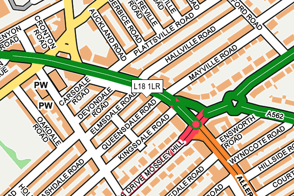
L18 1LR is located in the Penny Lane electoral ward, within the metropolitan district of Liverpool and the English Parliamentary constituency of Liverpool, Wavertree. The Sub Integrated Care Board (ICB) Location is NHS Cheshire and Merseyside ICB - 99A and the police force is Merseyside. This postcode has been in use since January 1980.


GetTheData
Source: OS OpenMap – Local (Ordnance Survey)
Source: OS VectorMap District (Ordnance Survey)
Licence: Open Government Licence (requires attribution)
| Easting | 339436 |
| Northing | 388322 |
| Latitude | 53.388248 |
| Longitude | -2.912092 |
GetTheData
Source: Open Postcode Geo
Licence: Open Government Licence
| Country | England |
| Postcode District | L18 |
| ➜ L18 open data dashboard ➜ See where L18 is on a map ➜ Where is Liverpool? | |
GetTheData
Source: Land Registry Price Paid Data
Licence: Open Government Licence
Elevation or altitude of L18 1LR as distance above sea level:
| Metres | Feet | |
|---|---|---|
| Elevation | 50m | 164ft |
Elevation is measured from the approximate centre of the postcode, to the nearest point on an OS contour line from OS Terrain 50, which has contour spacing of ten vertical metres.
➜ How high above sea level am I? Find the elevation of your current position using your device's GPS.
GetTheData
Source: Open Postcode Elevation
Licence: Open Government Licence
| Ward | Penny Lane |
| Constituency | Liverpool, Wavertree |
GetTheData
Source: ONS Postcode Database
Licence: Open Government Licence
| January 2024 | Violence and sexual offences | On or near Parking Area | 497m |
| January 2024 | Shoplifting | On or near Parking Area | 497m |
| December 2023 | Public order | On or near Limedale Road | 195m |
| ➜ Get more crime data in our Crime section | |||
GetTheData
Source: data.police.uk
Licence: Open Government Licence
| Devondale Road (Allerton Road) | Mossley Hill | 96m |
| Plattsville Road (Allerton Road) | Mossley Hill | 112m |
| Carsdale Road (Allerton Road) | Mossley Hill | 127m |
| Allerton Road (Queens Drive) | Mossley Hill | 170m |
| Ensworth Road (Allerton Road) | Allerton | 193m |
| Mossley Hill Station | 1km |
| Wavertree Technology Park Station | 2km |
| West Allerton Station | 2.2km |
GetTheData
Source: NaPTAN
Licence: Open Government Licence
GetTheData
Source: ONS Postcode Database
Licence: Open Government Licence

➜ Get more ratings from the Food Standards Agency
GetTheData
Source: Food Standards Agency
Licence: FSA terms & conditions
| Last Collection | |||
|---|---|---|---|
| Location | Mon-Fri | Sat | Distance |
| Allerton Road | 16:00 | 12:00 | 132m |
| Church Road | 17:30 | 12:00 | 212m |
| Heathfield Road | 17:15 | 12:00 | 253m |
GetTheData
Source: Dracos
Licence: Creative Commons Attribution-ShareAlike
| Facility | Distance |
|---|---|
| Grove Mount Sports Ground (Closed) Penny Lane, Liverpool Grass Pitches | 353m |
| Palmerston Tennis Club Elm Hall Drive, Liverpool Outdoor Tennis Courts | 409m |
| Anytime Fitness (Liverpool) Allerton Road, Allerton Road, Mossley Hill, Liverpool Health and Fitness Gym | 434m |
GetTheData
Source: Active Places
Licence: Open Government Licence
| School | Phase of Education | Distance |
|---|---|---|
| Dovedale Community Primary School Herondale Road, Liverpool, L18 1JX | Primary | 473m |
| The Blue Coat School Church Road, Wavertree, Liverpool, L15 9EE | Secondary | 591m |
| Mosspits Lane Primary School Mosspits Lane, Liverpool, L15 6UN | Primary | 689m |
GetTheData
Source: Edubase
Licence: Open Government Licence
The below table lists the International Territorial Level (ITL) codes (formerly Nomenclature of Territorial Units for Statistics (NUTS) codes) and Local Administrative Units (LAU) codes for L18 1LR:
| ITL 1 Code | Name |
|---|---|
| TLD | North West (England) |
| ITL 2 Code | Name |
| TLD7 | Merseyside |
| ITL 3 Code | Name |
| TLD72 | Liverpool |
| LAU 1 Code | Name |
| E08000012 | Liverpool |
GetTheData
Source: ONS Postcode Directory
Licence: Open Government Licence
The below table lists the Census Output Area (OA), Lower Layer Super Output Area (LSOA), and Middle Layer Super Output Area (MSOA) for L18 1LR:
| Code | Name | |
|---|---|---|
| OA | E00033414 | |
| LSOA | E01006593 | Liverpool 042E |
| MSOA | E02001388 | Liverpool 042 |
GetTheData
Source: ONS Postcode Directory
Licence: Open Government Licence
| L18 1LW | Allerton Road | 42m |
| L18 1LG | Allerton Road | 60m |
| L18 1LT | Queensdale Road | 70m |
| L18 1LD | Kingsdale Road | 79m |
| L18 1LX | Elmsdale Road | 83m |
| L18 1LS | Menlove Avenue | 98m |
| L18 1LY | Devondale Road | 101m |
| L18 1LN | Allerton Road | 110m |
| L18 2DY | Queens Drive | 116m |
| L18 1LE | Elm Hall Drive | 137m |
GetTheData
Source: Open Postcode Geo; Land Registry Price Paid Data
Licence: Open Government Licence