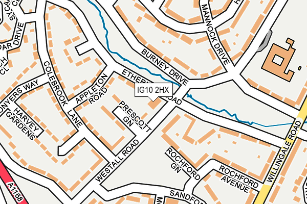
IG10 2HX is located in the Loughton Fairmead electoral ward, within the local authority district of Epping Forest and the English Parliamentary constituency of Epping Forest. The Sub Integrated Care Board (ICB) Location is NHS Hertfordshire and West Essex ICB - 07H and the police force is Essex. This postcode has been in use since January 1980.


GetTheData
Source: OS OpenMap – Local (Ordnance Survey)
Source: OS VectorMap District (Ordnance Survey)
Licence: Open Government Licence (requires attribution)
| Easting | 544086 |
| Northing | 196911 |
| Latitude | 51.652531 |
| Longitude | 0.081392 |
GetTheData
Source: Open Postcode Geo
Licence: Open Government Licence
| Country | England |
| Postcode District | IG10 |
| ➜ IG10 open data dashboard ➜ See where IG10 is on a map ➜ Where is Loughton? | |
GetTheData
Source: Land Registry Price Paid Data
Licence: Open Government Licence
Elevation or altitude of IG10 2HX as distance above sea level:
| Metres | Feet | |
|---|---|---|
| Elevation | 40m | 131ft |
Elevation is measured from the approximate centre of the postcode, to the nearest point on an OS contour line from OS Terrain 50, which has contour spacing of ten vertical metres.
➜ How high above sea level am I? Find the elevation of your current position using your device's GPS.
GetTheData
Source: Open Postcode Elevation
Licence: Open Government Licence
| Ward | Loughton Fairmead |
| Constituency | Epping Forest |
GetTheData
Source: ONS Postcode Database
Licence: Open Government Licence
| January 2024 | Violence and sexual offences | On or near Swanshope | 429m |
| October 2023 | Violence and sexual offences | On or near Mannock Drive | 183m |
| October 2023 | Violence and sexual offences | On or near Rockwood Gardens | 426m |
| ➜ Get more crime data in our Crime section | |||
GetTheData
Source: data.police.uk
Licence: Open Government Licence
| Mannock Drive (Burney Drive) | Debden | 147m |
| Mannock Drive (Burney Drive) | Debden | 192m |
| Etheridge Green (Etheridge Road) | Debden | 212m |
| Etheridge Green (Etheridge Road) | Debden | 230m |
| Newmans Lane (Rectory Lane) | Debden | 325m |
| Debden Underground Station | Debden | 812m |
| Chingford Station | 5.4km |
GetTheData
Source: NaPTAN
Licence: Open Government Licence
GetTheData
Source: ONS Postcode Database
Licence: Open Government Licence


➜ Get more ratings from the Food Standards Agency
GetTheData
Source: Food Standards Agency
Licence: FSA terms & conditions
| Last Collection | |||
|---|---|---|---|
| Location | Mon-Fri | Sat | Distance |
| Burney Drive | 17:15 | 12:00 | 347m |
| Newmans Lane | 17:30 | 12:00 | 363m |
| Debden Broadway Post Office | 18:30 | 12:00 | 603m |
GetTheData
Source: Dracos
Licence: Creative Commons Attribution-ShareAlike
| Facility | Distance |
|---|---|
| Debden Park High School Willingale Road, Loughton Sports Hall, Health and Fitness Gym, Artificial Grass Pitch, Grass Pitches, Studio, Outdoor Tennis Courts | 526m |
| New City College Epping Forest Borders Lane, Loughton Health and Fitness Gym, Sports Hall | 617m |
| Snap Fitness (Debden) Torrington Drive, Torrington Drive, Loughton Health and Fitness Gym | 669m |
GetTheData
Source: Active Places
Licence: Open Government Licence
| School | Phase of Education | Distance |
|---|---|---|
| St John Fisher Catholic Primary School Burney Drive, Loughton, IG10 2DY | Primary | 251m |
| Thomas Willingale Primary School and Nursery The Broadway, Loughton, IG10 3SR | Primary | 430m |
| Debden Park High School Willingale Road, Debden, Loughton, IG10 2BQ | Secondary | 616m |
GetTheData
Source: Edubase
Licence: Open Government Licence
The below table lists the International Territorial Level (ITL) codes (formerly Nomenclature of Territorial Units for Statistics (NUTS) codes) and Local Administrative Units (LAU) codes for IG10 2HX:
| ITL 1 Code | Name |
|---|---|
| TLH | East |
| ITL 2 Code | Name |
| TLH3 | Essex |
| ITL 3 Code | Name |
| TLH35 | West Essex |
| LAU 1 Code | Name |
| E07000072 | Epping Forest |
GetTheData
Source: ONS Postcode Directory
Licence: Open Government Licence
The below table lists the Census Output Area (OA), Lower Layer Super Output Area (LSOA), and Middle Layer Super Output Area (MSOA) for IG10 2HX:
| Code | Name | |
|---|---|---|
| OA | E00110629 | |
| LSOA | E01021778 | Epping Forest 011E |
| MSOA | E02004537 | Epping Forest 011 |
GetTheData
Source: ONS Postcode Directory
Licence: Open Government Licence
| IG10 2AH | Westall Road | 55m |
| IG10 2AQ | Prescott Green | 57m |
| IG10 2AG | Westall Road | 92m |
| IG10 2DX | Burney Drive | 98m |
| IG10 2BT | Rochford Green | 101m |
| IG10 2HZ | Etheridge Green | 120m |
| IG10 2HH | Appleton Road | 129m |
| IG10 2HQ | Colebrook Lane | 129m |
| IG10 2HT | Etheridge Road | 140m |
| IG10 2JB | Mannock Drive | 147m |
GetTheData
Source: Open Postcode Geo; Land Registry Price Paid Data
Licence: Open Government Licence