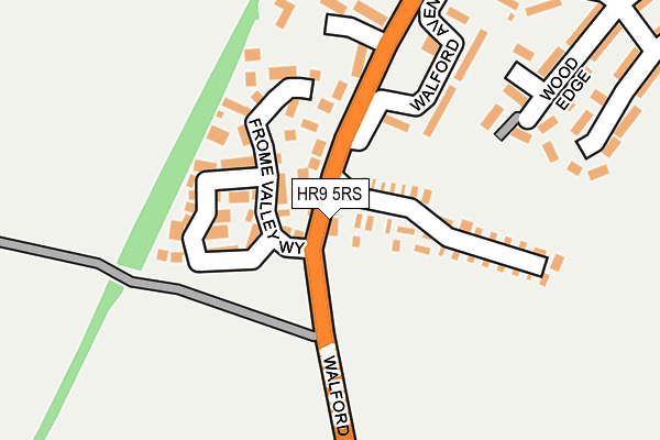
HR9 5RS is located in the Ross East electoral ward, within the unitary authority of Herefordshire, County of and the English Parliamentary constituency of Hereford and South Herefordshire. The Sub Integrated Care Board (ICB) Location is NHS Herefordshire and Worcestershire ICB - 18C and the police force is West Mercia. This postcode has been in use since January 1980.


GetTheData
Source: OS OpenMap – Local (Ordnance Survey)
Source: OS VectorMap District (Ordnance Survey)
Licence: Open Government Licence (requires attribution)
| Easting | 359496 |
| Northing | 222644 |
| Latitude | 51.900865 |
| Longitude | -2.590096 |
GetTheData
Source: Open Postcode Geo
Licence: Open Government Licence
| Country | England |
| Postcode District | HR9 |
| ➜ HR9 open data dashboard ➜ See where HR9 is on a map ➜ Where is Ross-on-Wye? | |
GetTheData
Source: Land Registry Price Paid Data
Licence: Open Government Licence
Elevation or altitude of HR9 5RS as distance above sea level:
| Metres | Feet | |
|---|---|---|
| Elevation | 60m | 197ft |
Elevation is measured from the approximate centre of the postcode, to the nearest point on an OS contour line from OS Terrain 50, which has contour spacing of ten vertical metres.
➜ How high above sea level am I? Find the elevation of your current position using your device's GPS.
GetTheData
Source: Open Postcode Elevation
Licence: Open Government Licence
| Ward | Ross East |
| Constituency | Hereford And South Herefordshire |
GetTheData
Source: ONS Postcode Database
Licence: Open Government Licence
| September 2023 | Violence and sexual offences | On or near Walford Avenue | 200m |
| July 2023 | Violence and sexual offences | On or near Walford Avenue | 200m |
| July 2023 | Violence and sexual offences | On or near Walford Avenue | 200m |
| ➜ Get more crime data in our Crime section | |||
GetTheData
Source: data.police.uk
Licence: Open Government Licence
| Walford Road | Tudorville | 183m |
| Walford Road | Tudorville | 197m |
| Post Office (Walford Road) | Tudorville | 318m |
| Post Office (Walford Road) | Tudorville | 318m |
| Purland Chase (B4234) | Coughton | 403m |
GetTheData
Source: NaPTAN
Licence: Open Government Licence
Estimated total energy consumption in HR9 5RS by fuel type, 2015.
| Consumption (kWh) | 28,673 |
|---|---|
| Meter count | 8 |
| Mean (kWh/meter) | 3,584 |
| Median (kWh/meter) | 2,223 |
GetTheData
Source: Postcode level gas estimates: 2015 (experimental)
Source: Postcode level electricity estimates: 2015 (experimental)
Licence: Open Government Licence
GetTheData
Source: ONS Postcode Database
Licence: Open Government Licence


➜ Get more ratings from the Food Standards Agency
GetTheData
Source: Food Standards Agency
Licence: FSA terms & conditions
| Last Collection | |||
|---|---|---|---|
| Location | Mon-Fri | Sat | Distance |
| Tudorville P.o. | 17:00 | 11:45 | 325m |
| Ashfield | 16:45 | 11:00 | 921m |
| Alton Street | 16:45 | 11:00 | 1,344m |
GetTheData
Source: Dracos
Licence: Creative Commons Attribution-ShareAlike
| Facility | Distance |
|---|---|
| Tudor Park Watling Street, Ross-on-wye Grass Pitches | 241m |
| St Joseph's Rc Primary School The Avenue, Ross-on-wye Grass Pitches, Sports Hall | 980m |
| Ashfield Park Primary School Redhill Road, Ross-on-wye Grass Pitches | 1.1km |
GetTheData
Source: Active Places
Licence: Open Government Licence
| School | Phase of Education | Distance |
|---|---|---|
| St Joseph's RC Primary School The Avenue, Walford Road, Ross-on-Wye, HR9 5AW | Primary | 981m |
| Ashfield Park Primary School Redhill Road, Ross-on-Wye, HR9 5AU | Primary | 1.1km |
| Walford Nursery & Primary School Walford, Ross-on-Wye, HR9 5SA | Primary | 1.7km |
GetTheData
Source: Edubase
Licence: Open Government Licence
The below table lists the International Territorial Level (ITL) codes (formerly Nomenclature of Territorial Units for Statistics (NUTS) codes) and Local Administrative Units (LAU) codes for HR9 5RS:
| ITL 1 Code | Name |
|---|---|
| TLG | West Midlands (England) |
| ITL 2 Code | Name |
| TLG1 | Herefordshire, Worcestershire and Warwickshire |
| ITL 3 Code | Name |
| TLG11 | Herefordshire, County of |
| LAU 1 Code | Name |
| E06000019 | Herefordshire, County of |
GetTheData
Source: ONS Postcode Directory
Licence: Open Government Licence
The below table lists the Census Output Area (OA), Lower Layer Super Output Area (LSOA), and Middle Layer Super Output Area (MSOA) for HR9 5RS:
| Code | Name | |
|---|---|---|
| OA | E00071000 | |
| LSOA | E01014063 | Herefordshire 022C |
| MSOA | E02002926 | Herefordshire 022 |
GetTheData
Source: ONS Postcode Directory
Licence: Open Government Licence
| HR9 5JD | Three Choirs Close | 62m |
| HR9 5JB | Sugarloaf Crescent | 96m |
| HR9 5HU | Frome Valley Way | 104m |
| HR9 5PZ | Walford Avenue | 161m |
| HR9 5QD | Woodedge | 241m |
| HR9 5QA | Purland | 248m |
| HR9 5UQ | Corinium Road | 301m |
| HR9 5QB | Tudor Rise | 312m |
| HR9 5PX | Walford Road | 313m |
| HR9 5PY | Walford Road | 329m |
GetTheData
Source: Open Postcode Geo; Land Registry Price Paid Data
Licence: Open Government Licence