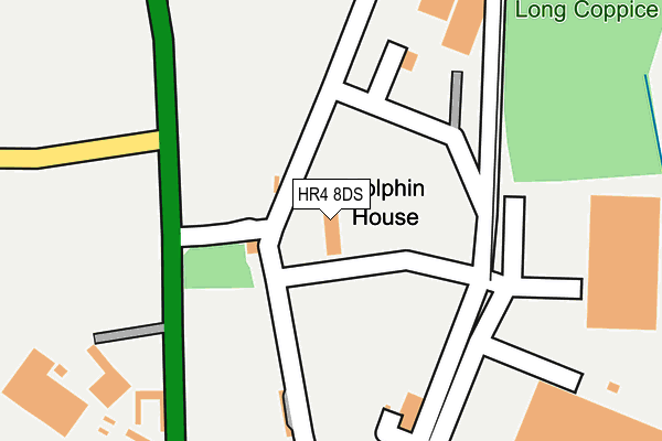
HR4 8DS is located in the Sutton Walls electoral ward, within the unitary authority of Herefordshire, County of and the English Parliamentary constituency of North Herefordshire. The Sub Integrated Care Board (ICB) Location is NHS Herefordshire and Worcestershire ICB - 18C and the police force is West Mercia. This postcode has been in use since June 2002.


GetTheData
Source: OS OpenMap – Local (Ordnance Survey)
Source: OS VectorMap District (Ordnance Survey)
Licence: Open Government Licence (requires attribution)
| Easting | 350241 |
| Northing | 246680 |
| Latitude | 52.116198 |
| Longitude | -2.728098 |
GetTheData
Source: Open Postcode Geo
Licence: Open Government Licence
| Country | England |
| Postcode District | HR4 |
| ➜ HR4 open data dashboard ➜ See where HR4 is on a map | |
GetTheData
Source: Land Registry Price Paid Data
Licence: Open Government Licence
Elevation or altitude of HR4 8DS as distance above sea level:
| Metres | Feet | |
|---|---|---|
| Elevation | 60m | 197ft |
Elevation is measured from the approximate centre of the postcode, to the nearest point on an OS contour line from OS Terrain 50, which has contour spacing of ten vertical metres.
➜ How high above sea level am I? Find the elevation of your current position using your device's GPS.
GetTheData
Source: Open Postcode Elevation
Licence: Open Government Licence
| Ward | Sutton Walls |
| Constituency | North Herefordshire |
GetTheData
Source: ONS Postcode Database
Licence: Open Government Licence
| Wellington Marsh (A49) | Wellington | 526m |
| Wellington Marsh (A49) | Wellington | 552m |
| St Peter's Close (Moreton-on-lugg - Marden Road) | Moreton On Lugg | 1,114m |
| Village Turn (A49) | Moreton On Lugg | 1,144m |
| Village Turn (A49) | Moreton On Lugg | 1,203m |
GetTheData
Source: NaPTAN
Licence: Open Government Licence
GetTheData
Source: ONS Postcode Database
Licence: Open Government Licence


➜ Get more ratings from the Food Standards Agency
GetTheData
Source: Food Standards Agency
Licence: FSA terms & conditions
| Last Collection | |||
|---|---|---|---|
| Location | Mon-Fri | Sat | Distance |
| Lyde | 17:00 | 07:45 | 1,706m |
| Sutton St Nicholas P.o. | 16:15 | 11:00 | 3,032m |
| The Vauld | 10:15 | 10:15 | 4,021m |
GetTheData
Source: Dracos
Licence: Creative Commons Attribution-ShareAlike
| Facility | Distance |
|---|---|
| Wellington Playing Field Wellington Playing Fields, Wellington, Hereford Grass Pitches | 1.5km |
| Marden Primary Academy Marden, Hereford Sports Hall, Grass Pitches, Outdoor Tennis Courts | 2.4km |
| The Volunteer Inn (Closed) Marden, Hereford Grass Pitches | 2.4km |
GetTheData
Source: Active Places
Licence: Open Government Licence
| School | Phase of Education | Distance |
|---|---|---|
| Wellington Primary School and Nursery Wellington, Hereford, HR4 8AZ | Primary | 1.6km |
| Marden Primary Academy Marden, Hereford, HR1 3EW | Primary | 2.4km |
| Sutton Primary Academy Bayley Way, Sutton St Nicholas, HEREFORD, HR1 3SZ | Primary | 3.4km |
GetTheData
Source: Edubase
Licence: Open Government Licence
The below table lists the International Territorial Level (ITL) codes (formerly Nomenclature of Territorial Units for Statistics (NUTS) codes) and Local Administrative Units (LAU) codes for HR4 8DS:
| ITL 1 Code | Name |
|---|---|
| TLG | West Midlands (England) |
| ITL 2 Code | Name |
| TLG1 | Herefordshire, Worcestershire and Warwickshire |
| ITL 3 Code | Name |
| TLG11 | Herefordshire, County of |
| LAU 1 Code | Name |
| E06000019 | Herefordshire, County of |
GetTheData
Source: ONS Postcode Directory
Licence: Open Government Licence
The below table lists the Census Output Area (OA), Lower Layer Super Output Area (LSOA), and Middle Layer Super Output Area (MSOA) for HR4 8DS:
| Code | Name | |
|---|---|---|
| OA | E00071109 | |
| LSOA | E01014082 | Herefordshire 008D |
| MSOA | E02002912 | Herefordshire 008 |
GetTheData
Source: ONS Postcode Directory
Licence: Open Government Licence
| HR4 8DT | 555m | |
| HR4 8DU | The Marsh | 675m |
| HR4 8DW | St Peters Close | 858m |
| HR4 8DA | Ordnance Close | 863m |
| HR4 8DN | St Peters Close | 872m |
| HR4 8DF | Cedar Close | 960m |
| HR4 8DJ | Nursery Drive | 981m |
| HR4 8DB | St Andrews Close | 985m |
| HR4 8DD | St Andrews Close | 986m |
| HR4 8DE | 1012m |
GetTheData
Source: Open Postcode Geo; Land Registry Price Paid Data
Licence: Open Government Licence