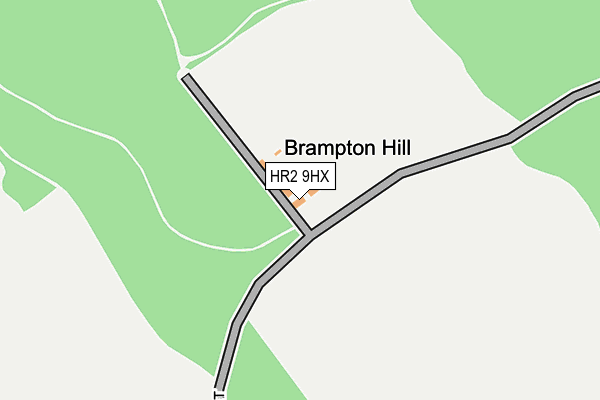
HR2 9HX is in Wormbridge, Hereford. HR2 9HX is located in the Golden Valley South electoral ward, within the unitary authority of Herefordshire, County of and the English Parliamentary constituency of Hereford and South Herefordshire. The Sub Integrated Care Board (ICB) Location is NHS Herefordshire and Worcestershire ICB - 18C and the police force is West Mercia. This postcode has been in use since January 1980.


GetTheData
Source: OS OpenMap – Local (Ordnance Survey)
Source: OS VectorMap District (Ordnance Survey)
Licence: Open Government Licence (requires attribution)
| Easting | 340148 |
| Northing | 235559 |
| Latitude | 52.015221 |
| Longitude | -2.873529 |
GetTheData
Source: Open Postcode Geo
Licence: Open Government Licence
| Locality | Wormbridge |
| Town/City | Hereford |
| Country | England |
| Postcode District | HR2 |
| ➜ HR2 open data dashboard ➜ See where HR2 is on a map | |
GetTheData
Source: Land Registry Price Paid Data
Licence: Open Government Licence
Elevation or altitude of HR2 9HX as distance above sea level:
| Metres | Feet | |
|---|---|---|
| Elevation | 180m | 591ft |
Elevation is measured from the approximate centre of the postcode, to the nearest point on an OS contour line from OS Terrain 50, which has contour spacing of ten vertical metres.
➜ How high above sea level am I? Find the elevation of your current position using your device's GPS.
GetTheData
Source: Open Postcode Elevation
Licence: Open Government Licence
| Ward | Golden Valley South |
| Constituency | Hereford And South Herefordshire |
GetTheData
Source: ONS Postcode Database
Licence: Open Government Licence
| Stoney Street (Kingstone Rd) | Great Brampton | 1,424m |
| Stoney Street (Kingstone Road) | Great Brampton | 1,437m |
| Gooses Foot Industrial Estate (B4348) | Kingstone | 1,497m |
| Gooses Foot Industrial Estate (B4368) | Kingstone | 1,498m |
GetTheData
Source: NaPTAN
Licence: Open Government Licence
| Percentage of properties with Next Generation Access | 100.0% |
| Percentage of properties with Superfast Broadband | 0.0% |
| Percentage of properties with Ultrafast Broadband | 0.0% |
| Percentage of properties with Full Fibre Broadband | 0.0% |
Superfast Broadband is between 30Mbps and 300Mbps
Ultrafast Broadband is > 300Mbps
| Percentage of properties unable to receive 2Mbps | 100.0% |
| Percentage of properties unable to receive 5Mbps | 100.0% |
| Percentage of properties unable to receive 10Mbps | 100.0% |
| Percentage of properties unable to receive 30Mbps | 100.0% |
GetTheData
Source: Ofcom
Licence: Ofcom Terms of Use (requires attribution)
GetTheData
Source: ONS Postcode Database
Licence: Open Government Licence


➜ Get more ratings from the Food Standards Agency
GetTheData
Source: Food Standards Agency
Licence: FSA terms & conditions
| Last Collection | |||
|---|---|---|---|
| Location | Mon-Fri | Sat | Distance |
| Great Brampton | 11:00 | 11:00 | 1,760m |
| Kingstone P.o. | 16:30 | 12:15 | 2,155m |
| Highland View | 16:00 | 09:00 | 2,377m |
GetTheData
Source: Dracos
Licence: Creative Commons Attribution-ShareAlike
| Facility | Distance |
|---|---|
| Kingstone And Thruxton Primary School Kingstone, Hereford Grass Pitches | 1.9km |
| Kingstone Academy Kingstone, Hereford Grass Pitches, Sports Hall | 2km |
| Brampton Golf Course Brampton Road, Madley, Hereford Golf | 2.2km |
GetTheData
Source: Active Places
Licence: Open Government Licence
| School | Phase of Education | Distance |
|---|---|---|
| Kingstone High School Kingstone, Hereford, HR2 9HJ | Secondary | 2km |
| Kingstone and Thruxton Primary School Kingstone, Hereford, HR2 9HJ | Primary | 2.1km |
| Madley Primary School Madley, Hereford, HR2 9PH | Primary | 3.7km |
GetTheData
Source: Edubase
Licence: Open Government Licence
The below table lists the International Territorial Level (ITL) codes (formerly Nomenclature of Territorial Units for Statistics (NUTS) codes) and Local Administrative Units (LAU) codes for HR2 9HX:
| ITL 1 Code | Name |
|---|---|
| TLG | West Midlands (England) |
| ITL 2 Code | Name |
| TLG1 | Herefordshire, Worcestershire and Warwickshire |
| ITL 3 Code | Name |
| TLG11 | Herefordshire, County of |
| LAU 1 Code | Name |
| E06000019 | Herefordshire, County of |
GetTheData
Source: ONS Postcode Directory
Licence: Open Government Licence
The below table lists the Census Output Area (OA), Lower Layer Super Output Area (LSOA), and Middle Layer Super Output Area (MSOA) for HR2 9HX:
| Code | Name | |
|---|---|---|
| OA | E00070778 | |
| LSOA | E01014021 | Herefordshire 020D |
| MSOA | E02002924 | Herefordshire 020 |
GetTheData
Source: ONS Postcode Directory
Licence: Open Government Licence
| HR2 9PF | 1001m | |
| HR2 9NB | Pickhatch Lane | 1279m |
| HR2 9ND | Pickhatch Lane | 1310m |
| HR2 9PG | Great Brampton Park | 1395m |
| HR2 9NE | 1421m | |
| HR2 9HY | Gooses Foot Industrial Estate | 1453m |
| HR2 9NA | 1486m | |
| HR2 9HQ | 1802m | |
| HR2 9HG | Yew Tree Cottages | 1850m |
| HR2 9EY | 1928m |
GetTheData
Source: Open Postcode Geo; Land Registry Price Paid Data
Licence: Open Government Licence