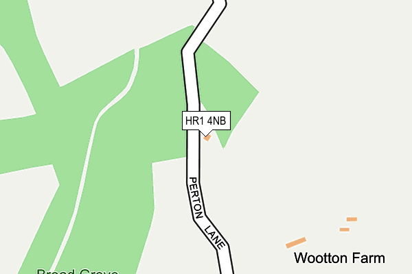
HR1 4NB is in Mordiford, Hereford. HR1 4NB is located in the Backbury electoral ward, within the unitary authority of Herefordshire, County of and the English Parliamentary constituency of North Herefordshire. The Sub Integrated Care Board (ICB) Location is NHS Herefordshire and Worcestershire ICB - 18C and the police force is West Mercia. This postcode has been in use since January 1980.


GetTheData
Source: OS OpenMap – Local (Ordnance Survey)
Source: OS VectorMap District (Ordnance Survey)
Licence: Open Government Licence (requires attribution)
| Easting | 359230 |
| Northing | 239300 |
| Latitude | 52.050579 |
| Longitude | -2.595945 |
GetTheData
Source: Open Postcode Geo
Licence: Open Government Licence
| Locality | Mordiford |
| Town/City | Hereford |
| Country | England |
| Postcode District | HR1 |
| ➜ HR1 open data dashboard ➜ See where HR1 is on a map | |
GetTheData
Source: Land Registry Price Paid Data
Licence: Open Government Licence
Elevation or altitude of HR1 4NB as distance above sea level:
| Metres | Feet | |
|---|---|---|
| Elevation | 150m | 492ft |
Elevation is measured from the approximate centre of the postcode, to the nearest point on an OS contour line from OS Terrain 50, which has contour spacing of ten vertical metres.
➜ How high above sea level am I? Find the elevation of your current position using your device's GPS.
GetTheData
Source: Open Postcode Elevation
Licence: Open Government Licence
| Ward | Backbury |
| Constituency | North Herefordshire |
GetTheData
Source: ONS Postcode Database
Licence: Open Government Licence
| Old Post Office (Unclassified Road) | Checkley | 898m |
| Old Post Office (Unclassified Road) | Checkley | 906m |
| The Maltings (Clayhill Pitch) | Dormington | 1,312m |
| The Maltings (Clayhill Pitch) | Dormington | 1,327m |
| Main Road (A438) | Dormington | 1,359m |
GetTheData
Source: NaPTAN
Licence: Open Government Licence
| Percentage of properties with Next Generation Access | 100.0% |
| Percentage of properties with Superfast Broadband | 0.0% |
| Percentage of properties with Ultrafast Broadband | 0.0% |
| Percentage of properties with Full Fibre Broadband | 0.0% |
Superfast Broadband is between 30Mbps and 300Mbps
Ultrafast Broadband is > 300Mbps
| Percentage of properties unable to receive 2Mbps | 0.0% |
| Percentage of properties unable to receive 5Mbps | 0.0% |
| Percentage of properties unable to receive 10Mbps | 100.0% |
| Percentage of properties unable to receive 30Mbps | 100.0% |
GetTheData
Source: Ofcom
Licence: Ofcom Terms of Use (requires attribution)
GetTheData
Source: ONS Postcode Database
Licence: Open Government Licence
| Last Collection | |||
|---|---|---|---|
| Location | Mon-Fri | Sat | Distance |
| Mordiford P.o. | 16:45 | 10:15 | 2,914m |
| Broadmoor Common | 10:15 | 10:15 | 3,049m |
| Lower Bartestree | 09:00 | 09:00 | 3,108m |
GetTheData
Source: Dracos
Licence: Creative Commons Attribution-ShareAlike
| Facility | Distance |
|---|---|
| Mordiford Cofe Primary School Mordiford, Hereford Grass Pitches | 2.8km |
| Bartestree And Lugwardine Playing Fields Bartestree, Hereford Grass Pitches | 3.7km |
| Berryfield Woolhope Playing Fields C1297 Woolhope To Woodland Car Park, Woolhope Grass Pitches, Outdoor Tennis Courts | 3.8km |
GetTheData
Source: Active Places
Licence: Open Government Licence
| School | Phase of Education | Distance |
|---|---|---|
| Mordiford CofE Primary School Mordiford, Hereford, HR1 4LW | Primary | 2.8km |
| Lugwardine Primary Academy Barneby Avenue, Bartestree, Hereford, HR1 4DH | Primary | 3.9km |
| St Mary's RC High School Lugwardine, Hereford, HR1 4DR | Secondary | 4.6km |
GetTheData
Source: Edubase
Licence: Open Government Licence
The below table lists the International Territorial Level (ITL) codes (formerly Nomenclature of Territorial Units for Statistics (NUTS) codes) and Local Administrative Units (LAU) codes for HR1 4NB:
| ITL 1 Code | Name |
|---|---|
| TLG | West Midlands (England) |
| ITL 2 Code | Name |
| TLG1 | Herefordshire, Worcestershire and Warwickshire |
| ITL 3 Code | Name |
| TLG11 | Herefordshire, County of |
| LAU 1 Code | Name |
| E06000019 | Herefordshire, County of |
GetTheData
Source: ONS Postcode Directory
Licence: Open Government Licence
The below table lists the Census Output Area (OA), Lower Layer Super Output Area (LSOA), and Middle Layer Super Output Area (MSOA) for HR1 4NB:
| Code | Name | |
|---|---|---|
| OA | E00070608 | |
| LSOA | E01013991 | Herefordshire 018B |
| MSOA | E02002922 | Herefordshire 018 |
GetTheData
Source: ONS Postcode Directory
Licence: Open Government Licence
| HR1 4ED | 858m | |
| HR1 4NA | 949m | |
| HR1 4EB | 1032m | |
| HR1 4HP | 1201m | |
| HR1 4ND | 1218m | |
| HR1 4EE | 1225m | |
| HR1 4FA | The Maltings | 1242m |
| HR1 4EF | 1261m | |
| HR1 4ES | 1272m | |
| HR1 4ER | 1363m |
GetTheData
Source: Open Postcode Geo; Land Registry Price Paid Data
Licence: Open Government Licence