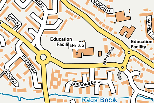
EN7 6JG is located in the Flamstead End electoral ward, within the local authority district of Broxbourne and the English Parliamentary constituency of Broxbourne. The Sub Integrated Care Board (ICB) Location is NHS Hertfordshire and West Essex ICB - 06K and the police force is Hertfordshire. This postcode has been in use since January 1980.


GetTheData
Source: OS OpenMap – Local (Ordnance Survey)
Source: OS VectorMap District (Ordnance Survey)
Licence: Open Government Licence (requires attribution)
| Easting | 534211 |
| Northing | 203580 |
| Latitude | 51.714901 |
| Longitude | -0.058700 |
GetTheData
Source: Open Postcode Geo
Licence: Open Government Licence
| Country | England |
| Postcode District | EN7 |
| ➜ EN7 open data dashboard ➜ See where EN7 is on a map ➜ Where is Cheshunt? | |
GetTheData
Source: Land Registry Price Paid Data
Licence: Open Government Licence
Elevation or altitude of EN7 6JG as distance above sea level:
| Metres | Feet | |
|---|---|---|
| Elevation | 50m | 164ft |
Elevation is measured from the approximate centre of the postcode, to the nearest point on an OS contour line from OS Terrain 50, which has contour spacing of ten vertical metres.
➜ How high above sea level am I? Find the elevation of your current position using your device's GPS.
GetTheData
Source: Open Postcode Elevation
Licence: Open Government Licence
| Ward | Flamstead End |
| Constituency | Broxbourne |
GetTheData
Source: ONS Postcode Database
Licence: Open Government Licence
| January 2024 | Anti-social behaviour | On or near Wheatcroft | 486m |
| January 2024 | Anti-social behaviour | On or near Wheatcroft | 486m |
| January 2024 | Anti-social behaviour | On or near Wheatcroft | 486m |
| ➜ Get more crime data in our Crime section | |||
GetTheData
Source: data.police.uk
Licence: Open Government Licence
| Jacksons Drive (Rosedale Way) | Flamstead End | 117m |
| School (Longfield Lane) | Flamstead End | 117m |
| School (Longfield Lane) | Flamstead End | 133m |
| Jacksons Drive (Rosedale Way) | Flamstead End | 139m |
| Fourfields Care Home (Rosedale Way) | Rosedale | 194m |
| Cheshunt Station | 2.7km |
| Theobalds Grove Station | 3km |
| Cuffley Station | 3.6km |
GetTheData
Source: NaPTAN
Licence: Open Government Licence
GetTheData
Source: ONS Postcode Database
Licence: Open Government Licence


➜ Get more ratings from the Food Standards Agency
GetTheData
Source: Food Standards Agency
Licence: FSA terms & conditions
| Last Collection | |||
|---|---|---|---|
| Location | Mon-Fri | Sat | Distance |
| Roundcroft | 17:30 | 11:30 | 644m |
| Flamstead End P.o | 18:30 | 12:00 | 893m |
| Goffs Lane | 17:00 | 11:30 | 915m |
GetTheData
Source: Dracos
Licence: Creative Commons Attribution-ShareAlike
| Facility | Distance |
|---|---|
| Flamstead End School Longfield Lane, Cheshunt, Waltham Cross Swimming Pool, Grass Pitches | 219m |
| Rosedale Sports Club Andrews Lane, Cheshunt, Waltham Cross Grass Pitches, Artificial Grass Pitch | 642m |
| Cheshunt Park Golf Centre Park Lane, Cheshunt Golf | 748m |
GetTheData
Source: Active Places
Licence: Open Government Licence
| School | Phase of Education | Distance |
|---|---|---|
| Fairfields Primary School and Nursery Rosedale Way, Cheshunt, Waltham Cross, EN7 6JG | Primary | 0m |
| Flamstead End School Longfield Lane, Cheshunt, Waltham Cross, EN7 6AG | Primary | 214m |
| St Paul's Catholic Primary School Park Lane, Cheshunt, EN7 6LR | Primary | 509m |
GetTheData
Source: Edubase
Licence: Open Government Licence
The below table lists the International Territorial Level (ITL) codes (formerly Nomenclature of Territorial Units for Statistics (NUTS) codes) and Local Administrative Units (LAU) codes for EN7 6JG:
| ITL 1 Code | Name |
|---|---|
| TLH | East |
| ITL 2 Code | Name |
| TLH2 | Bedfordshire and Hertfordshire |
| ITL 3 Code | Name |
| TLH23 | Hertfordshire CC |
| LAU 1 Code | Name |
| E07000095 | Broxbourne |
GetTheData
Source: ONS Postcode Directory
Licence: Open Government Licence
The below table lists the Census Output Area (OA), Lower Layer Super Output Area (LSOA), and Middle Layer Super Output Area (MSOA) for EN7 6JG:
| Code | Name | |
|---|---|---|
| OA | E00118502 | |
| LSOA | E01023324 | Broxbourne 009B |
| MSOA | E02004851 | Broxbourne 009 |
GetTheData
Source: ONS Postcode Directory
Licence: Open Government Licence
| EN7 6ES | Rosedale Way | 109m |
| EN7 6HW | Jacksons Drive | 114m |
| EN7 6AL | Longfield Lane | 147m |
| EN7 6AG | Longfield Lane | 148m |
| EN7 6ET | Rosedale Way | 152m |
| EN7 6EU | Rosedale Way | 164m |
| EN7 6HN | Jacksons Drive | 176m |
| EN7 6BP | Mundells | 187m |
| EN7 6AQ | Longfield Lane | 201m |
| EN7 6JQ | Cavell Road | 202m |
GetTheData
Source: Open Postcode Geo; Land Registry Price Paid Data
Licence: Open Government Licence