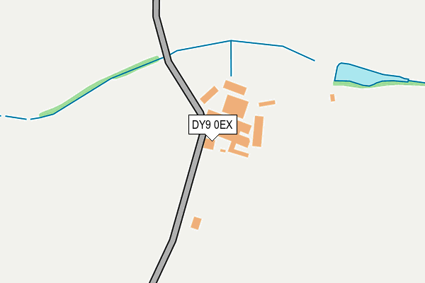
DY9 0EX is located in the Wyre Forest Rural electoral ward, within the local authority district of Wyre Forest and the English Parliamentary constituency of Wyre Forest. The Sub Integrated Care Board (ICB) Location is NHS Herefordshire and Worcestershire ICB - 18C and the police force is West Mercia. This postcode has been in use since January 1980.


GetTheData
Source: OS OpenMap – Local (Ordnance Survey)
Source: OS VectorMap District (Ordnance Survey)
Licence: Open Government Licence (requires attribution)
| Easting | 390647 |
| Northing | 278084 |
| Latitude | 52.400687 |
| Longitude | -2.138893 |
GetTheData
Source: Open Postcode Geo
Licence: Open Government Licence
| Country | England |
| Postcode District | DY9 |
| ➜ DY9 open data dashboard ➜ See where DY9 is on a map ➜ Where is Broome? | |
GetTheData
Source: Land Registry Price Paid Data
Licence: Open Government Licence
Elevation or altitude of DY9 0EX as distance above sea level:
| Metres | Feet | |
|---|---|---|
| Elevation | 110m | 361ft |
Elevation is measured from the approximate centre of the postcode, to the nearest point on an OS contour line from OS Terrain 50, which has contour spacing of ten vertical metres.
➜ How high above sea level am I? Find the elevation of your current position using your device's GPS.
GetTheData
Source: Open Postcode Elevation
Licence: Open Government Licence
| Ward | Wyre Forest Rural |
| Constituency | Wyre Forest |
GetTheData
Source: ONS Postcode Database
Licence: Open Government Licence
| Hackman's Gate Lane (Hackmans Gate Lane) | Hackman's Gate | 1,249m |
| Yew Tree Avenue | Holy Cross | 1,491m |
| Dark Lane (High Street) | Belbroughton | 1,606m |
| Dark Lane (High Street) | Belbroughton | 1,616m |
| Church (Church Rd) | Belbroughton | 1,650m |
| Hagley Station | 2.5km |
| Blakedown Station | 2.7km |
GetTheData
Source: NaPTAN
Licence: Open Government Licence
| Percentage of properties with Next Generation Access | 100.0% |
| Percentage of properties with Superfast Broadband | 0.0% |
| Percentage of properties with Ultrafast Broadband | 0.0% |
| Percentage of properties with Full Fibre Broadband | 0.0% |
Superfast Broadband is between 30Mbps and 300Mbps
Ultrafast Broadband is > 300Mbps
| Percentage of properties unable to receive 2Mbps | 0.0% |
| Percentage of properties unable to receive 5Mbps | 0.0% |
| Percentage of properties unable to receive 10Mbps | 0.0% |
| Percentage of properties unable to receive 30Mbps | 100.0% |
GetTheData
Source: Ofcom
Licence: Ofcom Terms of Use (requires attribution)
GetTheData
Source: ONS Postcode Database
Licence: Open Government Licence


➜ Get more ratings from the Food Standards Agency
GetTheData
Source: Food Standards Agency
Licence: FSA terms & conditions
| Last Collection | |||
|---|---|---|---|
| Location | Mon-Fri | Sat | Distance |
| Broome | 16:00 | 10:00 | 696m |
| Drayton | 16:15 | 08:30 | 2,040m |
| Ismere | 11:45 | 09:00 | 2,697m |
GetTheData
Source: Dracos
Licence: Creative Commons Attribution-ShareAlike
| Facility | Distance |
|---|---|
| Belbroughton Cricket Club Hackmans Gate Lane, Belbroughton, Stourbridge Grass Pitches | 1.4km |
| Centenary Fields - West Horsall Lane, Clent, Stourbridge Grass Pitches | 1.5km |
| Centenary Fields - East Pool Furlong, Clent, Stourbridge Grass Pitches | 1.7km |
GetTheData
Source: Active Places
Licence: Open Government Licence
| School | Phase of Education | Distance |
|---|---|---|
| Belbroughton CofE Primary School Bradford Lane, Belbroughton, Stourbridge, DY9 9TF | Primary | 1.8km |
| Clent Parochial Primary School Clent Parochial Primary School, Bromsgrove Road, Clent, DY9 9QP | Primary | 2km |
| Hagley Primary School Park Road, Hagley, Stourbridge, DY9 0NS | Primary | 2.4km |
GetTheData
Source: Edubase
Licence: Open Government Licence
The below table lists the International Territorial Level (ITL) codes (formerly Nomenclature of Territorial Units for Statistics (NUTS) codes) and Local Administrative Units (LAU) codes for DY9 0EX:
| ITL 1 Code | Name |
|---|---|
| TLG | West Midlands (England) |
| ITL 2 Code | Name |
| TLG1 | Herefordshire, Worcestershire and Warwickshire |
| ITL 3 Code | Name |
| TLG12 | Worcestershire CC |
| LAU 1 Code | Name |
| E07000239 | Wyre Forest |
GetTheData
Source: ONS Postcode Directory
Licence: Open Government Licence
The below table lists the Census Output Area (OA), Lower Layer Super Output Area (LSOA), and Middle Layer Super Output Area (MSOA) for DY9 0EX:
| Code | Name | |
|---|---|---|
| OA | E00165404 | |
| LSOA | E01032433 | Wyre Forest 001C |
| MSOA | E02006767 | Wyre Forest 001 |
GetTheData
Source: ONS Postcode Directory
Licence: Open Government Licence
| DY9 0EZ | Broome | 392m |
| DY9 0HB | 521m | |
| DY9 0HA | Broome | 556m |
| DY9 0HE | Broome | 847m |
| DY9 0EJ | Yieldingtree | 893m |
| DY9 0ET | Broome | 987m |
| DY9 0EL | Yieldingtree | 1031m |
| DY9 0HN | Thicknall Lane | 1093m |
| DY9 0EQ | Yieldingtree | 1124m |
| DY9 0DL | Hackmans Gate Lane | 1138m |
GetTheData
Source: Open Postcode Geo; Land Registry Price Paid Data
Licence: Open Government Licence