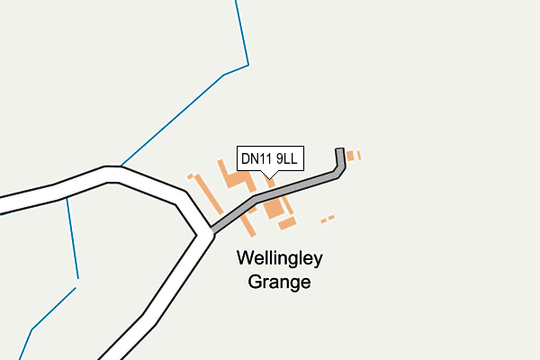
DN11 9LL is in Wellingley, Doncaster. DN11 9LL is located in the Tickhill & Wadsworth electoral ward, within the metropolitan district of Doncaster and the English Parliamentary constituency of Don Valley. The Sub Integrated Care Board (ICB) Location is NHS South Yorkshire ICB - 02X and the police force is South Yorkshire. This postcode has been in use since January 1980.


GetTheData
Source: OS OpenMap – Local (Ordnance Survey)
Source: OS VectorMap District (Ordnance Survey)
Licence: Open Government Licence (requires attribution)
| Easting | 459574 |
| Northing | 396237 |
| Latitude | 53.459542 |
| Longitude | -1.104227 |
GetTheData
Source: Open Postcode Geo
Licence: Open Government Licence
| Locality | Wellingley |
| Town/City | Doncaster |
| Country | England |
| Postcode District | DN11 |
➜ See where DN11 is on a map | |
GetTheData
Source: Land Registry Price Paid Data
Licence: Open Government Licence
Elevation or altitude of DN11 9LL as distance above sea level:
| Metres | Feet | |
|---|---|---|
| Elevation | 10m | 33ft |
Elevation is measured from the approximate centre of the postcode, to the nearest point on an OS contour line from OS Terrain 50, which has contour spacing of ten vertical metres.
➜ How high above sea level am I? Find the elevation of your current position using your device's GPS.
GetTheData
Source: Open Postcode Elevation
Licence: Open Government Licence
| Ward | Tickhill & Wadsworth |
| Constituency | Don Valley |
GetTheData
Source: ONS Postcode Database
Licence: Open Government Licence
| Oddy Lane (Doncaster Road) | Wadworth | 1,534m |
| Oddy Lane (Doncaster Road) | Wadworth | 1,543m |
GetTheData
Source: NaPTAN
Licence: Open Government Licence
| Percentage of properties with Next Generation Access | 100.0% |
| Percentage of properties with Superfast Broadband | 0.0% |
| Percentage of properties with Ultrafast Broadband | 0.0% |
| Percentage of properties with Full Fibre Broadband | 0.0% |
Superfast Broadband is between 30Mbps and 300Mbps
Ultrafast Broadband is > 300Mbps
| Percentage of properties unable to receive 2Mbps | 0.0% |
| Percentage of properties unable to receive 5Mbps | 100.0% |
| Percentage of properties unable to receive 10Mbps | 100.0% |
| Percentage of properties unable to receive 30Mbps | 100.0% |
GetTheData
Source: Ofcom
Licence: Ofcom Terms of Use (requires attribution)
GetTheData
Source: ONS Postcode Database
Licence: Open Government Licence


➜ Get more ratings from the Food Standards Agency
GetTheData
Source: Food Standards Agency
Licence: FSA terms & conditions
| Last Collection | |||
|---|---|---|---|
| Location | Mon-Fri | Sat | Distance |
| Atlee Avenue | 17:45 | 09:00 | 2,273m |
| Central Drive | 17:30 | 09:00 | 2,452m |
| Common Lane | 16:15 | 10:30 | 2,494m |
GetTheData
Source: Dracos
Licence: Creative Commons Attribution-ShareAlike
The below table lists the International Territorial Level (ITL) codes (formerly Nomenclature of Territorial Units for Statistics (NUTS) codes) and Local Administrative Units (LAU) codes for DN11 9LL:
| ITL 1 Code | Name |
|---|---|
| TLE | Yorkshire and The Humber |
| ITL 2 Code | Name |
| TLE3 | South Yorkshire |
| ITL 3 Code | Name |
| TLE31 | Barnsley, Doncaster and Rotherham |
| LAU 1 Code | Name |
| E08000017 | Doncaster |
GetTheData
Source: ONS Postcode Directory
Licence: Open Government Licence
The below table lists the Census Output Area (OA), Lower Layer Super Output Area (LSOA), and Middle Layer Super Output Area (MSOA) for DN11 9LL:
| Code | Name | |
|---|---|---|
| OA | E00038597 | |
| LSOA | E01007614 | Doncaster 039C |
| MSOA | E02001577 | Doncaster 039 |
GetTheData
Source: ONS Postcode Directory
Licence: Open Government Licence
| DN11 0RX | Memoir Grove | 1929m |
| DN11 0QW | Windsor View | 1930m |
| DN11 0RY | Tranquil Walk | 1932m |
| DN11 0RZ | Hethersett Way | 1933m |
| DN11 9LQ | Galley Hill | 1961m |
| DN11 0RR | Radburn Road | 1978m |
| DN11 0SB | Ormonde Way | 1992m |
| DN11 0RU | Memoir Grove | 1994m |
| DN11 0RS | Radburn Road | 2027m |
| DN11 0RA | Bahram Grove | 2033m |
GetTheData
Source: Open Postcode Geo; Land Registry Price Paid Data
Licence: Open Government Licence