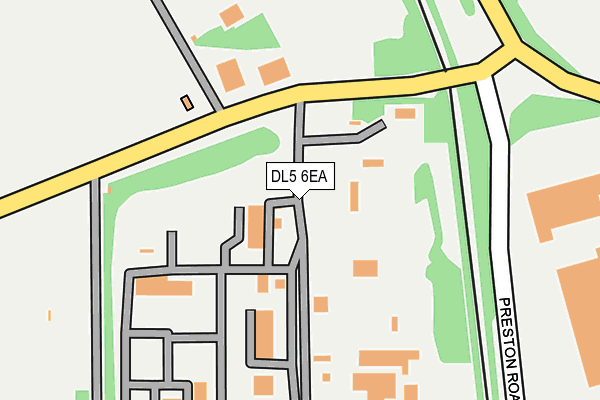
DL5 6EA is located in the Heighington & Coniscliffe electoral ward, within the unitary authority of Darlington and the English Parliamentary constituency of Sedgefield. The Sub Integrated Care Board (ICB) Location is NHS North East and North Cumbria ICB - 16C and the police force is Durham. This postcode has been in use since January 1980.


GetTheData
Source: OS OpenMap – Local (Ordnance Survey)
Source: OS VectorMap District (Ordnance Survey)
Licence: Open Government Licence (requires attribution)
| Easting | 426763 |
| Northing | 523857 |
| Latitude | 54.609182 |
| Longitude | -1.587177 |
GetTheData
Source: Open Postcode Geo
Licence: Open Government Licence
| Country | England |
| Postcode District | DL5 |
| ➜ DL5 open data dashboard ➜ See where DL5 is on a map ➜ Where is Newton Aycliffe? | |
GetTheData
Source: Land Registry Price Paid Data
Licence: Open Government Licence
Elevation or altitude of DL5 6EA as distance above sea level:
| Metres | Feet | |
|---|---|---|
| Elevation | 110m | 361ft |
Elevation is measured from the approximate centre of the postcode, to the nearest point on an OS contour line from OS Terrain 50, which has contour spacing of ten vertical metres.
➜ How high above sea level am I? Find the elevation of your current position using your device's GPS.
GetTheData
Source: Open Postcode Elevation
Licence: Open Government Licence
| Ward | Heighington & Coniscliffe |
| Constituency | Sedgefield |
GetTheData
Source: ONS Postcode Database
Licence: Open Government Licence
| May 2022 | Criminal damage and arson | On or near Hurworth Road | 487m |
| May 2022 | Criminal damage and arson | On or near Hurworth Road | 487m |
| May 2022 | Vehicle crime | On or near Hurworth Road | 487m |
| ➜ Get more crime data in our Crime section | |||
GetTheData
Source: data.police.uk
Licence: Open Government Licence
| Aerial House (School Aycliffe Lane) | School Aycliffe | 117m |
| Aerial House (School Aycliffe Lane) | School Aycliffe | 123m |
| Northfield Way (Horndale Avenue) | Newton Aycliffe | 455m |
| Northfield Way (Horndale Avenue) | Newton Aycliffe | 480m |
| Railway Station Bus Stop (Greenfield Way) | Newton Aycliffe | 554m |
| Newton Aycliffe Station | 0.5km |
| Heighington Station | 1.4km |
| Shildon Station | 3.7km |
GetTheData
Source: NaPTAN
Licence: Open Government Licence
GetTheData
Source: ONS Postcode Database
Licence: Open Government Licence


➜ Get more ratings from the Food Standards Agency
GetTheData
Source: Food Standards Agency
Licence: FSA terms & conditions
| Last Collection | |||
|---|---|---|---|
| Location | Mon-Fri | Sat | Distance |
| Beveridge Way | 17:30 | 12:00 | 894m |
| Burn Lane | 16:45 | 11:15 | 1,842m |
| Garburn Place | 16:45 | 10:45 | 1,968m |
GetTheData
Source: Dracos
Licence: Creative Commons Attribution-ShareAlike
| Facility | Distance |
|---|---|
| Newton Aycliffe Youth Fc School Aycliffe, Newton Aycliffe Grass Pitches | 141m |
| Oak Leaf Sports Complex School Aycliffe, Newton Aycliffe Sports Hall, Indoor Bowls, Golf, Squash Courts | 365m |
| Elmfield Primary School (Closed) Rowan Place, Newton Aycliffe Grass Pitches | 827m |
GetTheData
Source: Active Places
Licence: Open Government Licence
| School | Phase of Education | Distance |
|---|---|---|
| Stephenson Way Academy and Nursery School Stephenson Way, Newton Aycliffe, DL5 7DD | Primary | 1.2km |
| St Joseph's Catholic Primary School Garburn Place, Newton Aycliffe, DL5 7DE | Primary | 1.4km |
| Woodham Burn Community Primary School and Nursery Humphrey Close, Newton Aycliffe, DL5 4EX | Primary | 1.4km |
GetTheData
Source: Edubase
Licence: Open Government Licence
The below table lists the International Territorial Level (ITL) codes (formerly Nomenclature of Territorial Units for Statistics (NUTS) codes) and Local Administrative Units (LAU) codes for DL5 6EA:
| ITL 1 Code | Name |
|---|---|
| TLC | North East (England) |
| ITL 2 Code | Name |
| TLC1 | Tees Valley and Durham |
| ITL 3 Code | Name |
| TLC13 | Darlington |
| LAU 1 Code | Name |
| E06000005 | Darlington |
GetTheData
Source: ONS Postcode Directory
Licence: Open Government Licence
The below table lists the Census Output Area (OA), Lower Layer Super Output Area (LSOA), and Middle Layer Super Output Area (MSOA) for DL5 6EA:
| Code | Name | |
|---|---|---|
| OA | E00174206 | |
| LSOA | E01012334 | Darlington 001B |
| MSOA | E02002559 | Darlington 001 |
GetTheData
Source: ONS Postcode Directory
Licence: Open Government Licence
| DL5 7AZ | Beechfield | 617m |
| DL5 7BD | Elmfield Place | 623m |
| DL5 6QE | South Cottages | 627m |
| DL5 5JU | Cumby Road | 628m |
| DL5 6GP | Cypress Grove | 652m |
| DL5 7BE | Elmfield Place | 653m |
| DL5 6QD | North Cottages | 654m |
| DL5 6GQ | Magnolia Close | 660m |
| DL5 5JS | Doxford Close | 683m |
| DL5 5JX | Watson Road | 704m |
GetTheData
Source: Open Postcode Geo; Land Registry Price Paid Data
Licence: Open Government Licence