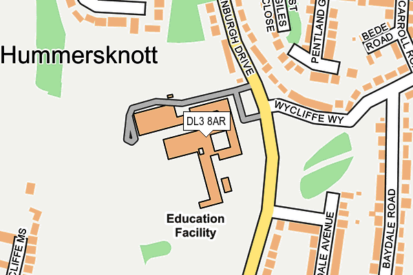
DL3 8AR is located in the Hummersknott electoral ward, within the unitary authority of Darlington and the English Parliamentary constituency of Darlington. The Sub Integrated Care Board (ICB) Location is NHS North East and North Cumbria ICB - 16C and the police force is Durham. This postcode has been in use since January 1980.


GetTheData
Source: OS OpenMap – Local (Ordnance Survey)
Source: OS VectorMap District (Ordnance Survey)
Licence: Open Government Licence (requires attribution)
| Easting | 426355 |
| Northing | 514079 |
| Latitude | 54.521323 |
| Longitude | -1.594356 |
GetTheData
Source: Open Postcode Geo
Licence: Open Government Licence
| Country | England |
| Postcode District | DL3 |
| ➜ DL3 open data dashboard ➜ See where DL3 is on a map ➜ Where is Darlington? | |
GetTheData
Source: Land Registry Price Paid Data
Licence: Open Government Licence
Elevation or altitude of DL3 8AR as distance above sea level:
| Metres | Feet | |
|---|---|---|
| Elevation | 50m | 164ft |
Elevation is measured from the approximate centre of the postcode, to the nearest point on an OS contour line from OS Terrain 50, which has contour spacing of ten vertical metres.
➜ How high above sea level am I? Find the elevation of your current position using your device's GPS.
GetTheData
Source: Open Postcode Elevation
Licence: Open Government Licence
| Ward | Hummersknott |
| Constituency | Darlington |
GetTheData
Source: ONS Postcode Database
Licence: Open Government Licence
| November 2023 | Anti-social behaviour | On or near Granton Close | 356m |
| June 2022 | Anti-social behaviour | On or near Edinburgh Drive | 107m |
| June 2022 | Anti-social behaviour | On or near Edinburgh Drive | 107m |
| ➜ Get more crime data in our Crime section | |||
GetTheData
Source: data.police.uk
Licence: Open Government Licence
| Edinburgh Drive | Hummersknott | 131m |
| Holyrood Avenue (Edinburgh Drive) | Hummersknott | 135m |
| Hummersknott Academy (Wycliffe Way) | Hummersknott | 135m |
| Edinburgh Drive | Hummersknott | 142m |
| Hanover Close (Edinburgh Drive) | Mowden | 266m |
| Darlington Station | 3km |
| North Road Station | 3.1km |
GetTheData
Source: NaPTAN
Licence: Open Government Licence
GetTheData
Source: ONS Postcode Database
Licence: Open Government Licence


➜ Get more ratings from the Food Standards Agency
GetTheData
Source: Food Standards Agency
Licence: FSA terms & conditions
| Last Collection | |||
|---|---|---|---|
| Location | Mon-Fri | Sat | Distance |
| Salutation Road | 17:30 | 09:30 | 438m |
| Tees Grange | 17:30 | 11:15 | 463m |
| Lauriston Close | 17:30 | 10:15 | 470m |
GetTheData
Source: Dracos
Licence: Creative Commons Attribution-ShareAlike
| Facility | Distance |
|---|---|
| Hummersknott Academy Edinburgh Drive, Darlington Grass Pitches, Sports Hall, Swimming Pool, Artificial Grass Pitch, Studio | 0m |
| Carmel College The Headlands, Darlington Health and Fitness Gym, Grass Pitches, Sports Hall, Artificial Grass Pitch | 633m |
| Darlington Mowden Park Rugby Football Club (Closed) Yiewsley Drive, Darlington Grass Pitches | 791m |
GetTheData
Source: Active Places
Licence: Open Government Licence
| School | Phase of Education | Distance |
|---|---|---|
| Hummersknott Academy Edinburgh Drive, Darlington, DL3 8AR | Secondary | 0m |
| Carmel College The Headlands, Darlington, DL3 8RW | Secondary | 649m |
| Embleton View Westgate House, Coniscliffe Road, Darlington, DL3 8TF | Not applicable | 839m |
GetTheData
Source: Edubase
Licence: Open Government Licence
The below table lists the International Territorial Level (ITL) codes (formerly Nomenclature of Territorial Units for Statistics (NUTS) codes) and Local Administrative Units (LAU) codes for DL3 8AR:
| ITL 1 Code | Name |
|---|---|
| TLC | North East (England) |
| ITL 2 Code | Name |
| TLC1 | Tees Valley and Durham |
| ITL 3 Code | Name |
| TLC13 | Darlington |
| LAU 1 Code | Name |
| E06000005 | Darlington |
GetTheData
Source: ONS Postcode Directory
Licence: Open Government Licence
The below table lists the Census Output Area (OA), Lower Layer Super Output Area (LSOA), and Middle Layer Super Output Area (MSOA) for DL3 8AR:
| Code | Name | |
|---|---|---|
| OA | E00062219 | |
| LSOA | E01012336 | Darlington 011A |
| MSOA | E02002569 | Darlington 011 |
GetTheData
Source: ONS Postcode Directory
Licence: Open Government Licence
| DL3 8AT | Edinburgh Drive | 146m |
| DL3 8AS | Wycliffe Way | 157m |
| DL3 8AU | Edinburgh Drive | 191m |
| DL3 8BA | Pentland Grove | 206m |
| DL3 8AW | Edinburgh Drive | 237m |
| DL3 8AP | Teesdale Avenue | 259m |
| DL3 8JX | Hummersknott Avenue | 259m |
| DL3 8TD | Coniscliffe Mews | 269m |
| DL3 8JT | Baydale Road | 279m |
| DL3 8JZ | Bede Road | 283m |
GetTheData
Source: Open Postcode Geo; Land Registry Price Paid Data
Licence: Open Government Licence