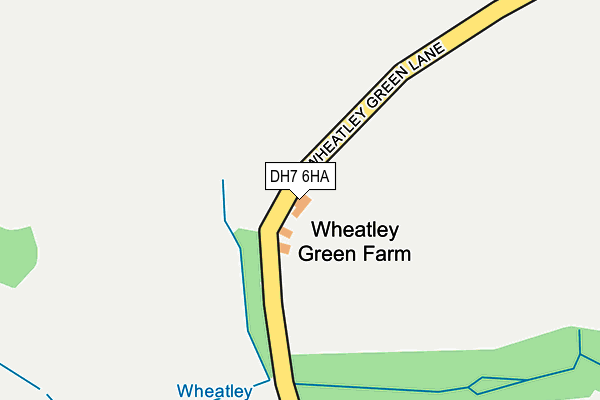
DH7 6HA is located in the Sacriston electoral ward, within the unitary authority of County Durham and the English Parliamentary constituency of North Durham. The Sub Integrated Care Board (ICB) Location is NHS North East and North Cumbria ICB - 84H and the police force is Durham. This postcode has been in use since January 1980.


GetTheData
Source: OS OpenMap – Local (Ordnance Survey)
Source: OS VectorMap District (Ordnance Survey)
Licence: Open Government Licence (requires attribution)
| Easting | 421900 |
| Northing | 549748 |
| Latitude | 54.842073 |
| Longitude | -1.660518 |
GetTheData
Source: Open Postcode Geo
Licence: Open Government Licence
| Country | England |
| Postcode District | DH7 |
| ➜ DH7 open data dashboard ➜ See where DH7 is on a map | |
GetTheData
Source: Land Registry Price Paid Data
Licence: Open Government Licence
Elevation or altitude of DH7 6HA as distance above sea level:
| Metres | Feet | |
|---|---|---|
| Elevation | 130m | 427ft |
Elevation is measured from the approximate centre of the postcode, to the nearest point on an OS contour line from OS Terrain 50, which has contour spacing of ten vertical metres.
➜ How high above sea level am I? Find the elevation of your current position using your device's GPS.
GetTheData
Source: Open Postcode Elevation
Licence: Open Government Licence
| Ward | Sacriston |
| Constituency | North Durham |
GetTheData
Source: ONS Postcode Database
Licence: Open Government Licence
| September 2021 | Violence and sexual offences | On or near Humbleburn Lane | 471m |
| September 2021 | Violence and sexual offences | On or near Humbleburn Lane | 471m |
| ➜ Get more crime data in our Crime section | |||
GetTheData
Source: data.police.uk
Licence: Open Government Licence
| Wheatley Green Farm (Wheatley Green Lane) | Holmside | 17m |
| Wheatley Green Farm (Wheatley Green Lane) | Holmside | 22m |
| Charlaw Inn (B6532 Beechgrove Terrace) | Blackhouse | 427m |
| Charlaw Inn (B6532 Beechgrove Terrace) | Blackhouse | 475m |
| Claytonville (B6532 Blackhouse Lane) | Blackhouse | 667m |
GetTheData
Source: NaPTAN
Licence: Open Government Licence
GetTheData
Source: ONS Postcode Database
Licence: Open Government Licence


➜ Get more ratings from the Food Standards Agency
GetTheData
Source: Food Standards Agency
Licence: FSA terms & conditions
| Last Collection | |||
|---|---|---|---|
| Location | Mon-Fri | Sat | Distance |
| Dysons Buildings, Blackhouse | 16:15 | 10:45 | 395m |
| Tyzack Street | 16:45 | 11:30 | 1,965m |
| Grange Villa Post Office | 17:00 | 11:30 | 2,583m |
GetTheData
Source: Dracos
Licence: Creative Commons Attribution-ShareAlike
| Facility | Distance |
|---|---|
| Craghead Welfare Middles Road, Craghead, Stanley Grass Pitches | 2.1km |
| Bloemfontein Primary School The Middles, Stanley Grass Pitches | 2.3km |
| South Moor Golf Club The Middles, Stanley Golf | 2.4km |
GetTheData
Source: Active Places
Licence: Open Government Licence
| School | Phase of Education | Distance |
|---|---|---|
| Edmondsley Primary School Edmondsley, Durham, DH7 6DU | Primary | 1.9km |
| Bloemfontein Primary School The Middles, Craghead, Stanley, DH9 6AG | Primary | 2.3km |
| Stanley Burnside Primary School Mendip Terrace, South Stanley, Stanley, DH9 6QP | Primary | 2.9km |
GetTheData
Source: Edubase
Licence: Open Government Licence
The below table lists the International Territorial Level (ITL) codes (formerly Nomenclature of Territorial Units for Statistics (NUTS) codes) and Local Administrative Units (LAU) codes for DH7 6HA:
| ITL 1 Code | Name |
|---|---|
| TLC | North East (England) |
| ITL 2 Code | Name |
| TLC1 | Tees Valley and Durham |
| ITL 3 Code | Name |
| TLC14 | Durham |
| LAU 1 Code | Name |
| E06000047 | County Durham |
GetTheData
Source: ONS Postcode Directory
Licence: Open Government Licence
The below table lists the Census Output Area (OA), Lower Layer Super Output Area (LSOA), and Middle Layer Super Output Area (MSOA) for DH7 6HA:
| Code | Name | |
|---|---|---|
| OA | E00104526 | |
| LSOA | E01020604 | County Durham 019A |
| MSOA | E02004296 | County Durham 019 |
GetTheData
Source: ONS Postcode Directory
Licence: Open Government Licence
| DH7 6EQ | 407m | |
| DH7 6EG | 420m | |
| DH7 6EJ | Beechgrove Terrace | 449m |
| DH7 6EP | Holmside | 546m |
| DH7 6ER | Deneholme Terrace | 560m |
| DH7 6ES | Holmside | 582m |
| DH7 6EL | Blackhouse | 597m |
| DH7 6ET | Oak Terrace | 602m |
| DH7 6EN | Blackhouse | 617m |
| DH7 6EU | Ashtree Terrace | 645m |
GetTheData
Source: Open Postcode Geo; Land Registry Price Paid Data
Licence: Open Government Licence