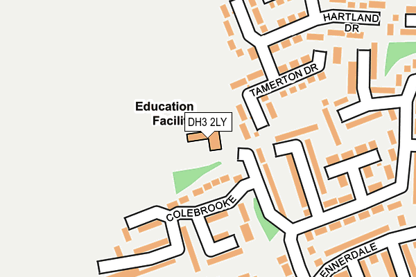
DH3 2LY is located in the Birtley electoral ward, within the metropolitan district of Gateshead and the English Parliamentary constituency of Blaydon. The Sub Integrated Care Board (ICB) Location is NHS North East and North Cumbria ICB - 13T and the police force is Northumbria. This postcode has been in use since January 1980.


GetTheData
Source: OS OpenMap – Local (Ordnance Survey)
Source: OS VectorMap District (Ordnance Survey)
Licence: Open Government Licence (requires attribution)
| Easting | 427796 |
| Northing | 554850 |
| Latitude | 54.887629 |
| Longitude | -1.568223 |
GetTheData
Source: Open Postcode Geo
Licence: Open Government Licence
| Country | England |
| Postcode District | DH3 |
| ➜ DH3 open data dashboard ➜ See where DH3 is on a map ➜ Where is Birtley? | |
GetTheData
Source: Land Registry Price Paid Data
Licence: Open Government Licence
Elevation or altitude of DH3 2LY as distance above sea level:
| Metres | Feet | |
|---|---|---|
| Elevation | 60m | 197ft |
Elevation is measured from the approximate centre of the postcode, to the nearest point on an OS contour line from OS Terrain 50, which has contour spacing of ten vertical metres.
➜ How high above sea level am I? Find the elevation of your current position using your device's GPS.
GetTheData
Source: Open Postcode Elevation
Licence: Open Government Licence
| Ward | Birtley |
| Constituency | Blaydon |
GetTheData
Source: ONS Postcode Database
Licence: Open Government Licence
| November 2023 | Burglary | On or near Ennerdale | 266m |
| July 2023 | Violence and sexual offences | On or near Ennerdale | 266m |
| July 2023 | Criminal damage and arson | On or near Ennerdale | 266m |
| ➜ Get more crime data in our Crime section | |||
GetTheData
Source: data.police.uk
Licence: Open Government Licence
| Glenluce | Barley Mow | 212m |
| Ennerdale (Ennerdale-w/B) | Barley Mow | 281m |
| Birtley Lane-leafield House (Birtley Lane) | Birtley | 302m |
| Kinross Close (The Drive) | Barley Mow | 315m |
| Windermere | Barley Mow | 353m |
| Chester-le-Street Station | 3.7km |
GetTheData
Source: NaPTAN
Licence: Open Government Licence
GetTheData
Source: ONS Postcode Database
Licence: Open Government Licence


➜ Get more ratings from the Food Standards Agency
GetTheData
Source: Food Standards Agency
Licence: FSA terms & conditions
| Last Collection | |||
|---|---|---|---|
| Location | Mon-Fri | Sat | Distance |
| Hartside ,barley Mow | 17:30 | 11:15 | 540m |
| Newtown, Durham Rd, Birtley | 17:30 | 12:00 | 545m |
| The Drive | 17:30 | 11:15 | 559m |
GetTheData
Source: Dracos
Licence: Creative Commons Attribution-ShareAlike
| Facility | Distance |
|---|---|
| Birtley Golf Club Birtley Lane, Birtley, Chester Le Street Golf | 393m |
| Birtley Leisure Centre Durham Road, Birtley, Chester Le Street Sports Hall, Health and Fitness Gym, Studio | 579m |
| Lord Lawson Comprehensive School (Closed) Portobello Road, Birtley, Chester Le Street Sports Hall, Health and Fitness Gym, Grass Pitches | 600m |
GetTheData
Source: Active Places
Licence: Open Government Licence
| School | Phase of Education | Distance |
|---|---|---|
| Portobello Primary School Tamerton Drive, Birtley, Chester le Street, DH3 2LY | Primary | 21m |
| Barley Mow Primary School Pembroke Avenue, Barley Mow, Birtley, Chester le Street, DH3 2DJ | Primary | 395m |
| Lord Lawson of Beamish Academy Birtley Lane, Birtley, Chester le Street, DH3 2LP | Secondary | 600m |
GetTheData
Source: Edubase
Licence: Open Government Licence
The below table lists the International Territorial Level (ITL) codes (formerly Nomenclature of Territorial Units for Statistics (NUTS) codes) and Local Administrative Units (LAU) codes for DH3 2LY:
| ITL 1 Code | Name |
|---|---|
| TLC | North East (England) |
| ITL 2 Code | Name |
| TLC2 | Northumberland, and Tyne and Wear |
| ITL 3 Code | Name |
| TLC22 | Tyneside |
| LAU 1 Code | Name |
| E08000037 | Gateshead |
GetTheData
Source: ONS Postcode Directory
Licence: Open Government Licence
The below table lists the Census Output Area (OA), Lower Layer Super Output Area (LSOA), and Middle Layer Super Output Area (MSOA) for DH3 2LY:
| Code | Name | |
|---|---|---|
| OA | E00041440 | |
| LSOA | E01008176 | Gateshead 026E |
| MSOA | E02001707 | Gateshead 026 |
GetTheData
Source: ONS Postcode Directory
Licence: Open Government Licence
| DH3 2LX | Tamerton Drive | 123m |
| DH3 2JG | Tantallon | 126m |
| DH3 2LF | Colebrooke | 144m |
| DH3 2LT | Lydford Way | 159m |
| DH3 2LU | Lydford Way | 197m |
| DH3 2JB | Mingarry | 219m |
| DH3 2LZ | Hartland Drive | 232m |
| DH3 2JE | Tantallon | 233m |
| DH3 2JD | Tantallon | 239m |
| DH3 2DT | Rosslyn Place | 243m |
GetTheData
Source: Open Postcode Geo; Land Registry Price Paid Data
Licence: Open Government Licence