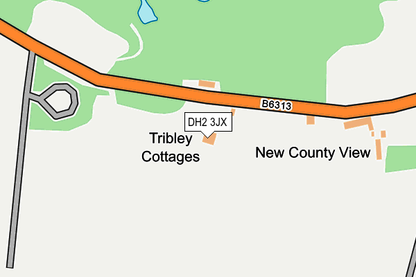
DH2 3JX is located in the Chester-le-Street West Central electoral ward, within the unitary authority of County Durham and the English Parliamentary constituency of North Durham. The Sub Integrated Care Board (ICB) Location is NHS North East and North Cumbria ICB - 84H and the police force is Durham. This postcode has been in use since January 1980.


GetTheData
Source: OS OpenMap – Local (Ordnance Survey)
Source: OS VectorMap District (Ordnance Survey)
Licence: Open Government Licence (requires attribution)
| Easting | 423824 |
| Northing | 551353 |
| Latitude | 54.856416 |
| Longitude | -1.630440 |
GetTheData
Source: Open Postcode Geo
Licence: Open Government Licence
| Country | England |
| Postcode District | DH2 |
| ➜ DH2 open data dashboard ➜ See where DH2 is on a map | |
GetTheData
Source: Land Registry Price Paid Data
Licence: Open Government Licence
Elevation or altitude of DH2 3JX as distance above sea level:
| Metres | Feet | |
|---|---|---|
| Elevation | 100m | 328ft |
Elevation is measured from the approximate centre of the postcode, to the nearest point on an OS contour line from OS Terrain 50, which has contour spacing of ten vertical metres.
➜ How high above sea level am I? Find the elevation of your current position using your device's GPS.
GetTheData
Source: Open Postcode Elevation
Licence: Open Government Licence
| Ward | Chester-le-street West Central |
| Constituency | North Durham |
GetTheData
Source: ONS Postcode Database
Licence: Open Government Licence
| September 2021 | Public order | On or near Petrol Station | 80m |
| June 2021 | Anti-social behaviour | On or near Petrol Station | 80m |
| March 2021 | Criminal damage and arson | On or near Petrol Station | 80m |
| ➜ Get more crime data in our Crime section | |||
GetTheData
Source: data.police.uk
Licence: Open Government Licence
| The Moorings (B6313 Beamish View) | Pelton Fell | 207m |
| The Moorings (B6313 Beamish View) | Pelton Fell | 279m |
| Metal Bridge (B6313) | Grange Villa | 481m |
| Metal Bridge (B6313) | Grange Villa | 492m |
| Crossroads (Newbridge Banks) | Grange Villa | 705m |
| Chester-le-Street Station | 3.4km |
GetTheData
Source: NaPTAN
Licence: Open Government Licence
| Percentage of properties with Next Generation Access | 100.0% |
| Percentage of properties with Superfast Broadband | 0.0% |
| Percentage of properties with Ultrafast Broadband | 0.0% |
| Percentage of properties with Full Fibre Broadband | 0.0% |
Superfast Broadband is between 30Mbps and 300Mbps
Ultrafast Broadband is > 300Mbps
| Percentage of properties unable to receive 2Mbps | 0.0% |
| Percentage of properties unable to receive 5Mbps | 0.0% |
| Percentage of properties unable to receive 10Mbps | 0.0% |
| Percentage of properties unable to receive 30Mbps | 100.0% |
GetTheData
Source: Ofcom
Licence: Ofcom Terms of Use (requires attribution)
GetTheData
Source: ONS Postcode Database
Licence: Open Government Licence


➜ Get more ratings from the Food Standards Agency
GetTheData
Source: Food Standards Agency
Licence: FSA terms & conditions
| Last Collection | |||
|---|---|---|---|
| Location | Mon-Fri | Sat | Distance |
| Grange Villa Post Office | 17:00 | 11:30 | 747m |
| Grange Terrace, Pelton | 17:00 | 09:00 | 1,007m |
| Newfield Post Office | 17:00 | 11:30 | 1,118m |
GetTheData
Source: Dracos
Licence: Creative Commons Attribution-ShareAlike
| Facility | Distance |
|---|---|
| Grange Villa Park Stone Row, Grange Villa Grass Pitches | 1km |
| Roseberry Primary School Pelton Lane, Pelton, Chester Le Street Grass Pitches, Sports Hall | 1.2km |
| Roseberry Grange Community Golf Club Chester Le Street Golf | 1.2km |
GetTheData
Source: Active Places
Licence: Open Government Licence
| School | Phase of Education | Distance |
|---|---|---|
| Roseberry Primary and Nursery School Pelton Lane, Pelton, Chester le Street, DH2 1NP | Primary | 1.2km |
| West Pelton Primary School Twizell Lane, West Pelton, Stanley, DH9 6SQ | Primary | 1.7km |
| Edmondsley Primary School Edmondsley, Durham, DH7 6DU | Primary | 2.1km |
GetTheData
Source: Edubase
Licence: Open Government Licence
The below table lists the International Territorial Level (ITL) codes (formerly Nomenclature of Territorial Units for Statistics (NUTS) codes) and Local Administrative Units (LAU) codes for DH2 3JX:
| ITL 1 Code | Name |
|---|---|
| TLC | North East (England) |
| ITL 2 Code | Name |
| TLC1 | Tees Valley and Durham |
| ITL 3 Code | Name |
| TLC14 | Durham |
| LAU 1 Code | Name |
| E06000047 | County Durham |
GetTheData
Source: ONS Postcode Directory
Licence: Open Government Licence
The below table lists the Census Output Area (OA), Lower Layer Super Output Area (LSOA), and Middle Layer Super Output Area (MSOA) for DH2 3JX:
| Code | Name | |
|---|---|---|
| OA | E00104607 | |
| LSOA | E01020618 | County Durham 011F |
| MSOA | E02004293 | County Durham 011 |
GetTheData
Source: ONS Postcode Directory
Licence: Open Government Licence
| DH2 3JU | 253m | |
| DH2 3JY | Blue House Bank | 618m |
| DH2 3LH | Coronation Terrace | 706m |
| DH2 3LL | Front Street | 712m |
| DH2 3LJ | Front Street | 733m |
| DH2 3NB | Stone Row | 819m |
| DH2 3LN | East Street | 822m |
| DH2 3LA | 824m | |
| DH2 2PD | Grange Terrace | 837m |
| DH2 3LW | West Street | 841m |
GetTheData
Source: Open Postcode Geo; Land Registry Price Paid Data
Licence: Open Government Licence