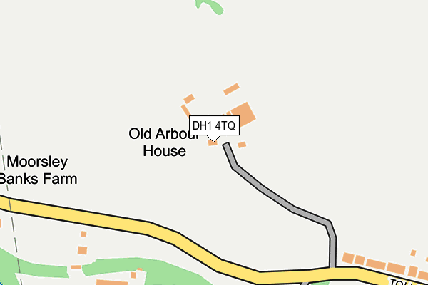
DH1 4TQ is in Crossgate Moor, Durham. DH1 4TQ is located in the Deerness electoral ward, within the unitary authority of County Durham and the English Parliamentary constituency of City of Durham. The Sub Integrated Care Board (ICB) Location is NHS North East and North Cumbria ICB - 84H and the police force is Durham. This postcode has been in use since January 1980.


GetTheData
Source: OS OpenMap – Local (Ordnance Survey)
Source: OS VectorMap District (Ordnance Survey)
Licence: Open Government Licence (requires attribution)
| Easting | 425517 |
| Northing | 542806 |
| Latitude | 54.779520 |
| Longitude | -1.604807 |
GetTheData
Source: Open Postcode Geo
Licence: Open Government Licence
| Locality | Crossgate Moor |
| Town/City | Durham |
| Country | England |
| Postcode District | DH1 |
| ➜ DH1 open data dashboard ➜ See where DH1 is on a map | |
GetTheData
Source: Land Registry Price Paid Data
Licence: Open Government Licence
Elevation or altitude of DH1 4TQ as distance above sea level:
| Metres | Feet | |
|---|---|---|
| Elevation | 100m | 328ft |
Elevation is measured from the approximate centre of the postcode, to the nearest point on an OS contour line from OS Terrain 50, which has contour spacing of ten vertical metres.
➜ How high above sea level am I? Find the elevation of your current position using your device's GPS.
GetTheData
Source: Open Postcode Elevation
Licence: Open Government Licence
| Ward | Deerness |
| Constituency | City Of Durham |
GetTheData
Source: ONS Postcode Database
Licence: Open Government Licence
| June 2022 | Burglary | On or near Toll House Road | 378m |
| June 2022 | Burglary | On or near Toll House Road | 378m |
| June 2022 | Burglary | On or near Toll House Road | 378m |
| ➜ Get more crime data in our Crime section | |||
GetTheData
Source: data.police.uk
Licence: Open Government Licence
| Moorsley Bank Farm (Toll House Road) | Durham | 248m |
| Moorsley Bank Farm (Toll House Road) | Durham | 262m |
| Toll House Road | Crossgate Moor | 308m |
| Toll House Road | Crossgate Moor | 351m |
| Moor Edge (A167) | Crossgate Moor | 439m |
| Durham Station | 1.5km |
GetTheData
Source: NaPTAN
Licence: Open Government Licence
| Percentage of properties with Next Generation Access | 100.0% |
| Percentage of properties with Superfast Broadband | 100.0% |
| Percentage of properties with Ultrafast Broadband | 0.0% |
| Percentage of properties with Full Fibre Broadband | 0.0% |
Superfast Broadband is between 30Mbps and 300Mbps
Ultrafast Broadband is > 300Mbps
| Percentage of properties unable to receive 2Mbps | 0.0% |
| Percentage of properties unable to receive 5Mbps | 0.0% |
| Percentage of properties unable to receive 10Mbps | 0.0% |
| Percentage of properties unable to receive 30Mbps | 0.0% |
GetTheData
Source: Ofcom
Licence: Ofcom Terms of Use (requires attribution)
GetTheData
Source: ONS Postcode Database
Licence: Open Government Licence


➜ Get more ratings from the Food Standards Agency
GetTheData
Source: Food Standards Agency
Licence: FSA terms & conditions
| Last Collection | |||
|---|---|---|---|
| Location | Mon-Fri | Sat | Distance |
| Crossgate Moor | 17:15 | 12:00 | 485m |
| Western Lodge, Whitesmocks | 17:15 | 12:00 | 937m |
| Fieldhouse Post Office | 17:30 | 12:00 | 1,006m |
GetTheData
Source: Dracos
Licence: Creative Commons Attribution-ShareAlike
| Facility | Distance |
|---|---|
| Durham Johnston Comprehensive School Crossgate Moor, Durham Health and Fitness Gym, Sports Hall, Grass Pitches, Artificial Grass Pitch, Studio | 512m |
| Durham Johnston Comprehensive School (Upper School) (Closed) Crossgate Moor, Durham Sports Hall, Grass Pitches, Athletics | 541m |
| Neville's Cross Primary School Relly Path, Durham Grass Pitches | 1km |
GetTheData
Source: Active Places
Licence: Open Government Licence
| School | Phase of Education | Distance |
|---|---|---|
| Durham Johnston Comprehensive School Crossgate Moor, Durham, DH1 4SU | Secondary | 541m |
| Neville's Cross Primary School and Nursery Relly Path, Neville's Cross, Durham, DH1 4JG | Primary | 1km |
| St Leonard's Catholic School, Durham North End, Durham, DH1 4NG | Secondary | 1.2km |
GetTheData
Source: Edubase
Licence: Open Government Licence
The below table lists the International Territorial Level (ITL) codes (formerly Nomenclature of Territorial Units for Statistics (NUTS) codes) and Local Administrative Units (LAU) codes for DH1 4TQ:
| ITL 1 Code | Name |
|---|---|
| TLC | North East (England) |
| ITL 2 Code | Name |
| TLC1 | Tees Valley and Durham |
| ITL 3 Code | Name |
| TLC14 | Durham |
| LAU 1 Code | Name |
| E06000047 | County Durham |
GetTheData
Source: ONS Postcode Directory
Licence: Open Government Licence
The below table lists the Census Output Area (OA), Lower Layer Super Output Area (LSOA), and Middle Layer Super Output Area (MSOA) for DH1 4TQ:
| Code | Name | |
|---|---|---|
| OA | E00171856 | |
| LSOA | E01020680 | County Durham 026B |
| MSOA | E02004310 | County Durham 026 |
GetTheData
Source: ONS Postcode Directory
Licence: Open Government Licence
| DH1 4TH | 327m | |
| DH1 4HU | Toll House Road | 363m |
| DH1 4HT | Moor Edge | 398m |
| DH1 4AG | Newcastle Road | 483m |
| DH1 4HS | Crossgate Moor Gardens | 505m |
| DH1 4HY | Nevilledene | 507m |
| DH1 4AH | Neville Terrace | 511m |
| DH1 4HX | Newcastle Road | 512m |
| DH1 4AF | Viewforth Villas | 542m |
| DH1 4BP | Red Hills Lane | 542m |
GetTheData
Source: Open Postcode Geo; Land Registry Price Paid Data
Licence: Open Government Licence