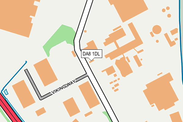
DA8 1DL is located in the Erith electoral ward, within the London borough of Bexley and the English Parliamentary constituency of Erith and Thamesmead. The Sub Integrated Care Board (ICB) Location is NHS South East London ICB - 72Q and the police force is Metropolitan Police. This postcode has been in use since January 1980.


GetTheData
Source: OS OpenMap – Local (Ordnance Survey)
Source: OS VectorMap District (Ordnance Survey)
Licence: Open Government Licence (requires attribution)
| Easting | 550817 |
| Northing | 179211 |
| Latitude | 51.491736 |
| Longitude | 0.171052 |
GetTheData
Source: Open Postcode Geo
Licence: Open Government Licence
| Country | England |
| Postcode District | DA8 |
| ➜ DA8 open data dashboard ➜ See where DA8 is on a map ➜ Where is Erith? | |
GetTheData
Source: Land Registry Price Paid Data
Licence: Open Government Licence
Elevation or altitude of DA8 1DL as distance above sea level:
| Metres | Feet | |
|---|---|---|
| Elevation | 10m | 33ft |
Elevation is measured from the approximate centre of the postcode, to the nearest point on an OS contour line from OS Terrain 50, which has contour spacing of ten vertical metres.
➜ How high above sea level am I? Find the elevation of your current position using your device's GPS.
GetTheData
Source: Open Postcode Elevation
Licence: Open Government Licence
| Ward | Erith |
| Constituency | Erith And Thamesmead |
GetTheData
Source: ONS Postcode Database
Licence: Open Government Licence
| June 2022 | Other theft | On or near Church Manorway | 233m |
| June 2022 | Violence and sexual offences | On or near Battle Road | 475m |
| June 2022 | Anti-social behaviour | On or near Bronze Age Way | 482m |
| ➜ Get more crime data in our Crime section | |||
GetTheData
Source: data.police.uk
Licence: Open Government Licence
| Lower Road Church Manorway (Lower Road) | Hillside | 436m |
| Lower Road Church Manorway (Lower Road) | Hillside | 437m |
| St Francis Road (West Street) | Hillside | 562m |
| St Francis Road (West Street) | Hillside | 584m |
| Mayfield Road (Da17) (Lower Road) | Hillside | 601m |
| Erith Station | 1.2km |
| Belvedere Station | 1.3km |
| Slade Green Station | 3km |
GetTheData
Source: NaPTAN
Licence: Open Government Licence
GetTheData
Source: ONS Postcode Database
Licence: Open Government Licence


➜ Get more ratings from the Food Standards Agency
GetTheData
Source: Food Standards Agency
Licence: FSA terms & conditions
| Last Collection | |||
|---|---|---|---|
| Location | Mon-Fri | Sat | Distance |
| Lower Road Post Office | 18:00 | 12:00 | 640m |
| Anderson Way | 18:30 | 11:45 | 943m |
| Anderson Way Meter Box | 948m | ||
GetTheData
Source: Dracos
Licence: Creative Commons Attribution-ShareAlike
| Facility | Distance |
|---|---|
| Bexley College (Closed) Tower Road, Belvedere Health and Fitness Gym | 777m |
| Bodyworks (Bexley College) (Closed) Tower Road, Belvedere Health and Fitness Gym | 809m |
| North Kent Indoor Bowls Club (Closed) Crabtree Manorway South, Belvedere Indoor Bowls | 828m |
GetTheData
Source: Active Places
Licence: Open Government Licence
| School | Phase of Education | Distance |
|---|---|---|
| Belvedere Infant School Mitchell Close, Belvedere, DA17 6AA | Primary | 869m |
| Trinity Church of England School, Belvedere Erith Road, Belvedere, DA17 6HT | Secondary | 928m |
| Belvedere Junior School Mitchell Close, Belvedere, DA17 6AA | Primary | 966m |
GetTheData
Source: Edubase
Licence: Open Government Licence
| Risk of DA8 1DL flooding from rivers and sea | Very Low |
| ➜ DA8 1DL flood map | |
GetTheData
Source: Open Flood Risk by Postcode
Licence: Open Government Licence
The below table lists the International Territorial Level (ITL) codes (formerly Nomenclature of Territorial Units for Statistics (NUTS) codes) and Local Administrative Units (LAU) codes for DA8 1DL:
| ITL 1 Code | Name |
|---|---|
| TLI | London |
| ITL 2 Code | Name |
| TLI5 | Outer London - East and North East |
| ITL 3 Code | Name |
| TLI51 | Bexley and Greenwich |
| LAU 1 Code | Name |
| E09000004 | Bexley |
GetTheData
Source: ONS Postcode Directory
Licence: Open Government Licence
The below table lists the Census Output Area (OA), Lower Layer Super Output Area (LSOA), and Middle Layer Super Output Area (MSOA) for DA8 1DL:
| Code | Name | |
|---|---|---|
| OA | E00001991 | |
| LSOA | E01000405 | Bexley 004C |
| MSOA | E02000068 | Bexley 004 |
GetTheData
Source: ONS Postcode Directory
Licence: Open Government Licence
| DA8 1DE | Church Manorway | 210m |
| DA8 1AY | Lower Road | 435m |
| DA8 1BJ | Battle Road | 488m |
| DA8 1BS | Battle Road | 520m |
| DA17 6DU | Battle Road | 538m |
| DA8 1DH | Willis Road | 540m |
| DA8 1BP | Glendale Road | 559m |
| DA8 1BT | Valley Road | 578m |
| DA17 6EB | Stanmore Road | 584m |
| DA8 1NT | Neptune Walk | 599m |
GetTheData
Source: Open Postcode Geo; Land Registry Price Paid Data
Licence: Open Government Licence