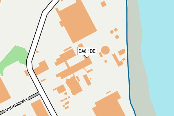
DA8 1DE lies on Church Manorway in Erith. DA8 1DE is located in the Erith electoral ward, within the London borough of Bexley and the English Parliamentary constituency of Erith and Thamesmead. The Sub Integrated Care Board (ICB) Location is NHS South East London ICB - 72Q and the police force is Metropolitan Police. This postcode has been in use since January 1980.


GetTheData
Source: OS OpenMap – Local (Ordnance Survey)
Source: OS VectorMap District (Ordnance Survey)
Licence: Open Government Licence (requires attribution)
| Easting | 550735 |
| Northing | 179404 |
| Latitude | 51.493491 |
| Longitude | 0.169927 |
GetTheData
Source: Open Postcode Geo
Licence: Open Government Licence
| Street | Church Manorway |
| Town/City | Erith |
| Country | England |
| Postcode District | DA8 |
➜ See where DA8 is on a map ➜ Where is Erith? | |
GetTheData
Source: Land Registry Price Paid Data
Licence: Open Government Licence
Elevation or altitude of DA8 1DE as distance above sea level:
| Metres | Feet | |
|---|---|---|
| Elevation | 10m | 33ft |
Elevation is measured from the approximate centre of the postcode, to the nearest point on an OS contour line from OS Terrain 50, which has contour spacing of ten vertical metres.
➜ How high above sea level am I? Find the elevation of your current position using your device's GPS.
GetTheData
Source: Open Postcode Elevation
Licence: Open Government Licence
| Ward | Erith |
| Constituency | Erith And Thamesmead |
GetTheData
Source: ONS Postcode Database
Licence: Open Government Licence
1-2, CALLENDER COTTAGES, CHURCH MANORWAY, ERITH, DA8 1DE 2005 26 JAN £335,000 |
GetTheData
Source: HM Land Registry Price Paid Data
Licence: Contains HM Land Registry data © Crown copyright and database right 2025. This data is licensed under the Open Government Licence v3.0.
| Dentons Wharf (Mulberry Way) | Thamesmead East | 506m |
| Dentons Wharf | Thamesmead East | 523m |
| Lower Road Church Manorway (Lower Road) | Hillside | 610m |
| Lower Road Church Manorway (Lower Road) | Hillside | 618m |
| Mayfield Road (Da17) (Lower Road) | Hillside | 623m |
| Belvedere Station | 1.2km |
| Erith Station | 1.4km |
| Rainham (London) Station | 3km |
GetTheData
Source: NaPTAN
Licence: Open Government Licence
GetTheData
Source: ONS Postcode Database
Licence: Open Government Licence


➜ Get more ratings from the Food Standards Agency
GetTheData
Source: Food Standards Agency
Licence: FSA terms & conditions
| Last Collection | |||
|---|---|---|---|
| Location | Mon-Fri | Sat | Distance |
| Lower Road Post Office | 18:00 | 12:00 | 656m |
| Anderson Way | 18:30 | 11:45 | 770m |
| Anderson Way Meter Box | 775m | ||
GetTheData
Source: Dracos
Licence: Creative Commons Attribution-ShareAlike
| Risk of DA8 1DE flooding from rivers and sea | Very Low |
| ➜ DA8 1DE flood map | |
GetTheData
Source: Open Flood Risk by Postcode
Licence: Open Government Licence
The below table lists the International Territorial Level (ITL) codes (formerly Nomenclature of Territorial Units for Statistics (NUTS) codes) and Local Administrative Units (LAU) codes for DA8 1DE:
| ITL 1 Code | Name |
|---|---|
| TLI | London |
| ITL 2 Code | Name |
| TLI5 | Outer London - East and North East |
| ITL 3 Code | Name |
| TLI51 | Bexley and Greenwich |
| LAU 1 Code | Name |
| E09000004 | Bexley |
GetTheData
Source: ONS Postcode Directory
Licence: Open Government Licence
The below table lists the Census Output Area (OA), Lower Layer Super Output Area (LSOA), and Middle Layer Super Output Area (MSOA) for DA8 1DE:
| Code | Name | |
|---|---|---|
| OA | E00001991 | |
| LSOA | E01000405 | Bexley 004C |
| MSOA | E02000068 | Bexley 004 |
GetTheData
Source: ONS Postcode Directory
Licence: Open Government Licence
| DA17 6DU | Battle Road | 605m |
| DA8 1BJ | Battle Road | 609m |
| DA8 1AY | Lower Road | 623m |
| DA17 6AX | Crabtree Manorway North | 625m |
| DA17 6DZ | Lower Road | 655m |
| DA8 1BP | Glendale Road | 668m |
| DA17 6EB | Stanmore Road | 674m |
| DA8 1DH | Willis Road | 675m |
| DA8 1BS | Battle Road | 675m |
| DA17 6EA | Gordon Road | 678m |
GetTheData
Source: Open Postcode Geo; Land Registry Price Paid Data
Licence: Open Government Licence