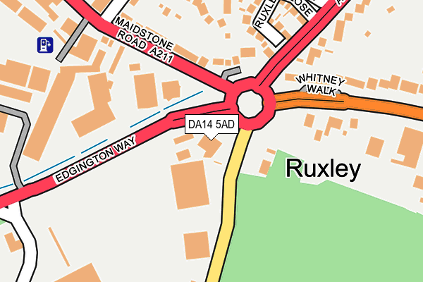
DA14 5AD is located in the St Paul's Cray electoral ward, within the London borough of Bromley and the English Parliamentary constituency of Orpington. The Sub Integrated Care Board (ICB) Location is NHS South East London ICB - 72Q and the police force is Metropolitan Police. This postcode has been in use since January 1980.


GetTheData
Source: OS OpenMap – Local (Ordnance Survey)
Source: OS VectorMap District (Ordnance Survey)
Licence: Open Government Licence (requires attribution)
| Easting | 547929 |
| Northing | 170541 |
| Latitude | 51.414594 |
| Longitude | 0.125860 |
GetTheData
Source: Open Postcode Geo
Licence: Open Government Licence
| Country | England |
| Postcode District | DA14 |
| ➜ DA14 open data dashboard ➜ See where DA14 is on a map ➜ Where is Ruxley? | |
GetTheData
Source: Land Registry Price Paid Data
Licence: Open Government Licence
Elevation or altitude of DA14 5AD as distance above sea level:
| Metres | Feet | |
|---|---|---|
| Elevation | 40m | 131ft |
Elevation is measured from the approximate centre of the postcode, to the nearest point on an OS contour line from OS Terrain 50, which has contour spacing of ten vertical metres.
➜ How high above sea level am I? Find the elevation of your current position using your device's GPS.
GetTheData
Source: Open Postcode Elevation
Licence: Open Government Licence
| Ward | St Paul's Cray |
| Constituency | Orpington |
GetTheData
Source: ONS Postcode Database
Licence: Open Government Licence
| January 2024 | Violence and sexual offences | On or near Maddocks Close | 500m |
| December 2023 | Violence and sexual offences | On or near Palm Avenue | 304m |
| December 2023 | Other theft | On or near Palm Avenue | 304m |
| ➜ Get more crime data in our Crime section | |||
GetTheData
Source: data.police.uk
Licence: Open Government Licence
| Ruxley Corner (Maidstone Road) | Foots Cray | 85m |
| Ruxley Corner (Maidstone Road) | Foots Cray | 138m |
| Ruxley Nursery (Maidstone Road) | Ruxley | 213m |
| Barton Road (North Cray Road) | Ruxley | 272m |
| Ruxley Nursery (Maidstone Road) | Ruxley | 287m |
| Albany Park Station | 2.3km |
| St Mary Cray Station | 2.6km |
| Sidcup Station | 2.6km |
GetTheData
Source: NaPTAN
Licence: Open Government Licence
GetTheData
Source: ONS Postcode Database
Licence: Open Government Licence


➜ Get more ratings from the Food Standards Agency
GetTheData
Source: Food Standards Agency
Licence: FSA terms & conditions
| Last Collection | |||
|---|---|---|---|
| Location | Mon-Fri | Sat | Distance |
| Honeydene | 17:30 | 11:30 | 576m |
| Bedensfield Post Office | 17:30 | 11:30 | 754m |
| The Grove | 17:30 | 11:30 | 934m |
GetTheData
Source: Dracos
Licence: Creative Commons Attribution-ShareAlike
| Facility | Distance |
|---|---|
| North Cray Primary School (Closed) Bedens Road, Sidcup Grass Pitches | 404m |
| Bromley Ski Centre (Closed) Sandy Lane, St. Pauls Cray, Orpington Ski Slopes | 558m |
| Bannatyne Health Club (Orpington) Sandy Lane, St. Pauls Cray, Orpington Health and Fitness Gym, Swimming Pool, Studio, Squash Courts | 699m |
GetTheData
Source: Active Places
Licence: Open Government Licence
| School | Phase of Education | Distance |
|---|---|---|
| Hope Community School 167 Rectory Lane, Sidcup, DA14 5BU | Primary | 705m |
| St Peter Chanel Catholic Primary School Baugh Road, Sidcup, DA14 5ED | Primary | 902m |
| Kemnal Technology College Sevenoaks Way, Sidcup, DA14 5AA | Secondary | 1.1km |
GetTheData
Source: Edubase
Licence: Open Government Licence
The below table lists the International Territorial Level (ITL) codes (formerly Nomenclature of Territorial Units for Statistics (NUTS) codes) and Local Administrative Units (LAU) codes for DA14 5AD:
| ITL 1 Code | Name |
|---|---|
| TLI | London |
| ITL 2 Code | Name |
| TLI6 | Outer London - South |
| ITL 3 Code | Name |
| TLI61 | Bromley |
| LAU 1 Code | Name |
| E09000006 | Bromley |
GetTheData
Source: ONS Postcode Directory
Licence: Open Government Licence
The below table lists the Census Output Area (OA), Lower Layer Super Output Area (LSOA), and Middle Layer Super Output Area (MSOA) for DA14 5AD:
| Code | Name | |
|---|---|---|
| OA | E00003542 | |
| LSOA | E01000728 | Bromley 019E |
| MSOA | E02000145 | Bromley 019 |
GetTheData
Source: ONS Postcode Directory
Licence: Open Government Licence
| DA14 5AH | Sandy Lane | 69m |
| DA14 5HX | Maidstone Road | 138m |
| DA14 5AJ | Sandy Lane | 148m |
| DA14 5LS | Ruxley Close | 190m |
| DA14 5JE | Palm Avenue | 231m |
| DA14 5HS | Maidstone Road | 257m |
| DA14 5JW | Mount Culver Avenue | 265m |
| DA14 5HB | Maidstone Road | 303m |
| DA14 5JN | St Georges Road | 316m |
| DA14 5AN | Maidstone Road | 330m |
GetTheData
Source: Open Postcode Geo; Land Registry Price Paid Data
Licence: Open Government Licence