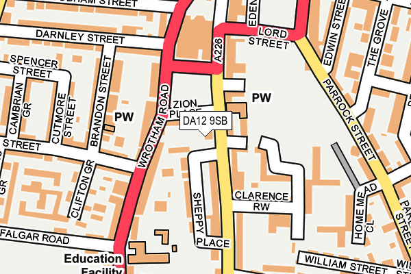
DA12 9SB is located in the Pelham electoral ward, within the local authority district of Gravesham and the English Parliamentary constituency of Gravesham. The Sub Integrated Care Board (ICB) Location is NHS Kent and Medway ICB - 91Q and the police force is Kent. This postcode has been in use since February 2005.


GetTheData
Source: OS OpenMap – Local (Ordnance Survey)
Source: OS VectorMap District (Ordnance Survey)
Licence: Open Government Licence (requires attribution)
| Easting | 564726 |
| Northing | 173729 |
| Latitude | 51.438608 |
| Longitude | 0.368645 |
GetTheData
Source: Open Postcode Geo
Licence: Open Government Licence
| Country | England |
| Postcode District | DA12 |
| ➜ DA12 open data dashboard ➜ See where DA12 is on a map ➜ Where is Gravesend? | |
GetTheData
Source: Land Registry Price Paid Data
Licence: Open Government Licence
Elevation or altitude of DA12 9SB as distance above sea level:
| Metres | Feet | |
|---|---|---|
| Elevation | 30m | 98ft |
Elevation is measured from the approximate centre of the postcode, to the nearest point on an OS contour line from OS Terrain 50, which has contour spacing of ten vertical metres.
➜ How high above sea level am I? Find the elevation of your current position using your device's GPS.
GetTheData
Source: Open Postcode Elevation
Licence: Open Government Licence
| Ward | Pelham |
| Constituency | Gravesham |
GetTheData
Source: ONS Postcode Database
Licence: Open Government Licence
| June 2022 | Anti-social behaviour | On or near Zion Place | 43m |
| June 2022 | Criminal damage and arson | On or near Zion Place | 43m |
| June 2022 | Public order | On or near Zion Place | 43m |
| ➜ Get more crime data in our Crime section | |||
GetTheData
Source: data.police.uk
Licence: Open Government Licence
| Clarence Row (Windmill Street) | Gravesend | 110m |
| Clarence Row (Windmill Street) | Gravesend | 146m |
| The Grove (Parrock Street) | Gravesend | 207m |
| Bat And Ball (Wrotham Road) | Gravesend | 269m |
| Tivoli House (Windmill Street) | Gravesend | 273m |
| Gravesend Station | 0.3km |
| Tilbury Town Station | 2.8km |
| Northfleet Station | 3.2km |
GetTheData
Source: NaPTAN
Licence: Open Government Licence
GetTheData
Source: ONS Postcode Database
Licence: Open Government Licence


➜ Get more ratings from the Food Standards Agency
GetTheData
Source: Food Standards Agency
Licence: FSA terms & conditions
| Last Collection | |||
|---|---|---|---|
| Location | Mon-Fri | Sat | Distance |
| Wrotham Road Post Office | 18:30 | 12:00 | 106m |
| Homemead | 17:30 | 11:15 | 256m |
| Woodville Gardens | 18:30 | 11:00 | 263m |
GetTheData
Source: Dracos
Licence: Creative Commons Attribution-ShareAlike
| Facility | Distance |
|---|---|
| Windmill Gardens Clarence Place, Gravesend Outdoor Tennis Courts | 322m |
| Gravesend Cricket Club Wrotham Road, Gravesend Grass Pitches | 396m |
| Shapers (Gravesend) Milton Road, Gravesend Health and Fitness Gym | 419m |
GetTheData
Source: Active Places
Licence: Open Government Licence
| School | Phase of Education | Distance |
|---|---|---|
| Wrotham Road Primary School Wrotham Road, Gravesend, DA11 0QF | Primary | 195m |
| Bronte School 7 Pelham Road, Gravesend, DA11 0HN | Not applicable | 426m |
| Holy Trinity Church of England Primary School Trinity Road, Gravesend, DA12 1LU | Primary | 429m |
GetTheData
Source: Edubase
Licence: Open Government Licence
The below table lists the International Territorial Level (ITL) codes (formerly Nomenclature of Territorial Units for Statistics (NUTS) codes) and Local Administrative Units (LAU) codes for DA12 9SB:
| ITL 1 Code | Name |
|---|---|
| TLJ | South East (England) |
| ITL 2 Code | Name |
| TLJ4 | Kent |
| ITL 3 Code | Name |
| TLJ43 | Kent Thames Gateway |
| LAU 1 Code | Name |
| E07000109 | Gravesham |
GetTheData
Source: ONS Postcode Directory
Licence: Open Government Licence
The below table lists the Census Output Area (OA), Lower Layer Super Output Area (LSOA), and Middle Layer Super Output Area (MSOA) for DA12 9SB:
| Code | Name | |
|---|---|---|
| OA | E00123324 | |
| LSOA | E01024291 | Gravesham 002D |
| MSOA | E02005056 | Gravesham 002 |
GetTheData
Source: ONS Postcode Directory
Licence: Open Government Licence
| DA12 9SW | Windmill Street | 0m |
| DA12 1BL | Windmill Street | 33m |
| DA12 1BH | Zion Place | 42m |
| DA12 1BB | Windmill Street | 42m |
| DA12 1BU | Victoria Avenue | 46m |
| DA12 1BJ | Windmill Street | 67m |
| DA11 0PW | Wrotham Road | 72m |
| DA12 1BT | Sheppy Place | 84m |
| DA11 0PN | Wrotham Road | 100m |
| DA12 1HJ | Clarence Row | 105m |
GetTheData
Source: Open Postcode Geo; Land Registry Price Paid Data
Licence: Open Government Licence